Download
1 / 25
250 likes | 384 Views
Climate Change and Hurricane Intensity and Frequency: What is the controversy? Dr. Steven M. Lazarus Florida Institute of Technology Marine and Environmental Science.

E N D
Climate Change and Hurricane Intensity and Frequency: What is the controversy? Dr. Steven M. Lazarus Florida Institute of Technology Marine and Environmental Science
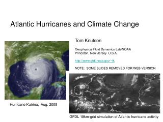
Since 1995 there has been an increase in the frequency and, in particular, the intensity of hurricanes in the Atlantic. For example, 1995-2002 highest level of North Atlantic hurricane activity on record Compared with previous 24 years (1971-94) the last 8 years have seen: 1. a doubling of overall activity for the Atlantic basin 2. a 2.5-fold increase in major hurricanes 3. five-fold increase in hurricanes affecting the Caribbean region. What factors are responsible for the observed changes in Atlantic hurricane activity and/or intensity? Hurricane frequency, intensity, longevity depend on several (not necessarily independent) factors including SSTs, wind shear. I will focus on SSTs today…
OCEANIC HEAT CONTENT Tropical cyclones can be thought of to a first approximation as a natural heat engine or Carnot cycle (Emanuel 1987). Thus, global warming can theoretically influence the maximum potential intensity of tropical cyclones through alterations of the surface energy flux and/or the upper-level cold exhaust (Emanuel 1987, Lighthill et al. 1994, Henderson-Sellers et al. 1998). Hurricanes form over tropical waters (between 8° and 20° latitude) in areas of high humidity, light winds, and warm sea surface temperatures (typically 26.5°C [80°F] or greater) through at least 50 m of ocean (Gray, 1979).
The Hurricane Heat Engine Despite the difficult nature of forecasting storm intensity, it is generally agreed that there exist thermodynamic limits to intensity that apply in the absence of significant interaction between storms and their environment (K. Emanuel). The “upper bound” (or limit) depends on sea surface temperature and the vertical temperature structure of the atmosphere. • Evaporation (ocean looses heat)/Atm gains “latent” heat, the heat gained during this leg is referred to as isothermal expansion (pressure decr). • Adiabatic ascent in eyewall (no heat gain/loss, just conversion from latent to sensible). Heat is eventually lost to space. • “Thermodynamic Engine”. There is a maximum efficiency…(from 2nd Law) OCEAN
The maximum efficiency (it is impossible to convert the whole heat input to work) E is given by: Where Ts and To are the the temperature of the ocean surface and average system temperature • For a given SST, the deeper the convection colder air at storm top the lower the average temperature To and thus higher efficiency. • if we know… • how much heat air has in the eyewall, and, • the vertical temperature structure of the air in the environment of the storm, • then, • we can calculate how high air will rise in the eyewall, and • we can calculate To ~ 3% of the heat energy is typically converted mechanical energy of the circulating winds. Storm intensifies until the energy generated is in equilibrium with the frictional dissipation between the winds and sea surface.
*Depends on assumptions about momentum/heat exchange, eyewall relative humidity, pressure…
How well does the theory work? upper limit Atlantic tropical cyclones near their maximum strength vs. theoretical limit based on climatological conditions at the observed locations of the storms (Emanuel).
In Summary… Hurricanes derive their energy from the thermodynamic disequilibrium that exists between the tropical oceans and the overlying atmosphere. By taking into account both the rate and the efficiency with which this reservoir of heat energy can be converted into wind energy it is possible to derive a speed limit for hurricanes, which depends mostly on ocean and atmospheric temperatures. This speed limit is in good accord with the results of computer simulations of hurricanes, but in nature, interaction of tropical cyclones with their atmospheric and oceanic environment limits the intensity of most (but not all) storms to values well below the theoretical limit. Nevertheless, limit theory is useful for estimating the most intense storm likely to strike a given area over a reasonably long period of time (Emanuel).
So what is the all controversy surrounding climate change and hurricane intensity and/or frequency? Unfortunately some of the debate has been unprofessional… Stick to the science (e.g., what is generally accepted as known, versus varying levels of uncertainty)!
Problem is that during the 20th century, the climate swings of the AMO have likely alternately camouflaged and exaggerated the effects of global warming, thereby making the contribution of global warming more difficult to ascertain. During warm phases of the AMO, the numbers of tropical storms that mature into severe hurricanes is much greater than during cool phases (at least twice as many). Cannot yet predict exactly when the AMO will switch. However ocean models do produce realistic AMO cycles. Large-scale droughts in the U.S. tend to be associated with positive AMO (i.e., North Atlanticwarming that occurred in the 1930s, 1950s and since 1995. SST = MEAN SST + CLIMATE CHANGE + AMO
Atlantic basin activity cycles with about 3.5 major (i.e., Cat 3 or greater) hurricanes/yr in active periods and ~1.5 major hurricanes/yr during quiet periods (~25-40 years). Alternating periods of varying hurricane activity are related to what is referred to as the Atlantic Multidecadal Oscillation (AMO). The AMO is an ongoing series of relatively long-duration changes in the sea surface temperature of the North Atlantic Ocean (0-70o N), with cool and warm phases ~20-40 years long and SST differences of about 1°F between extremes. These changes are natural and have been occurring for at least the last 1,000 years. WE ARE CURRENTLY IN A WARM PHASE!
trend short term variability Extended Reconstructed Sea surface Temperature (ERSST) Constructed using the most recently available International Comprehensive Ocean-Atmosphere Data Set (ICOADS) SST data and improved statistical methods that allow stable reconstruction using sparse data. *Ocean heat content change is the appropriate metric to assess climate system heat changes including global warming (R. Pielke)
1944 to 1950 was particularly active for Florida. There were a total of eleven hurricanes that hit the state (at least one per year, Pielke and Landsea 1998). AMO or aerosols? non-AMO AMO
Looks like a decent correlation between the apparent AMO/SST fluctuations and TC counts… • Detailed multivariate statistical analyses of the SST signal which are used to separate longer term variations from trends do not support the significant role of the AMO in the current SST warming (Mann and Park, 1994). • If the AMO were responsible for the current SST warming in the North Atlantic, the thermohaline circulation should have also intensified (models show that the two are in phase, Knight et al. 2005). • If anything, observations support a decreased THC.
Recently Published Articles… • Hoyos, Agudelo, Webster, and Curry: March 2006 Science • Examined joint distribution of hurricane intensity with variables identified in the literature as contributing to their intensification • Use information theory to separate trends from the short-term/natural modes of variability. • Trend of increasing # of cat 4/5 hurricanes for1970–2004 directly linked to the trend in sea-surface temperature • Other “aspects" of the tropical environment, influence shorter-term variations in hurricane intensity, but don’t contribute substantially to the observed global trend. • Mann, Emanuel: June 2006 EOS Transaction • Statistical methods to separate AMO and climate signals • “Development regions” in N. Atlantic (August-October) • Decadally smoothed SST highly correlated to TC counts but not to AMO R(t) ~ AMO • bivariate model (global SSTs + aerosol forcing) skillfully predicts SST over 30 yr independent period r = 0.73 decadally smoothed SSTs T(t) = aG(t) + R(t)
Trenberth, Shea: June 2006 Geophysical Research Letters • Subtracted the global trend from the “irregular” Atlantic temperatures—in an attempt to separate global warming from the Atlantic natural cycle. • Calculations attribute (partition) the SST increases: • 1. global warming ~ 0.8oF • 2. after-effects from the 2004-05 El Nino ~ 0.4oF. • 3. AMO < 0.2oF Michaels, Knappenberger, and Davis:May 2006Geophysical Research Letters • Significant relationship between sea-surface temperature (SST) and tropical cyclone intensity, however the relationship is much less clear in the upper range of SSTs normally associated with these storms. • Step-like, rather than a continuous, influence of SST on cyclone strength, suggesting that there exists a SST threshold that must be exceeded before tropical cyclones develop into major hurricanes. • SST influence varies markedly over time, thereby indicating that other aspects of the tropical environment are also critically important for tropical cyclone intensification.
Webster, Holland, Curry, and Chang: September 2005 Science • Examined the number of tropical cyclones/cyclone days and intensity over the past 35 years, in an environment of increasing sea surface temperature. • Large increase in the number and proportion of hurricanes reaching categories 4 and 5. Largest increase in the North Pacific, Indian, and Southwest Pacific Oceans, and smallest percentage increase in the North Atlantic Ocean. Increases have taken place while the number of cyclones and cyclone days has decreased in all basins except the North Atlantic during the past decade. • Chan: March 2006 Science • Analyses of tropical cyclone records from the western North Pacific reveal that the recent increase in occurrence of intense typhoons reported by Webster et al. (Reports, 16 Sep. 2005, p. 1844) is not a trend. Rather, it is likely a part of the large interdecadal variations in the number of intense typhoons related to similar temporal fluctuations in the atmospheric environment. • Increase is only obvious for the period from the late 1980s to the late 1990 • Webster et al. (2005) omit pre-1970 satellite data; there were a large number of category 4 and 5 typhoons also occurred between 1960 and 1974. • Also disputes Trenberth's finding that "trends are evident in the environment in which Atlantic hurricanes form".
Webster et al. respond… • Chan analysis confuses relationships associated with the long-term variations with those associated with shorter term variability (interannual and decadal). • In particular…atmospheric changes associated with El Niño–Southern Oscillation (ENSO) events give rise to an anticorrelation (negative correlation of –0.3) between storm intensity and SST, which is not related to longer term variability trends. • %NCAT45 is a far better indicator of the shift upwards in hurricane intensity than NCAT45 used by Chan, because NCAT45 is dominated by the large variations in total number of tropical storms. During the 1960s, both SST and %NCAT45 were relatively high. • Emanuel: July 2005 Nature • Theory/modeling predict increase in hurricane intensity with increasing global mean temperatures, but work on the detection of trends in hurricane activity has focused mostly on their frequency, which shows no trend. • “Potential destructiveness” index (PDI) for hurricanes has trended upward due to both longer storm lifetimes and greater storm intensities. • Index highly correlated with tropical SST, reflecting well-documented climate signals, including BOTH multi-decadal oscillations in the North Atlantic and North Pacific, and global warming.
And the latest (BAMS August 2006, Curry et al.) • Poor counter arguments (that dispute the climate impact on hurricanes) • Findings disagree with NHC (appeal to authority) • Not qualified (ad-hominem) • Motivated by funding (dismissive) • Illogical main point but valid peripheral/secondary • Atlantic TC frequency follows natural trends that are not impacted by greenhouse warming (not proven!) • Minimum in TC landfall during the 1970’s/higher earlier in the century and thus no impact associated with global warming (unrepresentative sample) • No relationship between SST increase and TC intensity because storms do not always intensify over warmer water (single causation issue).
Valid concerns… • Poor quality of data in 1970’s and 1980’s • Stats would change if work done with Cat 3, 4, 5 instead of Cat 4,5 • Non-US data problematic (inconsistencies) • Correlation between SSTs and HI does not necessarily prove causation • Other factors (we’ve discussed these!) • Recent SST increases are part of the natural cycle.. Curry et al. (2006) proceed to discuss how to address the “valid” questions!
Where were we? Dennis: July 5 – July 11 *Earliest formation of a fourth tropical cyclone and the strongest Atlantic hurricane ever to form before August
If we look at one predictor (SST) that influences tropical cyclone development… July 2005 Throughout much of the 2005 hurricane season SSTs across the tropical Atlantic (10-20oN), where many Atlantic hurricanes originate, were a record 1.7F above the 1901-1970 average. July 2006
Where are we now? • Improvements in our ability to predict tropical cyclone (hurricane) intensity has lagged behind improvements in track forecasts (we don’t fully understand hurricanes nor do we have a handle on the ambient factors…highly nonlinear interactions). • Computer power limits the model horizontal resolution to values well below those necessary to resolve eyes and eyewalls. • There exists a relatively clearly defined set of conditions for tropical cyclogenesis, but there doesn't seem to be a distinct set of conditions that leads to the development of a tropical depression . wind shear, SSTs, SAL (Saharan Air Layer)…
Some final comments… • Issue of climate impact of tropical storm frequency is far more controversial, with little guidance from existing theory. • Empirical studies show that when accumulated over large enough samples, the statistics of hurricane intensity are strongly controlled by this theoretical potential intensity. • Global climate models show an increase in TC intensity with anthropogenic global warming, leading to the prediction that actual storm intensity should increase with time • There are reasons to believe that global tropical SST trends may have less effect on tropical cyclones than regional fluctuations, as tropical cyclone potential intensity is sensitive to the difference between SST and average tropospheric temperature. • Although the frequency of tropical cyclones is an important scientific issue, it is not by itself an optimal measure of tropical cyclone threat. The actual monetary loss in wind storms rises roughly as the cube of the wind speed. • Coastal development is the least ambiguous issue – not only in terms of financial impact but also in terms of habitat destruction.