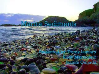
Marine Sediments
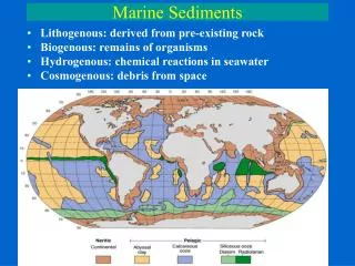
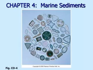
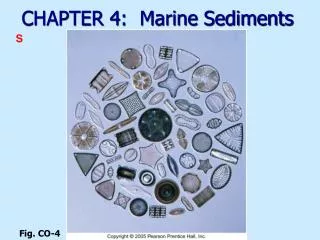
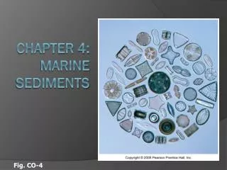
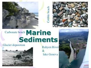
Marine Sediments. Cobble beach. Carbonate beach. Glacier deposition. Rahyen River & lake Geneva. Objectives. Definition Classification Wentworth scale Types Origin/ sources Factors affecting sediments distribution Deep Ocean sediments Sea floor spreading. Sediment.

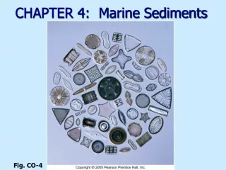
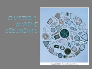
Marine Sediments
E N D
Presentation Transcript
Marine Sediments Cobble beach Carbonate beach Glacier deposition Rahyen River & lake Geneva
Objectives • Definition • Classification • Wentworth scale • Types • Origin/ sources • Factors affecting sediments distribution • Deep Ocean sediments • Sea floor spreading.
Sediment • It is a naturally unconsolidated particulate material that is broken down by processes of weathering and erosion. • It is subsequently transported by the action of wind, water, or ice, and/or by the force of gravity acting on the particle itself. • Sediments are most often transported by water, wind and glaciers. • Beach sands and river channel deposits are examples of water transport and deposition. • Loess are examples of aeolian transport and deposition. • Glacialmoraine deposits are ice-transported sediments.
Activity #1 • The major force bringing continental sediments to the open ocean is (are)(a) glaciers(b) Neritic currents(c) rivers(d) turbidity currents(e) wind
Classification • Sediments are classified based on: • 1- Particle Size. • 2- Sediment Origin/ Source
Particle sizes of Marine sediments: The beach Material is typically classified according to diameter 27 — 28 mm 25 — 26 mm 22 — 24 mm 21 mm 2-4 — 20 mm 2-8 — 2-4 mm 2-9 — 2-12 mm Boulder Cobble Pebble Gravel Sand Silt Clay
Pebble Cobble Gravel Sand
Wentworth scale • Grain diameter >250 mm 64-256 mm 4-64 mm 2-4 mm 0.5-1 mm 0.25-0.5 mm 0.062-0.25 mm 0.004-0.062 mm < 0.004 mm Boulder Cobble Pebble Granule Coarse Medium Fine Gravel Silt Clay Sand
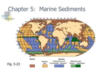
Deep ocean sediments comprise • Biogenic oozes • Siliceous oozes that mainly form from diatoms and radiolaria. • Calcarious oozes (e.g., form from coccolithophores and foraminifera) below the carbonate compensation depth .CCD); and • Abyssal clays That are often wind-transported, particularly in the tropical oceans.
Five primary factors control the distribution of sediments in the oceans: • Age of the underlying crust • Tectonic history of the ocean crust • Structural trends in basement • Nature and location of sediment source, and • The nature of the sedimentary processes delivering sediments to epicenters.
Sea floor Spreading amedkadr@yahoo.com
Continental Drift • Hypothesis of continental drift. • The continents were once joined together in a supercontintent called Pangaea and have since moved away from one another. • Evidences of the hypothesis: • (1) the similarity in shape of the continents, as if they once fit together like the pieces of puzzles. • (2) the presence of some fossils whose spores could not cross wide oceans, widely-separated continents of Africa, Australia, and India. • (3) the presence of glacial deposits on continents now found near the equator; • (4) the similarity of rock sequences on different continents. • This hypothesis was not widely accepted until new technology made exploration of the ocean floor possible. amedkadr@yahoo.com
The Ocean Floor • A map of the ocean floor shows a variety of topographic features: flat plains, long mountain chains, and deep trenches. • Mid-ocean ridges are part of chain of mountains some 84,000 km long. The Mid-Atlantic Ridge is the longest mountain chain on Earth. • These ridges are spreading centers or divergent plate boundaries where the upwelling of magma from the mantle creates new ocean floor. • Deep-sea trenches are long, narrow basins which extend 8-11 km below sea level. • Trenches develop adjacent to subduction zones, where oceanic lithosphere slides back into the mantle.
Deep-sea trenches: • long, narrow, and very deep (up to 11 km) basins oriented parallel to continents and associated with subduction of oceanic lithosphere. Lithosphere : • The rigid, outermost layer of the Earth; includes crust and uppermost mantle and is about 100 km thick. • Mid-ocean ridge: • a continuous mountain chain on the floor of all major ocean basins which marks the site where new ocean floor is created as two lithospheric plates move away from one another. • Pangaea or Pangea: • The proposed "supercontinent" that began to break apart 200 million years ago to form the present continents. . amedkadr@yahoo.com
Plate tectonics: • The Earth's lithosphere is broken into plates that move over a plastic layer in the mantle. Plate interactions produce earthquakes, volcanoes, and mountains. • Sea-floor spreading: • a hypothesis, that new ocean floor is created where two plates move away from one another at mid-ocean ridges. • Subduction zone: • a long, narrow zone where one lithospheric plate descends beneath another. • Divergent plate boundary: • a boundary between two plates that move away from one another; new lithosphere is created between the spreading plates. amedkadr@yahoo.com