Download
1 / 31
310 likes | 458 Views
Southeast Asia Fire Danger Rating System Project. Bryan Lee, Michael Brady, Bill de Groot, Caren Dymond, Robert Field, Orbita Roswintiarti Natural Resources Canada, Canadian Forest Service. Outline. Project Goals Adaptation Activities Operation Activities Application Activities

E N D
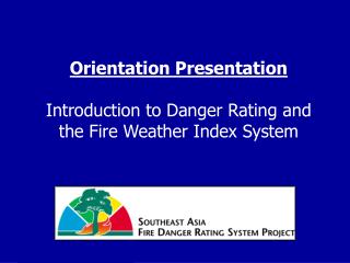
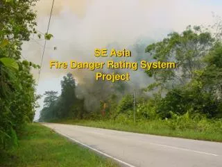
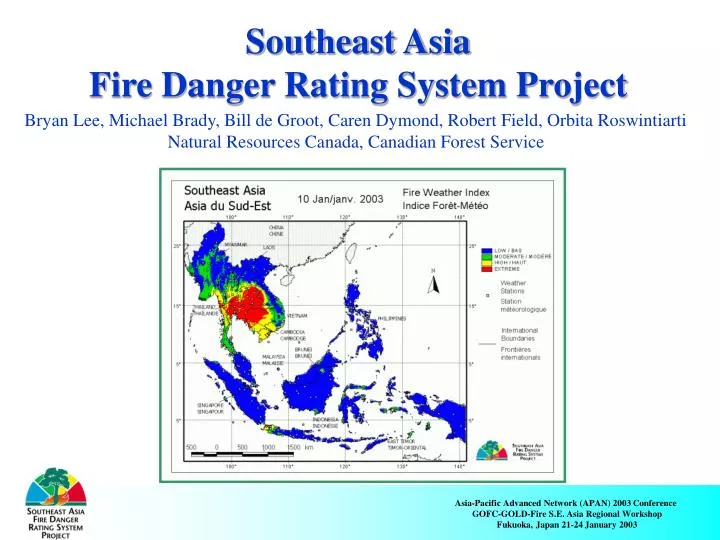
Southeast Asia Fire Danger Rating System Project Bryan Lee, Michael Brady, Bill de Groot, Caren Dymond, Robert Field, Orbita Roswintiarti Natural Resources Canada, Canadian Forest Service
Outline • Project Goals • Adaptation Activities • Operation Activities • Application Activities • Linking ground-based FDRS with remote sensing • Conclusions
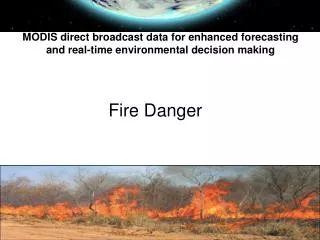
SE Asia FDRS Project Goals: • Enhance the application of fire science in SE Asia • Develop early warning systems for fire and haze events using fire danger rating technology • Improved mechanisms to manage transboundary haze
Fire Danger Rating System Evaluates the fire environment on regular intervals and in an objective way Interpretation provides information and guidelines for fire management Fire Danger • The ability of a fire to start, spread and do damage
Benefits of a FDRS for Southeast Asia • Provide an early warning system for fire and smoke events • Promote the wise use of fire • Support fire prevention fire activities • Assist in managing fire fighting resources • Promote technology transfer, fire science and policy formulation
FDRS Structure Weather Topography Fuels Emissions Factors Fire Weather Fire Behavior Fire Emissions Guides and Systems developed by Fire Management Research Fire Management Resources Values at Risk Fire Management Decisions
I. Status of SE ASIA Adaptation Activities • Fire Climate Assessment (26 years)– Sumatra Understanding El-Nino affects Non El-Nino Conditions El-Nino Conditions
I. Status of SE ASIA Adaptation Activities • FDRS Calibration – started for Indonesia and Malaysia E.g. Climate distributions from 6-year NCDC data
I. Status of SE ASIA Adaptation Activities Based on satellite fire detection • FDRS Calibration
I. Status of SE ASIA Adaptation Activities • FDRS Calibration Based on visibility observations
I. Status of SE ASIA Adaptation Activities Closed forest Woody Slash Shrub-lands Open forest • Fuel Characterization Grassland Peat soil Mineral soil
I. Status of SE ASIA Adaptation Activities • Fuel Mapping – based on Landsat TM data from 2000
I. Status of SE ASIA Adaptation Activities • Field studies on peat moisture and grass biomass • Lab studies testing ignition thresholds Data collection complete – data being analyzed
I. Status of SE ASIA Adaptation Activities Teams trained in Jakarta, Sandakan and Kuala Lumpur • Training of developers and operators
II. Status of SE ASIA Operation Activities • Operating for • SE Asia in Edmonton • Indonesia in Jakarta and Medan • Malaysia in Kuala Lumpur • Soon to be Operating in • Sandakan for Sabah • Daily FDRS map production
II. Status of SE ASIA Operation Activities • Web-based • SE Asia in Edmonton • Indonesia in Jakarta (www.fdrs.or.id) • Kuala Lumpur for Malaysia • 2-way Radio • Within Fire Control Directorate for Indonesia • Television • Part of nightly news broadcast on a national Indonesian station • Communication of FDRS to users
II. Status of SE ASIA Operation Activities E.g. SE Asia website
II. Status of SE ASIA Operation Activities Formal training program developed by a team from 4 countries. • Training in FDRS for users
III. Status of SE ASIA Application Activities • Fire Management – ongoing activities Interpreting FDRS maps to aid fire managers • Prevention programs • Mobilization • Suppression
III. Status of SE ASIA Application Activities E.g. Difficulty of Control Interpretation Low Moderate High Extreme These fires generally do not spread much beyond their point of origin. Control of these fires is easily accomplished through direct attack around the entire fire perimeter by firefighters using hand tools and water from backpack pumps. Hand-constructed fireguards are likely to be challenged. Water under pressure and heavy machinery are generally required for effective action at the fire's head. Severe drought conditions and dangerous burning conditions exist. The probability for suppression success is low.
FDRS III. Status of SE ASIA Application Activities Fire Weather • Haze modeling – ongoing activities Remote sensing Fuel Moisture Fuel Type Fire Behavior Fire Size Fire Location Atmospheric Conditions Emission Yields Transport and Deposition Air Quality
III. Status of SE ASIA Application Activities Smoke from Borneo pollutes air in Malaysia Smoke from Sumatra disperses into atmosphere • Haze modeling – ongoing activities
III. Status of SE ASIA Application Activities Smoke Dispersion • Linking fire danger rating & emissions with dispersion and transport models • Retrospective simulation of severe episodes
III. Status of SE ASIA Application Activities • Haze modeling – expected results • Improved interpretation of monsoonal wind and thermodynamic patterns over Southeast Asia. • New simulations of mesoscale wind and thermodynamic patterns during peak fire occurrences to support forecasting.
III. Status of SE ASIA Application Activities E.g.; Early Warning of Haze Events
Discussion Linking ground-based FDRS with remote sensing projects Fire Records Satellite Images Topography Human Activities Fire Climate Daily Satellite Images Daily Weather Data Hotspot & Burned area Locations and Statistics Daily FDRS Maps Fire Management Resources Fire Hazard Map Fire Management Guidelines Daily reports Weekly status and forecasts
Palangkaraya (approx.) Banjarmasin Discussion E.g. Monitoring through daily reports Central Kalimantan 19/08/2002 MODIS rapid response
Discussion E.g. Burned area mapping • Ground photograph of the large burned scar • B) Burned scars (orange areas) as detected in a multitemporal ERS image • C) The hotspots detected by NOAA-AVHRR are overlaid onto the ERS image • From: F. Siegertand A.A. Hoffmann2000 Remote Sensing of Environment Volume 72, Issue 1, April, Pages 64-77
Conclusions • A Fire Danger Rating System exists for SE Asia • Indonesia and Malaysia have the capacity to operate their own systems • A regional system would be beneficial to forecast and monitor transboundary haze • Many opportunities remain to improve the existing systems
Thank you http://fms.nofc.cfs.nrcan.gc.ca/seasia User ID: seasia Password: seasia