Download
1 / 39
390 likes | 585 Views
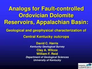
Analogs for Fault-controlled Ordovician Dolomite Reservoirs, Appalachian Basin: Geological and geophysical characterization of Central Kentucky outcrops. David C. Harris Kentucky Geological Survey Clay A. Wilcox William F. Reid Department of Geological Sciences University of Kentucky.

E N D
Analogs for Fault-controlled Ordovician Dolomite Reservoirs, Appalachian Basin:Geological and geophysical characterization of Central Kentucky outcrops David C. Harris Kentucky Geological Survey Clay A. Wilcox William F. Reid Department of Geological Sciences University of Kentucky
Outline • Outcrop analogs: petrography and geochemistry • MS thesis by Clay Wilcox • Seismic reflection work • MS thesis by Bill Reid • Recently drilled corehole at Stoner Branch locality
Acknowledgements New York State Energy Research and Development Authority U.S. Department of Energy, National Energy Technology Laboratory Triana Energy, Inc.
Outcrop Project Goals Characterize shallow Ordovician tectonic dolomites to improve exploration strategies • Approach: petrography, geochemistry, shallow high-resolution seismic, integration with New York reservoirs
C h r o n o s t r a t i g r a p h i c U n i t s N o r t h G l o b a l A m e r i c a n S y s t e m S e r i e s S t a g e / S e r i e s J u n i a t a B u l l D r a k e s F m Q u e e n s t o n F o r k F m F m F m G r a n t A s h l o c k L a k e L o r r a i n e F m L i m e s t o n e G r o u p C a l l o w a y F a i r v i e w C r e e k F m / L e i p e r s F m G a r r a r d S l t s . C l a y s U t i c a F m K o p e F e r r y Units affected by fault-controlled dolomitization T r e n t o n L e x i n g t o n G r o u p L i m e s t o n e T r e n t o n L i m e s t o n e H i g h B r i d g e B l a c k R i v e r B l a c k R i v e r G r o u p G r o u p G r o u p Upper and Middle Ordovician Stratigraphy
Structural Features • Northern boundary fault of Rome Trough • Left-lateral wrench fault system • Central Ky. Mineral District
S B 1 S 3 2 B 1 B S 1 B S 9 1 S B 1 1 B 0 S 4 8 B 1 S B S S B 2 6 B S S B S 4 3 B S B 7 B S 5 0 0 . 2 5 0 . 5 0 . 7 5 1 Mile S t o n e r B r a n c h D o l o s t o n e S a m p l e L o c a l i t y I n d e x
Ordovician Outcrops • Petrography: conventional and CL • Geochemical techniques • oxygen and carbon stable isotopes • microprobe (trace elements) • Cores: continuous core through Trenton and Black River to top Knox • MS theses by Clay Wilcox and Bill Reid
Petrography • Multiple generations of dolomite and calcite • Early dolomite: euhedral rhombs, replacive, non-Fe with some Fe zoning, luminescent • Later calcite cement, non-Fe to Fe • Late dolomite: Fe-rich, saddle dolomite, fills pores and replaces other grains/cement, non-luminescent
LINE 1 CNR Core Location LINE 4 LINE 2 USGS 1 Allen LINE 3 Stoner Branch Seismic Location Map
Data collected at lightbulb and Stoner Branch P-wave and S-wave (shear) data Data used to locate corehole Seismic imaging of dolomites
KY River Fault Core Location Depth 23m 40m 58m 76m Line length: 240 meters Line 1B Shear Wave
N S Extent of Dolomitization Line length: 240 meters Line 1A (P-wave)
Extent of Dolomitization Line 3B (shear wave) N S Line length: 154 meters
Stoner Branch Corehole • Provide data on vertical distribution of dolomite • Evaluate dolomite in Black River • CNR drilled continuous HQ and NQ core from 27 to 1005 ft (306m); TD reached Oct. 23 • Penetrated several small faults in shallow section • Penetrated Ky. River Fault Zone in the Black River: 175 ft (53m) of fractured limestone and breccia • TD in Knox on footwall, 280 ft high to downthrown block
<507FT> Subsea Depth SW NE GR CNPOR RHOB GAMMA_NEU 960 0 200 30 -10 2 3 0 200 30 Garrard Siltstone 20 ft faulted out in Garrard/Clays Ferry 860 100 Clays Ferry Formation 760 200 Trenton Ls 660 300 560 400 460 500 Black River Group Pencil Cave Bentonite 360 600 280 ft faulted out in Black River/Wells Creek 260 700 160 800 60 900 -40 1000 Wells Creek Dolomite -140 1100 St. Peter Sandstone -240 Knox Group 1200 -340 1300 ROME OIL & GAS CO COLUMBIA NATURAL RES LLC ALLEN JAMES B ALLEN JAMES B JR 3-04 1
Preliminary Core Observations • Dolomitization limited to upper 220 ft: Trenton and Black River not pervasively dolomitized along fault • Fabric-selective dolomitization present in Trenton • Breccias in fault zone are dolomitized- but very limited alteration outside of fault zone in deeper section
Black Riverfault breccia with multiple calcite generations823 ft
805-814 731-741 675-685
Fault Breccias • Calcite, dolomite, sphalerite, barite, pyrite mineralization present • Abundant evidence of multiple reactivation • Cross-cutting relationships and structural features will allow relative timing of fault movement and mineralization to be determined
Conclusions • Distribution, petrography and geochemistry of central Ky. Ordovician dolomites suggests hydrothermal origin • Complex diagenetic history, with multiple dolomitization events • Facies selectivity differs for different dolomite types • Fault conduits are primary control on distribution, but other factors control alteration zones
Final Project Review • PTTC-sponsored core workshop and final project review: Spring, 2005 • KGS Core and Sample Repository, Lexington, Kentucky • Optional field trip if there is interest