Download
1 / 41
410 likes | 433 Views
A group of neighbors seeking re-evaluation of NCDOT's road expansion project due to inaccurate data, increased traffic, safety concerns, and limited community access. Goals include working with officials, providing information, and proposing alternative solutions.

E N D
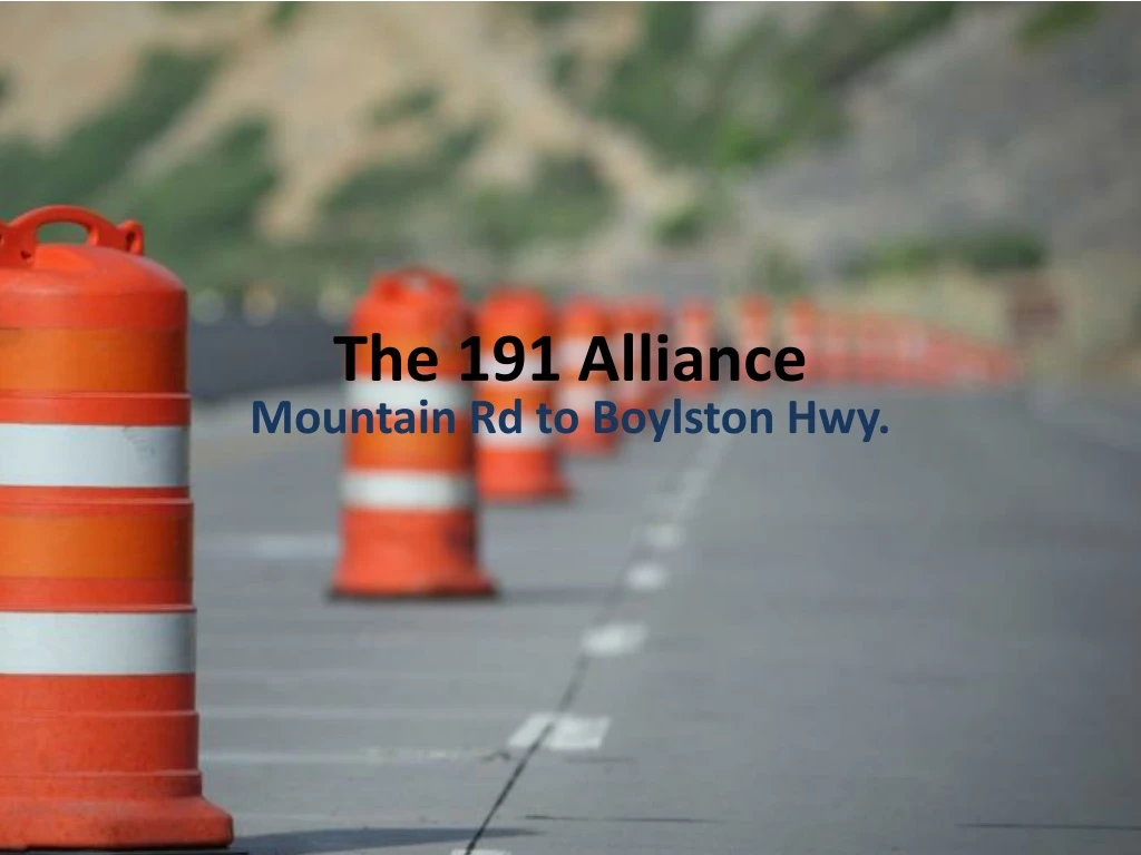
The 191 Alliance Mountain Rd to Boylston Hwy.
Who Are We? • A group of neighbors concerned about the impact of NCDOT’s R-2588B project to widen 191 from Mountain Rd to Boylston Hwy. • Our primary goal is: To facilitate re-evaluation of the R-2588B road expansion project because: • the Balfour Parkway project has been canceled and no longer impacts 191, and • the School Safety project is still in progress and we do not know what impact it will have.
Additional Goals Include • Working with county commissioners and FBRMPO; • Making concerns known: • Provide information • Publicize peoples’ opinions • Providing alternative solutions; • Defining the change we want to see; • Gaining active support of our neighbors.
What Are The Issues?NCDOT says, “It’s a collector arterial.” But we say, “No, it’s a community.” • Inaccurate traffic data • Increased traffic • Does not resolve safety issues • Does not reduce accidents • Community Access – limited left turns • Environmental impact • Decreased property values • Increased taxation • Alternative solutions not considered • Negligible economic impact for communities
Vehicle-Miles Traveled Are Decreasing 1946-2013 U.S. Dept of Trans.
A four-lane NC-191 was originally intended as a continuation of the four-lane Balfour Parkway Four Lanes (R-2588B) FourLanes
What NCDOT States “The purpose of this project is to improve safety and mobility along N.C. 191. . . “The project corridor experiences congestion during peak traffic hours which is projected to worsen in the future (12,400 vehicles per day currently use the corridor on average). The corridor also has a very high crash rate (257 crashes per million vehicle miles), well above the statewide average (197 crashes per million vehicle miles). The majority of these accidents are rear end crashes.”NCDOT Public Meeting Handout, March 15, 2018
NCDOT Handout Errors • The 257 crashes per millionmiles should be: 257 crashes per hundred million miles • The calculated total of 257 crashes per hundred million miles is based on 11,000 vehicles per day, not 12,400. • At 12,400 vehicles per day, the total would be 227 crashes per hundred million miles, not 257. • However, the actual volume is 11,485vehicles per day, not 12,400, which means there were 239crashes per hundred million miles, not257.
NC-191 Traffic Forecasts – Conclusions • When it comes to forecasts, NCDOT’s track record dismal. • 2001 - 2017, traffic southeast of Banner Farm Road increased < 0.5% per year. • Cancellation of the Balfour Parkway means • 20% lesstraffic than original forecast. • Traffic volume on most of NC-191 in 2040 will remain below the currentcapacity. • 2040 traffic may exceed current capacity only in the vicinity of the two schools and possibly from School House Road to NC-280. • County population growth rate has decreased from 2.56% in 2000, to 1.13% in 2017, which significantly impacts forecasts. NCDOT ignores traffic fluctuations andopts for straight line forecast.
How Wide?This project is classified as a Rural Arterial But we say, “No, it’s a community.” • 4-lanes= • Median = • Bike path = • Curbs & Gutters = Total = 44’ 17.5’ 10’ (5’ both directions) 4’ 75.5+ feet • Typical right-of-ways = 150’ – 250’ • Easements can extend beyond right-of-ways
R-2588B Design DataLeft & Right Turn Capability From Rugby to NC-280 • All commercial between School House and 280 • Town Center • Flavor First • Patten Seed Co • River Oak • Mills River Village From Rugby to Mountain Rd. • West High & Rugby Middle schools • Haywood Knolls
R-2588B Design DataNo Left-turn Capability • Merchant-Goodson House • Moto Café • Lei Shi • Bradley Rd/Party Barn • Husky Chiropractic • Hair Salon • Dollar General • Open Arms Pregnancy Center • All homes bordering 191 • Merriwood community • Crestwood • Haywood Park Estates • Tradition • Johnson Farm & Jamison House • Triple Creek • Cimarron Village • Sheffield Estates
Current Beliefs Most people agree that NC-191 needs: • wider lanes • wider shoulders • a center turn-lane • a safer traffic environment • improvementsto handle twice-daily school congestion, and high crash rate between Rugby and Mountain Rd. • Balfour cancellation and latest NCDOT traffic forecast, dictate the need to reassess R-2588B, and to consider or incorporate alternatives.
Current Beliefs • Widening NC-191 to four lanes was originally intended as a continuation of the Balfour Parkway. • A middle left-turn lane can reduce rear-end crashes. • Taxes ($$)will increase: • Upkeep and maintenance costs will increase • Larger road surfaces means more road to repair • Additional equipment will be needed • Longer times for snow removal
Current Beliefs The current 191 widening project will: • Spur development that is inconsistent with the character of rural Henderson County; • Endanger residents and commuters with additional traffic and the influx of business and population; • Introduce environmental concerns, including air, noise, water , and land pollution, and significant loss of wildlife and wetland habitats; • Result in permanent, irreparable harm to the environment and communities along 191. • Provide no significant economic benefit to residents.
How Will R-2588B Affect You • Project aspects: • Interrupts the flow of traffic • Travel times are longer • Slower traffic • Construction stop/go constraints • Projected project completion never on or before stated completion date • Creates unsuitable environment during construction period • Construction barriers and devices • Mud and dirt • Unsightly construction control measures • Unsightly construction equipment, materials, and service areas
How Will R-2588B Affect You • Travel aspects: • Increased traffic • Increased number and type of accidents • Increased personal injury and property damage • Faster driving • Increased inattentive driving • Travel distance does not decrease • No significant time savings • Increased air, noise, and land pollution • Reinstatement of emissions testing $$ • Having to make u-turns if going left • Traffic jam at Mountain Rd intersection 4-lane 2-lane
How Will R-2588B Affect You • Services aspects: • Emergency services • Longer response times due to no left turns • Increased personal and/or property damage • Life and/or property may be lost • Home services • Increased wait times due to no left turns • Service personnel not familiar with area will take longer • School buses will take longer and increase danger to children when having to make u-turns.
How Will R-2588B Affect You • Environmental aspects: • Increased pollution • Air - emissions • Land - garbage • Noise - traffic • Water - runoff • Increased runoff will pollute French Broad River • Decreased wildlife • pollution effects • vehicular homicide • Decreased local flora species • Permanent damage to environment
How Will R-2588B Affect You • Societal aspects: • Increased non-resident personnel • Increased crime • Higher traffic volume brings more road rage • Increased stress to residents • Noise • Inability to exit/enter left • Leave earlier for appointments, etc. • Increase housing and business development
An Alternative to R-2588B • Turn 191 into a 3-lane road with the center lane acting as a turn lane and median. • Widen the two outer lanes. • Widen shoulders for additional safety • Pave for: • right-turn lanes at intersections ; • right-turn lanes into major subdivisions (8); and • bike lanes and pedestrian walkways. • Install guard wire at significant drop-offs.
3-Lanes - How Wide?This project is classified as a Rural Arterial But we say, “No, it’s a community.” • 3-lanes= • Median = • Bike path = • Curbs & Gutters = Total = 33’ 0’ 10’ (5’ both directions) 4’ 47+ feet • Typical right-of-ways = 150’ – 250’ Easements can extend beyond right-of-ways
Crossing, Turning & Through Conflict Points 4 lanes 3 lanes
Left-Turn Sight Distance 4 lanes 3 lanes
Who do we need to convince? • NotNCDOT • They won’t listen to us • Henderson County Board of Commissioners (BofC) • Decision maker on Henderson County road projects. • If the BofC passes a resolution asking NCDOT to reconsider its plans, the MPO will take heed and offer a similar resolution • NCDOT does what the MPO asks them to do • Public comments (3 minutes); e-mails; face-to-face meetings • Be civil and respectful
What Can You Do? • Visit our website: www.191alliance.org • Subscribe to our newsletter • Click the Subscribe link • Click on Subscribe to our newsletter • Complete and submit the form • Visit the Contacts page • Send a letter to your town leaders • Send a letter to your county commissioners • Click the Pathways link • Select a pathway • Become involved
Resources & References • “America in 2015”http://uli.org/wp-content/uploads/ULI-Documents/America-in-2015.pdf • “Highway 29: A Corridor Study, Greer, SC”https://southcarolina.uli.org/wp-content/uploads/sites/48/2012/07/Hwy29-Final_033115.pdf • “Evaluation of Lane Reduction,” Federal Highway Administrationhttps://www.fhwa.dot.gov/publications/research/safety/10053/index.cfm • ROADEX project http://www.roadex.org/wp-content/uploads/2014/01/ROADEX-Road-Widening-Guidelines-2012.pdf • "The Fundamental Law of Road Congestion: Evidence from US Cities.” Gilles Duranton (University of Pennsylvania), and Matthew A. Turner (University of Toronto. 2009/2011. National Bureau of Economic Research, Cambridge, MA. • “On a Paradox of Traffic Planning,” Dietrich Braess, Transportation Science 39 (2005): 446-450
Resources& References • “To stop a road widening project, be persistent”https://www.strongtowns.org/journal/2017/4/6/road-widening-stop-toledo • “A Review of the 2002 Mills River Watershed Management Strategy, Ten Years Later “ftp://ftp.ashevillenc.gov/Water/Mills-River-Watershed-Mgt-Strategy/Review-2002-Mills-River-Watershed-Mgmt-Strategy.pdf • “7 Tips for When Road Construction Affects Your Business”https://www.inc.com/guides/2010/10/seven-tips-for-when-road-construction-affects-your-business.html • “No More Freeway Expansions” (links to letters)https://nomorefreewayspdx.com/about/ • “The Future of Commuting”https://www.vox.com/2015/4/29/8513699/future-of-commuting • “Road pricing most effective in reducing vehicle emissions”https://m.phys.org/news/2017-10-road-pricing-effective-vehicle-emissions.html
Resources& References • “Was $1.6 Billion Worth It?”https://www.nytimes.com/2016/12/20/us/los-angeles-drivers-on-the-405-ask-was-1-6-billion-worth-it.html • “Transportation equity: Why peak period road pricing is fair”http://cityobservatory.org/transportation-equity/ • “The end of the road? Challenging the road-building consensus”https://www.cpre.org.uk/resources/transport/roads/item/4543-the-end-of-the-road-challenging-the-road-building-consensus • “How America’s Most Important Highway Fails”https://www.wsj.com/graphics/how-americas-most-important-highway-fails/ (requires sign-in) • “Why road widening is a bad idea”http://bengaluru.citizenmatters.in/2224-audacity-of-hope-to-solve-road-problems-2224
Resources & References • “Road congestion”http://www.economicsonline.co.uk/Market_failures/Road_congestion.html • “The effects of Road widening”https://prezi.com/yan98lwnk4je/the-effects-of-road-widening/ • “Advantages and Disadvantages of Road Transport”http://www.yourarticlelibrary.com/geography/transportation/advantages-and-disadvantages-of-road-transport/42135 • “The Impact of Road Projects in England”http://www.cpre.org.uk/resources/transport/roads/item/download/4848 • “The end of the Road? Challenging the road-building consensus”https://www.cpre.org.uk/resources/transport/roads/item/download/4851 • “The Impact of Road Widening on the Local Economy”https://domz60.wordpress.com/2013/08/13/the-impact-of-road-widening-on-the-local-economy/
Resources & References • “Effects of Roads on Ecological Conditions”https://www.nap.edu/read/11535/chapter/5 • “Speed”https://www.parisschoolofeconomics.eu/IMG/pdf/Duranton-RUES-june2012.pdf • “The Futility of Widening, Round 2”https://www.strongtowns.org/journal/2018/2/21/the-futility-of-widening-round-2 • Does building more roads create more traffic?https://www.citymetric.com/transport/does-building-more-roads-create-more-traffic-934 • Traffic: Why It’s Getting Worse, What Government Can Dohttps://www.brookings.edu/research/traffic-why-its-getting-worse-what-government-can-do/