Download
1 / 52
520 likes | 669 Views
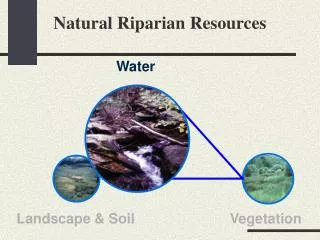
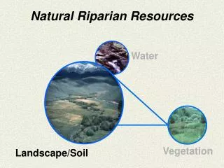
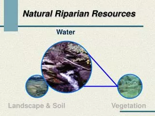
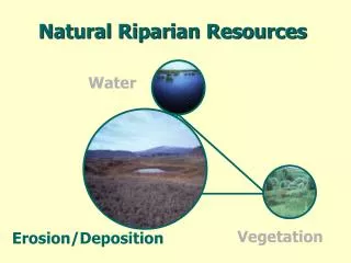
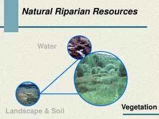
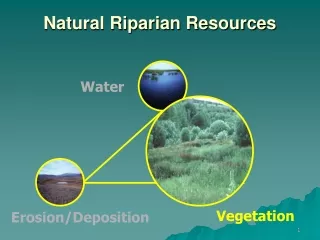
Natural Riparian Resources. Water. Vegetation. Landscape/Soil. Landform. Little Salmon River. Riggins. Salmon River. King Hill Creek. Clover Creek. Riparian Soils. Volume composition of a silt loam surface soil. Soil Particle Size. Granite. Basalt.

E N D
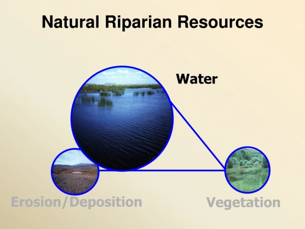
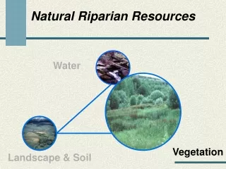
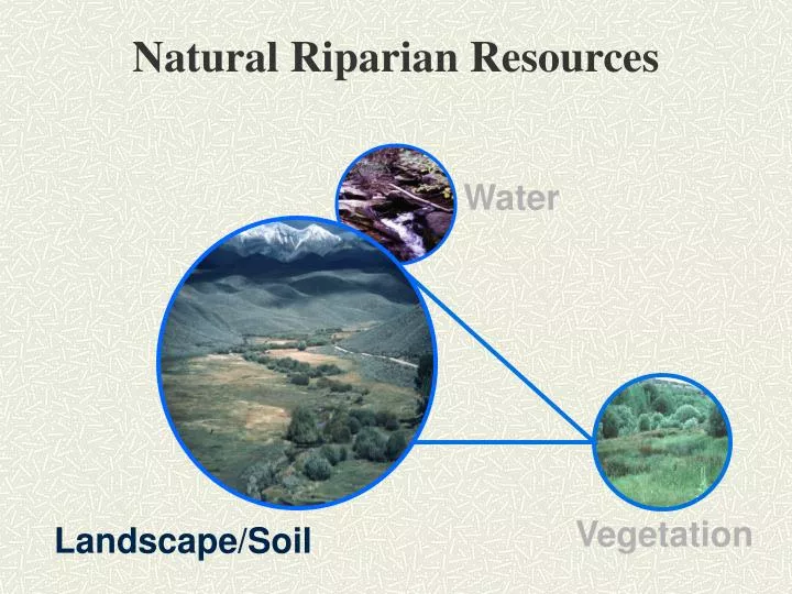
Natural Riparian Resources Water Vegetation Landscape/Soil
Landform Little Salmon River Riggins Salmon River
Upward Movement of Water in Soil I n c h e s Days
13) Flood plain and channel characteristics (i.e., rocks, overflow channels, coarse and/or large woody material) are adequate to dissipate energy • Proper function lotic riparian-wetland areas must dissipate energy • Appropriate channel size and shape • Fully developed floodplain • Adequate roughness • Appropriate vegetation cover
Is the floodplain fully developed (see question 1)? • Is there sufficient overflow channels, vegetation, rock, and woody debris to handle high flows without degrading? • Is the floodplain capable of growing woody species? • Are woody riparian species present on the floodplain and/or streambanks? • Is the sinuosity and width/depth ratio appropriate for the site (see Question 3)?
Is the floodplain fully developed (see question 1)? • Is there sufficient overflow channels, vegetation, rock, and woody debris to handle high flows without degrading? • Is the floodplain capable of growing woody species? • Are woody riparian species present on the floodplain and/or streambanks? • Is the sinuosity and width/depth ratio appropriate for the site (see Question 3)?
Is the floodplain fully developed (see question 1)? • Is there sufficient overflow channels, vegetation, rock, and woody debris to handle high flows without degrading? • Is the floodplain capable of growing woody species? • Are woody riparian species present on the floodplain and/or streambanks? • Is the sinuosity and width/depth ratio appropriate for the site (see Question 3)?
Is the floodplain fully developed (see question 1)? • Is there sufficient overflow channels, vegetation, rock, and woody debris to handle high flows without degrading? • Is the floodplain capable of growing woody species? • Are woody riparian species present on the floodplain and/or streambanks? • Is the sinuosity and width/depth ratio appropriate for the site (see Question 3)?
14) Point bars are revegetating with riparian-wetland vegetation
Is there a distinct and relatively continuous line of stabilizing riparian vegetation on the point bar? • Is there sprout and/or young woody species on the point bar? • Is herbaceous stabilizing riparian species expanding?
Is there a distinct and relatively continuous line of stabilizing riparian vegetation on the point bar? • Is there sprout and/or young woody species on the point bar? • Is herbaceous stabilizing riparian species expanding?
Is there a distinct and relatively continuous line of stabilizing riparian vegetation on the point bar? • Is there sprout and/or young woody species on the point bar? • Is herbaceous stabilizing riparian species expanding?
Is there a distinct and relatively continuous line of stabilizing riparian vegetation on the point bar? • Is there sprout and/or young woody species on the point bar? • Is herbaceous stabilizing riparian species expanding?
Is there a distinct and relatively continuous line of stabilizing riparian vegetation on the point bar? • Is there sprout and/or young woody species on the point bar? • Is herbaceous stabilizing riparian species expanding?
Question 15 - Lateral stream movement is associated with natural sinuosity • The channel is appropriate for the landform and in balance with normal processes • Channel movement is a slow process • Appropriate vegetation and/or streambank cover • Channel aggrading • Multi-thread channel vs. single thread channel
Does the streambanks have an adequate amount of stabilizing vegetation (see Questions 9 & 11)? • Is there evidence of rapid point bar growth (see question 3?) • Is the channel widening? Is the channel aggrading? • Is the channel multi-thread (“D” channel type)? • Is sinuosity appropriate for the valley type (see Question 3)?
Does the streambanks have an adequate amount of stabilizing vegetation (see Questions 9 & 11)? • Is there evidence of rapid point bar growth (see question 3?) • Is the channel widening? Is the channel aggrading? • Is the channel multi-thread (“D” channel type)? • Is sinuosity appropriate for the valley type (see Question 3)?
Does the streambanks have an adequate amount of stabilizing vegetation (see Questions 9 & 11)? • Is there evidence of rapid point bar growth (see question 3? • Is the channel widening? Is the channel aggrading? • Is the channel multi-thread (“D” channel type)? • Is sinuosity appropriate for the valley type (see Question 3)?
Does the streambanks have an adequate amount of stabilizing vegetation (see Questions 9 & 11)? • Is there evidence of rapid point bar growth (see question 3? Is the channel widening? • Is the channel aggrading? • Is the channel multi-thread (“D” channel type)? • Is sinuosity appropriate for the valley type (see Question 3)?
16 - System is vertically stable • Is the down-cutting within natural rates or accelerated • Accelerated erosion, down-cutting • Headcut • Potential to move up through a wetland • Lower water table
Flat Canyon Creek • Is there a head cut capable of moving upstream within or below the reach? • Are there hydrologic modifiers such as abandon beaver dams, logs, or structures that have water moving under them? • Is sediment or debris accumulation causing the water to flow out of the channel?
Sage Creek • Is there a head cut capable of moving upstream within or below the reach? • Are there hydrologic modifiers such as abandon beaver dams, logs, or structures that have water moving under them? • Is sediment or debris accumulation causing the water to flow out of the channel?
Is there a head cut capable of moving upstream within or below the reach? • Are there hydrologic modifiers such as abandon beaver dams, logs, or structures that have water moving under them? • Is sediment or debris accumulation causing the water to flow out of the channel?
Is there a head cut capable of moving upstream within or below the reach? • Are there hydrologic modifiers such as abandon beaver dams, logs, or structures that have water moving under them? • Is sediment or debris accumulation causing the water to flow out of the channel?
17 - Stream is in balance with the water and sediment being supplied by the watershed (i.e., no excessive erosion or deposition) • Streams transport water and sediment • Increases or decreases in water • Channel degradation • Sediment transport • Channel erosion • Erosion increases sediment • Channel • Upland or side channels
Is there evidence of increased water flow such as channel degradation or channel erosion (see Question 5)? • Are there mid-channel bars, sediment filled pools, sand/silt/clay channel bottoms (see question 3)? • Is there channel braiding? • Are streambanks stable (see Question 11)?
James Creek • Is there evidence of increased water flow such as channel degradation or channel erosion (see Question 5)? • Are there mid-channel bars, sediment filled pools, sand/silt/clay channel bottoms (see question 3)? • Is there channel braiding? • Are streambanks stable (see Question 11)?