Download
1 / 19
190 likes | 326 Views
Using Large Scale Circulation Indices to Predict the Intensity of Cold Air Outbreaks Over Extended Time Scales Across the Southeastern U.S. Chip Konrad NOAA Southeast Regional Climate Center Department of Geography University of North Carolina at Chapel Hill. Context

E N D
Using Large Scale Circulation Indices to Predict the Intensity of Cold Air Outbreaks Over Extended Time Scales Across the Southeastern U.S. Chip KonradNOAA Southeast Regional Climate CenterDepartment of GeographyUniversity of North Carolina at Chapel Hill
Context • Need more specificity in long range weather and climate forecasts • Big question: What are the probabilities of getting an extreme weather event? 3 month temperature outlook with 1.5 month lead 8-14 day temperature outlook
Background • Much known about the forcings and patterns associated with cold air outbreaks (CAOs) on the synoptic scale (e.g. Konrad and Colucci, 1988; Konrad 1996). • Konrad (1998) and Cellitti et al. (2006) made associations between CAOs and large scale circulation. • These circulations exhibit periodicities and persistence over a range of scales (e.g. multi-week, seasonal and decadal) • This suggests the possibility of predicting CAO frequencies and intensities over extended time periods.
The North Atlantic Oscillation (NAO) and Arctic Oscillation (AO) Downward Trend
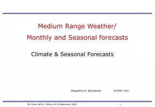
The Pacific Decadal Oscillation (PDO) Entering a positive phase PDO + PDO- September 2009 SST Anomalies
Temporal clustering of extreme CAOs and AO-/NAO- Konrad et al 2008
Methodology • Develop daily time series of surface temperature at 18 first order weather stations across southeastern U.S. • 57 cold seasons (Dec-Mar) from 1950-2006. • 2. Seasonally normalize time series. • Construct a 5 day running mean and define CAOs by minimums in the series • Distinguish CAOs based on intensity: • Extreme: 5+ yr return interval • Strong: 1–5 yr return interval • Ordinary: <1 yr return interval Washington Richmond Roanoke Norfolk Greensboro Raleigh - Durham Asheville Charlotte Greenville-Spartanburg Atlanta Columbia Athens Charleston Birmingham Macon Savannah Jacksonville Tallahassee
Example of the Identification of CAOs Z CAO #2 Ordinary CAO #1 - Extreme January 1982
Background (continued) • 3. Obtain daily circulation indices, seasonally normalize and develop time series of 5-day running means: • North Atlantic Oscillation (NAO) • Arctic Oscillation (AO) • Pacific-North American (PNA) • 4. Acquire monthly ocean indices and seasonally normalize: • Pacific Decadal Oscillation (PDO) • El Nino – Southern Oscillation (ENSO 3.4) • 5. Explore contemporaneous and lag relationships between CAO intensity and the circulation indices. • 6. Develop predictive tree regression models.
Results Ia. Composite 1000 hPa Heights for Extreme vs. Strong Cold Outbreaks Extreme Strong Day 0 Day -5 Day -10
Ib. Composite 500 hPa Heights for Extreme vs. Strong Cold Outbreaks Extreme Strong Day 0 Day -5 Day -10
PNA 1c. Composites of three circulation indices for extreme, strong, and ordinary outbreaks z AO Day z NAO Day z Day
The percentages of CAOs associated with each quartile phase of the circulation indices
Percentage of extreme cold outbreaks associated with the negative NAO phase stratified by the three phases of the QBO, PDO, and PNA.
II. Associate NAO negative events with incipient CAO intensity Ordinary NAO- event Extreme NAO- event Example of the identification of NAO negative events
Probability of an ordinary, strong, and extreme CAOs during the two week period following the maturation point of NAO- events stratified by intensity
Probability of an ordinary, strong, and extreme cold air outbreak during the two week period following the maturation point of strong NAO- events stratified by the phases of the QBO and PDO.
III. Develop Forecast Models: AI Based tree-modeling approach 1. Randomly select of 50 % of the events sample and use it to build a tree model. 2. Validate this model using 100 randomly selected sub-samples containing 50% of the original sample. 3. Evaluate the performance of this model using the mean r2 value (amount of variance explained) for the100 validation runs. 4. Carry out the above procedure 10,000 times and select the model that has the highest mean r2 value in the validation runs. • Advantages of this Approach • No a priori assumptions need to be made regarding the distribution of the sample. • An iterative random selection of training sub-samples allows for the testing of many different trees, each containing unique sets of variables and splitting points for a given variable. • A random selection of many validation sub-samples allows for tree to be tested with many different combinations of events statistically more robust.
Using September mean circulation indices to predict extreme CAOs for the cold season Tree Regression Model Training r2 =.69 Mean validation r2 =.65 Population r2 =.56 AO > -0.13 < -0.13 29 58 NAO PDO 18 <0.14 11 > 0.36 >0.14 < 0.36 37 21 10 4 8 7 8 17 20 13 Class 1 Class 2 Class 3 Class 4 % extreme CAOs 10%20% 0% 70% (7/10) % in class 6 % 10% 0% 88% (7/8)