Download
1 / 30
300 likes | 496 Views
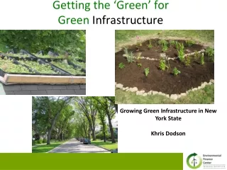
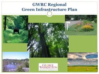
GWRC Regional Green Infrastructure Plan. Purpose of Presentation. Introduce Green Infrastructure Planning Explain its benefits and uses Summarize project results, draft findings and recommendations. Steering Committee Members: Amber Forestier Kevin Utt (chair) Chris Folger Mac Saphir

E N D
Purpose of Presentation • Introduce Green Infrastructure Planning • Explain its benefits and uses • Summarize project results, draft findings and recommendations • Steering Committee Members: • Amber Forestier Kevin Utt (chair) • Chris Folger Mac Saphir • David Nunnally Michael Lott • Eric Lawrence Stott Paula Chow • Jacob Pastwik Patricia Kurpiel
Many Types of Planning • Land Use • Transportation • Utility Plans • Green Infrastructure
What is Green Infrastructure? Green infrastructure is an inter-connected network of natural areas, other open spaces and management practices that conserve natural ecosystem functions, sustain clean air, promote better water quality (by performing or mimicking natural processes to infiltrate, evapo-transpirate or reuse storm water or runoff); thereby providing a wide array of benefits to society.
Green Infrastructure Includes: • Commercial and non-commercial forests, • Waterways & wetlands, • Wildlife areas, • Historic landscapes, • Working farms and pasture, • Public parks and open spaces, and • Low-impact development practices (e.g. rain gardens, bio-retention basins, green roofs, etc.)
Regional Green Infrastructure Plan Goals • To come to a common understanding on green infrastructure’s value. • To provide new and enhanced tools and information to individual property owners, development and conservation interests, local governments’ jurisdictions, and other stakeholders to use to make land use decisions. • To maintain natural landscapes and systems that constitute green infrastructure, thereby ensuring the health, safety, and welfare of the community, and saving money. • Promote sound environmental management practices that provide cost-effective and sustainable solutions to regulatory challenges.
Green Infrastructure Offers economic, social, and environmental benefits Economic Benefits • Provide healthy food • Provide jobs • Support tourism • Support local manufacturing • Increase surrounding property values • Manage storm water more cost-effectively when compared to engineered solutions
Green Infrastructure Offers economic, social, and environmental benefits Social Benefits • Improves public health • Enhances childhood intellectual & emotional • development • Reduces childhood obesity • Improves fitness by access to recreation • Stronger family network
Green Infrastructure Offers economic, social, and environmental benefits Environmental Benefits • Provides storm water management function • Reduces the erosion of top soil • Protects and preserves water quality • Improves regional air quality
FY 2009: Update of Regional Eco-Cores & Corridors Data • DCR’s Natural Heritage Program produced Va. Conservation Lands Needs Assessment (VCLNA) data…a statewide system to categorize & prioritize areas for their ecological value. • Project reviewed these data w/ LG staffs and re-scored areas based on local values and development actions that affected their score. • Updated scoring for the impact of post-2000 development in reducing the natural area
FY 2010: Urban Ecosystems Analysis • Analyzed satellite imagery from 1996, 2001, 2006 and 2009 • Detected trends in changes in land cover and calculated the ecosystem impacts of these changes.
2009 Regional and Local Green Infrastructure Estimates
Regional Trends: 1996 - 2009 (Source- Urban Ecosystem Analysis for the George Washington Region, GWRC, Summer 2010) • 45 sq. miles of tree canopy lost • 4.17% regional loss of tree canopy • 43.4% regional increase in • impervious surface area • 48.6% regional population growth
Regional Impact of the Loss of Green Infrastructure, 1996-2009 • Reduced capacity to remove air pollutants: • 2.89 million lbs per year • Economic cost of lack of removal of air pollutants: • $7.7 million per year • Storm water management capacity loss: • 223.7 million cu ft of rainwater • Economic cost of lost storm water management function: • $447.4 million (Source: Urban Ecosystem Analysis for the George Washington Region, GWRC, Summer 2010)
FY 2010: Estimating Impervious Surface Study • Surveyed LGs to determine what data they had to estimate impervious surface on a small area basis (e.g. sub-watershed) • Determined by comparing 30-meter vs 1-meter imagery for Fredericksburg that 30-meter imagery : • over-estimated impervious surface area by 34% • under-estimated tree canopy by 40% • Identified the potential for cost-effective regional classified land cover classification project to support WIP and other planning initiatives
FY2011: Regional Scenario Planning (FAMPO/GWRC) • “Greenprint” scenario (using green infrastructure plan data) tested against other scenarios: • compact growth centers & • “jobs/housing balance” • Public opinion survey results showed slightly higher public preference (36%) for Greenprint Scenario over Compact Growth Scenario (34%)
Benefits and Uses of a Green Infrastructure Plan • A tool for community growth management, comprehensive planning, land conversion planning, hazard mitigation planning and watershed management planning • Aid localities in targeting parkland acquisition • Aid in analyzing potential PDR and TDR sites, Urban Development Areas, and conservation easements • Used for meeting water quality goals • Supports other regulatory programs such as EPA TMDLs and the Chesapeake Bay Preservation Act
Significant Local GI Initiatives A few of the most significant local initiatives: • Crow’s Nest – Phase 2 Acquisition (Stafford) • Spotsylvania Trailways Plan Adoption • Adoption of Urban Development Areas (Stafford & Spotsylvania) • City riparian conservation easements along Rappahannock & Rapidan Rivers • City LID Ordinance & Tree Planting Initiative • Mattaponi Wildlife Management Area (Caroline)
Findings In spite losses of GI due to development, the Region enjoys an enviable supply of GI. While estimates vary, GI clearly contributes to Region’s environmental quality through the ecosystem services performed by GI. LGs lack detailed data on impervious cover to perform the best watershed management planning and identify urban retrofit program opportunities. A stronger partnership with SWCDs is needed to address agricultural run-off and promote urban and rural nutrient credit trading.
Findings (continued) • Rural localities will be more challenged in development of watershed implementation plans, lacking the program development achieved through the established urban MS4 program in more urban localities. • Public narrowly prefers GI scenario to guide future development. • LGs have utilized many of the planning tools authoroized in Virginia that support GI as part of their growth management and environmental protection policies.
Findings (continued) • LGs have been very active with GI-supportive initiatives; including conservation easement and parkland acquisition, designating urban development areas, adopting trail plans, supporting working farms, etc. • LGs (through the RRBC) have encouraged innovative market-based solutions which support rural sector through nutrient credit trading programs and other initiatives. • The Region lacks a local land trust to acquire, hold and manage conservation easements.
Findings (continued) • 11. LG staff have expressed interest in seeking an amendment to the Code of Virginia (§ 15.2-961.1) that allows local governments* authority (if designated ozone non-attainment) to adopt a local ordinance to include in site plan review process provisions for the preservation or replacement of trees on the development site. • *Currently limited to Northern VA (PD 8)
Recommendations Explore and pursue funding opportunities to secure a 1-meter (or better) classified land cover data layer to enhance the Region’s green and grey infrastructure planning, including watershed implementation and stormwater management planning.
Recommendations (cont.) 2. Pursue amendment of the Code of Virginia (§ 15.2-961.1) to include PD 16 so that local governments are enabled (should they be designated part of ozone non-attainment area) to require tree conservation and preservation in the site plan review process for development proposals.
Recommendations (cont.) • The region set a goal of increasing regional tree canopy by 5 percent, replacing the loss of tree canopy over the 1996-2009 era, with priority for infilling gaps in riparian buffers, and complementing water quality protection programs implemented and expanded to respond to Chesapeake Bay watershed implementation planning goals.
Recommendations (cont.) • 4. Continued collaboration of local government stormwater program managers and environmental planners to develop coordinated local response to Chesapeake Bay Watershed Implementation Plan Phase 2 process.
Recommendations (cont.) • 5. Invite the SWCD Executive Committees and Staff to meet with GWRC watershed implementation plan committee to explore improvements in working relations to achieve cooperative partnership on watershed implementation planning and other appropriate regional planning activities.
Recommendations (cont.) 6. GWRC Board endorsement (or acceptance) of the Regional Green Infrastructure Plan and direction to staff to communicate the Plan document to local governments and other stakeholders in the Region as an advisory tool to help the communities incorporate green infrastructure planning into local planning initiatives.