Download
1 / 56
560 likes | 580 Views
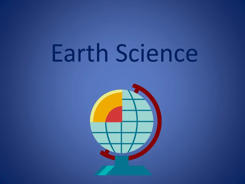
Earth Science. Main Layers of the Earth:. Crust Mantle Core. The Crust. Hard , solid, and strong Cooler than other layers Thinner beneath the oceans and made of basalt Thicker beneath the continents and made of granite. The Mantle.

E N D
Main Layers of the Earth: • Crust • Mantle • Core
The Crust • Hard , solid, and strong • Cooler than other layers • Thinner beneath the oceans and made of basalt • Thicker beneath the continents and made of granite
The Mantle • Composed of two layers: the upper mantle and lower mantle • Upper mantle is solid • Lower mantle is viscous
The Core • Composed of iron and nickel • Made of two layers: inner core and outer core • Outer core is liquid • Inner core is solid due to pressure
The Lithosphere • The uppermost part of the mantle and crust together for a rigid layer called the lithosphere.
The Asthenopshere • The hotter, less rigid, viscous layer underneath the lithosphere is called the asthenosphere.
Continents Today • North America • South America • Asia • Europe • Africa • Antarctica • Australia
Continents Millions of Years Ago Alfred Wegner suggested we once had a supercontinent or one huge continent called Pangaea.
Alfred Wegener Alfred Wegener was a German scientist who supported his belief in Pangaea with the following evidence: • same rocks • Same fossils • Same plants • Continents fit together like puzzle pieces
Continental Drift Alfred Wegener proposed the theory or idea of continental drift. This theory stated that there was once a supercontinent that broke apart or divided. However, he could not explain why.
http://www.geo.cornell.edu/hawaii/220/PRI/continental_puzzle.htmlhttp://www.geo.cornell.edu/hawaii/220/PRI/continental_puzzle.html
Laurasia and Gondwana • Alfred Wegener believed that Pangaea broke into two pieces: a northern continent called Laurasia and a southern continent called Gondwana.
Laurasia and Gondwana Split Laurasia: • North America • Europe • Asia Gondwana: • South America • Africa • Antarctica • Australia
How Did Pangaea Break Apart? The earth is broken into seven large pieces and many smaller pieces called plates.
How Did Pangaea Break Apart? Continents and oceans ride on plates and it is the plate that move across Earth’s viscous mantle.
Ridges There are long cracks in the ocean floor called ridges where magma from the mantle oozes up and spills onto the ocean floor.
Sea Floor Spreading Plates move away from the ridge as new ocean crust forms. This movement of just a few inches each year is called sea floor spreading.
Trenches A trench is formed when and ocean plate meets a continental plate and ocean plate moves beneath the lighter continental plate. As it moves downward or subduction occurs, a deep trench is formed.
Plate Boundaries There are three types of plate boundaries: • Divergent boundaries • Convergent boundaries • Transform boundaries
Divergent Boundaries The place where two plates move apart or diverge is called a divergent boundary. Most occur along the mid ocean ridges where sea-floor spreading occurs. On land, they create rift valleys. Great Rift Valley in East Africa.
Convergent Boundaries The place where two plates come together or converge is called a convergent boundary . There are three types: • Ocean and ocean • Continent and continent • Ocean and continent • Fuego and Acatenango, as seen fromthe flanks of the Volcan de Agua, near Antigua Guatemala Fuego and Acatenango, as seen fromthe flanks of the Volcan de Agua, near Antigua Guatemala
Ocean to Ocean Subduction Where two plates carrying oceanic crust meet at a trench, the plate that is more dense sinks under the other plate.
Ocean to Continent Subduction The more dense oceanic crust sinks beneath the less dense continental plate.
Continent to Continent When two plate carrying continental crust collide, subduction does not occur. Neither piece is dense enough to sink. Instead, the collision squeezes the crust into mighty mountain ranges.
Transform Boundaries A transform boundary is a place where two plates slip past each other, moving in opposite directions. Earthquakes often occur along transform boundaries. San Andreas Fault in California
Faults Faults - breaks in Earth’s crust where rocks have slipped past each other -form along boundaries
Types of Volcanoes • Cinder Cone • Shield • Stratovolcano or Composite http://www.scholastic.com/play/volcano.htm
Cinder Cone Volcano Cinder cone volcanoes are formed from cinder, rock, and ash that are deposited around the vent after violent explosions. Paricutin in Mexico
Shield Volcano Shield volcanoes are formed when lava flows gently from the vent, spreads and build a broad gently sloping mountain. Mauna Loa in Hawaii
Stratovolcano or Composite Volcano Stratovolcanoes or composite volcanoes are steep sided, cone shaped mountains that rise over 10,000 feet. They are made from alternating layers of gently flowing lava, ash, and cinder. Mt. Fugi in Japan
Harmful Effects of Volcanoes • Hot lava • Ash • Poisonous gases • Mudflows (lahars)
Classification of Volcanoes • Active - erupt regularly • Dormant/Inactive – have erupted in historical times but are currently not erupting • Extinct – have not erupted in historical times
Earthquakes – vibrations produced by the breaking of rock; studied by scientists called seismologists
Focus and Epicenter Focus - the point beneath Earth's surface where rock breaks under stress and the plates shift and that is what causes the earthquake. Epicenter- the part of the earth's surface directly above the focus of an earthquake
Classification of Earthquakes Richter Scale – a measure of the energy released during the earthquake; ranges from 1-10 Modified Mercalli Scale – a measure of the amount of damage done by the earthquake; ranges from 1-12
Mountains Four types of mountains: • Folded mountains • Dome mountains • Fault block mountains • Volcanic mountains
Folded Mountains Folded mountains form when two plates push against each other and fold upward.
Dome Mountains Dome mountains are formed when plates push against each other and bulge making a shape like an upside-down bowl.
Fault Block Mountains Fault block mountains form along cracks or fault sin plates.
Volcanic Mountains Volcanic mountains are mostly found under the oceans where magma from Earth’s mantle pushes plates apart although they can also be found on land.
How Much of Earth’s Water is in Usable Form? 97% of Earth’s Water is Salt Water 2% of Earth’s Water is Freshwater that is frozen in Ice Caps and Glaciers 1% of Earth’s Water is Freshwater in Usable Form
Eras of Earth • Paleozoic • Mesozoic • Cenozoic http://www.science4us.com/elementary-earthspace-science/earth/history-of-earth/