Download
1 / 40
400 likes | 564 Views
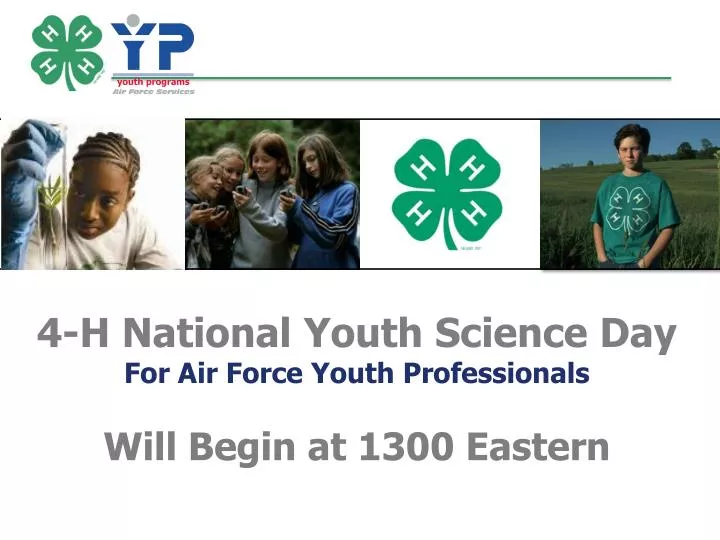
4-H National Youth Science Day For Air Force Youth Professionals Will Begin at 1300 Eastern. 4-H National Youth Science Day 2013 – 4-H Maps & Apps. Casey D. Mull 4-H / Air Force Partnership Adapted from Original by Melanie Biersmith. 4-H National Youth Science Day.

E N D
4-H National Youth Science Day For Air Force Youth Professionals Will Begin at 1300 Eastern
4-H National Youth Science Day 2013 – 4-H Maps & Apps Casey D. Mull 4-H / Air Force Partnership Adapted from Original by Melanie Biersmith
4-H National Youth Science Day • Through the National Science Experiment, youth will join the discussion during this year’s • 4-H National Youth Science Day – Wednesday, October 9, 2013 • Experiment may be conducted anytime • Register your event • Play the online game • Download the app • Enter your results in photo gallery • Access resources online at www.4-h.org/NYSD
Information & Resources: http://www.4-h.org/NYSD • Experiment Guides • Facilitator version • Youth version • Promotional Toolkit • Flyer • Bookmark • Newspaper ad • Banner • Poster • Media How-to Guides • Media alert • Press release • Social media • NAE4-HA Webinars (4-h.org) • Extended Learning
NYSD Video Watch the Experiment How-To Video (5 Minutes) http://www.4-h.org/4-h-national-youth-science-day/science-experiments-projects/geographic-information-systems-4-h-maps-and-apps/#2013howtovideo
The Issue: Using GIS Mapping to Solve Community Problems In this year's experiment, 4-H Maps & Apps, young people will become geospatial thinkers as they design and map their ideal park, use GIS mapping to solve community problems and contribute data about their community to the United States Geological Survey (USGS). GIS enables us to take any kind of spatial data — any information that has a location associated with it — and overlay it on top of base maps with other data layers. Layering spatial data enables us to see patterns, do analyses, and solve problems in very powerful ways.
The Experiment: An Overview • This experiment is a joint project of The Colorado State University Extension, National 4-H Council, 4-H National Headquarters • 2 different downloads available: FACILITATOR GUIDE & • YOUTH GUIDE
The Experiment: Standards Depending on the level of implementation and discussion the 4-H Maps & Apps experiment has the ability to support the National Science Education Standards based on age group
The Experiment: Materials • Maps & Apps Kit Items ($25) • Dry Erase Crayons • 8 Transparency Layer Sheets (30 x 30 inch each) • Base Layer Sheet • 1 Facilitator Guide • 5 Youth Guides • Items not included in Kit • Binder Clips • Paper & Pencil • 3”x5” Sticky Notes • 8.5”x11” sheet protectors • Feature Layer Cards & Other Appendix Items
The Experiment: Objectives • FACILITATOR GUIDE (page 4) • Develop an understanding of geospatial technology through hands-on activities that promote inquiry and elevate awareness of the significant role mapping plays in the world. • Apply basic GIS principles that include: categorizing elements of the environment into features groups, studying data by creating layers, and using maps to solve problems. • Practice geospatial thinking through the application of the geographic inquiry process and experiences with online map building and map interpretation. • Pique curiosity and inspire youth to pursue other geospatial projects and potentially geospatial careers in the future.
The Experiment: Overview • Intro – Why GIS? • Using spatial data to solve real world problems. • Intro – Think Like a Geospatial Scientist/The Geographic Inquiry Process • Using the 5 steps that geospatial scientists use to solve problems • The Power of GIS • Breaking it Down: The Anatomy of a GIS Map • Let’s Talk Layers • Location, Location, Location • Activity 1 – Park It! Be a Layer Player • Become a community designer and create a GIS map that represents a park that makes your community a better place to live. • Activity 2 – Problem Slayers! Let’s Talk Trash • Explore how GIS layers can be used to assess a messy situation by looking at data plotted out on a map and propose cost-effective solutions.
The Experiment: Introduction – Why GIS? Why GIS (Geographic Information Systems)? • Humans have used maps for thousands of years • With new technologies we can view the world and document what we see in very complex ways • GIS enables us to take any kind of spatial data and overlay it on top of base maps and other data layers • Layering data allows us to see patterns, do analyses, and solve problems
The Experiment: Intro - Think Like a Geospatial Scientist Geographic Inquiry Process Ask a geographic question Acquire geographic resources Explore geographic data Analyze geographic information Act upon geographic knowledge (Page 6 – Facilitator Guide)
The Experiment: Introduction – The Power of GIS • GIS helps answer questions and solve problems with visual pictures of data • Helps emergency responders • Assists architects and city planners • Enables local and national governments to evaluate an area’s exposure to risk
The Experiment: Introduction – The Anatomy of a GIS Map • GIS maps use 3 kinds of features: • Point features – (ex: house, tree) • Line features – (ex: roads, rivers) • Polygon features – (ex: fields, lakes) • *These features are “scale dependent”
The Experiment: Introduction – Layers Most GIS maps begin with an existing base map which provides background information – roads, political boundaries, landforms, etc. You can place additional layers that contain information about different features associated with the area on top of the base map. Layers can be placed on top of each other to reveal relationships that might not have been visible or noticed before. Example in Appendix A
The Experiment: Introduction – Location To see how things are related, we need to be able to identify exactly where they are. Most maps use latitude (north-south position) and longitude (east-west position). As long as your data is spatial it can be layered with other spatial data from the same area!
The Experiment: Activity 1 – Park It! • Park It! Be a Layer Player • Can be done using kits • OR • Can be done making copies from appendix • Make a decision based on #s in class & ability to manage the crowd • Don’t forget to copy feature layer cards
The Experiment: Activity 1 – Park It! If you have multiple groups and/or prepared multiple maps, then prepare a map gallery walk, provide feedback, review and reflect, and have groups plan a presentation of each map to the group. Don’t forget to post park designs in the photo gallery at www.4-h.org/NYSD.
The Experiment: Activity 2 – Problem Slayers • Problem Slayers! Let’s Talk Trash • Information not available in kits, make • copies ahead of time from appendix • They can work in teams of 4
The Experiment: Overview (again) • Intro – Why GIS? • Using spatial data to solve real world problems. • Intro – Think Like a Geospatial Scientist/The Geographic Inquiry Process • Using the 5 steps that geospatial scientists use to solve problems. • The Power of GIS • Breaking it Down: The Anatomy of a GIS Map • Let’s Talk Layers • Location, Location, Location • Activity 1 – Park It! Be a Layer Player • Become a community designer and create a GIS map that represents a park that makes your community a better place to live. • Activity 2 – Problem Slayers! Let’s Talk Trash • Explore how GIS layers can be used to assess a messy situation by looking at data plotted out on a map and propose cost-effective solutions.
The Experiment: Join the Discussion www.4-h.org/NYSD 2013 NYSD Photo Gallery
On Base Resources • Parents AKA Volunteers! • USAF GeoBase Program & Civil Engineering Flight • See Article Attached
Ties to AF Youth Programs • Making a Long Term Project • Have a GPS Scavenger Hunt • Develop a new Youth Center outdoor area using the same concepts • Apply for the ESRI 4-H GIS Software grant • Partner with the Civil Engineering Group (CEG) to learn more about the GeoBase program • Use GIS data to solve a base level problem • Transportation, lack of food options, fitness trails, etc
Questions? Casey Mull 4-H / Air Force Youth Specialist Casey.mull.ctr@us.af.mil or mullcd2@uga.edu
GIS TRIVIA #1 • The first truly operational GIS appeared in Ottawa, Ontario in 1962 • It was developed by Roger Tomlinson of Canada's Department of Forestry and Rural Development in an effort to use map overlays for analysis of various areas in Canada. • This early version was called CGIS. SOURCE http://geography.about.com/od/geographyintern/a/gisoverview.htm
GIS TRIVIA #2 Every time you “check in” on social media or geotag a post or photo, YOU are using GIS!
GIS QUOTES The application of GIS is limited only by the imagination of those who use it. Jack Dangermond, Esri Digital mapping is about to change our world by documenting the real world, then integrating the information into our computers, phones, and lifestyles. Roll over, Mason and Dixon: spurred by space photography, global satellite positioning, mobile phones, search engines and new ways of marketing information for the World Wide Web, the ancient art of cartography is now on the cutting edge. Levy, S. 2004. A future with nowhere to hide? Newsweek 143(23):78
GIS TRIVIA #3 The interactive maps you view on a phone or the Internet use GIS technology. Using Google Maps, people can add traffic information to road maps or view satellite images of their town or neighborhood. SOURCE http://education.nationalgeographic.com/education/encyclopedia/geographic-information-system-gis/?ar_a=1
GIS TRIVIA #4 • GIS relies on GPS (Global Positioning System) • The Global Positioning System is a U.S. owned utility that provides users with positioning, navigation, and timing services. • The system consists of three segments: the space segment, the control segment, and the user segment. • The US Air Force develops, maintains, and operates the space and control segments. • In May 2000, President Clinton removed the “Selective Availability” portion of the public GPS signals. SOURCE http://www.gps.gov/systems/gps/