Download
1 / 17
170 likes | 312 Views
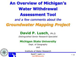
Michigan’s W ater W ithdrawal A ssessment Process and Using the WWA Tool for Planning and Watershed Management. David P. Lusch , Ph.D. Distinguished Senior Research Specialist Michigan State University Dept. of Geography, Remote Sensing & GIS Research and Outreach Services Group

E N D
Michigan’s Water Withdrawal Assessment Process and Using the WWA Tool for Planning and Watershed Management David P. Lusch, Ph.D. DistinguishedSenior Research Specialist Michigan State University Dept. of Geography,Remote Sensing & GIS Research and Outreach Services Group Institute of Water Research and
Michigan’s Water Withdrawal Assessment Process for Planning and Watershed Management • Overview of the groundwater & surface water resources of the Northern Lower Peninsula • Overview of the Water Withdrawal Assessment Tool (WWAT) • Example uses of the WWAT for sustainable community development
Michigan’s Water Withdrawal Assessment Process for Planning and Watershed Management
Michigan’s Water Withdrawal Assessment Process for Planning and Watershed Management Sturgeon R. Pigeon R. Thunder Bay R. Platte R. Boardman R. Au Sable R. Betsie R. Manistee R. Au Gres R. Pine R. Little Manistee R. Muskegon R. Rifle R. Pere Marquette R.
Michigan’s Water Withdrawal Assessment Process for Planning and Watershed Management
Aquifers • Any geologic material that stores and transmits groundwater • Two basic types: • Bedrock Aquifers • Glacial Aquifers
Groundwater Inventory & Mapping http://gwmap.rsgis.msu.edu
Bedrock Aquifers Rb ? ? Sa PB Sc Mi Ma 3.6 X vertical exaggeration KILOMETERS GLACIAL DEPOSITS Rb Sa Sc PB Freshwater / Saline-water interface Mi Ma
Glacial Sediment Characterization Confining material dominates Marginal aquifer material mixed with partially confining material dominates Marginal aquifer material dominates Aquifer material dominates
Michigan’s Water Withdrawal Assessment Process for Planning and Watershed Management • The next segment • Assessment Tool