Download
1 / 20
210 likes | 477 Views
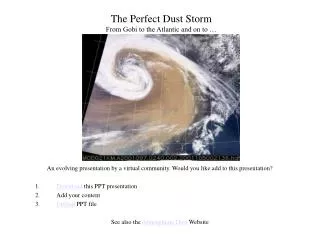
The Perfect Dust Storm From Gobi to the Atlantic and on to …. An evolving presentation by a virtual community. Would you like add to this presentation? Download this PPT presentation Add your content Upload PPT file See also the Atmospheric Dust Website.

E N D
The Perfect Dust Storm From Gobi to the Atlantic and on to … An evolving presentation by a virtual community. Would you like add to this presentation? Download this PPT presentation Add your content Upload PPT file See also the Atmospheric Dust Website
Stories on the perfect dust storm. Tom Gill, April 13, tgill@TTU.EDU Fierce Sandstorms Hit China Western Arid Regions Alternate link Zev Levin, April 17, zev@hail.tau.ac.il The Chinese Dust Storm – A personal Report
Dustfall on Snow at Zhenbeitai, China. This picture was taken near the ACE-Asia sampling station on the afternoon of 9 April 2001, the day following the big dust storm. Photo: Sondra Sage (sage@cemrc.org) Submitte: Rich Arimoto (arimoto@cemrc.org)
China Dust • Earth Observatory
The Prospero Dust Reports: Joe Prospero, jprospero@rsmas.miami.edu, April 8 Dust Summary April 17 Dust Summary
Dust Transport: NRL Model D. Wespthal, westphal@nrlmry.navy.mil • On April 7, The NRL dust model shows the dust cloud emerging from the Gobi desert • A week later, part of the dust cloud passes over N.America toward the Atlantic See the animation that illustrates the transport dynamics
Satellite Images of the Storm (GMS-5, SeaWiFS) Click o the images for full resolution See animation of the April 6 Storm Gif small (340kB) Gif med ( 3 mb) Gif large (11 mb) AVI large (19 mb)
SeaWiFS Images of THE Dust Storm Norman Kuring, norman@tursiops.gsfc.nasa.gov See full size SeaWiFS images of dust transport across the Pacific (1.6 mb each) for April 6, 7, 8, 9, 10, 11, 12, 13, 14, 15 High resolution SeaWiFS images for April 7, 10, 13
Friday, the 13th TOMS Absorbing Aerosol Index See also the daily TOMS animation, April 6 - April 22
Dust Seen over the West Coast of NAM Dust is recognized by the yellow coloration, compared to bluish sulfate/organic haze.
GOES View of the Dust Streak Across N. America, Friday, April 13 GOES10 (West) view of dust streak on the morning of Friday 13th GOES8 (East) view of dust streak on the evening of Friday 13th
GOES View of the Dust Streak Across N. America, April 17 GOES10 (West) view of dust streak on the morning of April 17 GOES8 (East) view of dust streak on the evening of April 17
.. and on to the Atlantic … The dust plume location from the GOES8 over the Atlantic is consistent with the dust location over the Midwest on the day before.
Light Extinction and Scattering During Dust Event • IMPROVE Network, Bret Schichtel, Schichtel@cira.colostate.edu • Transmissometer measures the total light extinction, Bext, while the nephelometer records the light scattering, Bsp, integrated over all angles except near the direction of the light. • Nephelometers underestimate coarse particle scattering by as much as 50% due to truncation of the forward scattering lobe. • The large difference between the Bext and Bsp along with the low RH at Yosemite and the Grand Canyon Nat. Parks is a good indication that the Asian dust was present during April 14-17.
Lidar Depolarization by Dust.Salt Lake City, April 15 K. Sassen, ksassen@met.utah.edu • Preliminary (hurried) lidar images of the 15 April dust layer over Salt Lake City. • The linear depolarization ratios in the surface to 4.5 km MSL dust layer were ~20%, sometimes ~25%, and up to ~15% aloft. This is quite high for our region.
.. and so on… • Insert your slides here or anywhere else…