Download
1 / 23
230 likes | 474 Views
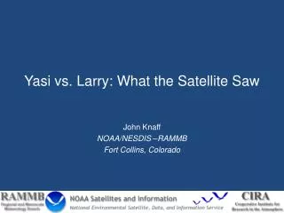
Yasi vs. Larry: What the Satellite Saw . John Knaff NOAA/NESDIS –RAMMB Fort Collins, Colorado. Overview. TC Larry (2006). TC Yasi (2011). Landfall 3 February near Mission Beach 138km S. of Cairns 929 hPa (Tully Sugar Mill) 110 kt (10-min, BoM ) 135 kt (1-min, JTWC)

E N D
Yasi vs. Larry: What the Satellite Saw John Knaff NOAA/NESDIS –RAMMB Fort Collins, Colorado
Overview TC Larry (2006) TC Yasi (2011) Landfall 3 February near Mission Beach 138km S. of Cairns 929 hPa (Tully Sugar Mill) 110 kt (10-min, BoM) 135 kt (1-min, JTWC) 200 + n.miGale force winds 60 + n.miHurricane force winds 5 meter tidal surge Fast translation Long track • Landfall 20 March • South of Innisfail • 95km S. of Cairns • 940 hPa (best track, BoM) • 959 hPa (measured, 2-4 h post landfall) • 100kt (10-min, BoM) • 240 km/h gusts, BoM • 115 kt (1-min, JTWC, best) • 90 n.mi Gale force wind • 30 n.mi Hurricane force wind • 4.9 meter inundation • Average length track
Larry Landfall Intensity Best track Imagery BoM • 100kt / 115 kt • 940 hPa (table),959 hPa observed • Gusts to 240 km/h damage derived JTWC • 100 kt / 115 kt Translation 270/13 kt Subjective T-numbers of 6.5 (127 kt) are possible. 6-hour average close to 6.0
Eyewall Replacement? Microwave imagery (NRLMRY) IR imagery suggests Possible eyewall replacement starting at ~ 16-17 UTC Microwave suggest two eyewalls a little earlier at 1541 UTC
Eyewall Replacement? 89 GHz 1700 UTC Radar Composite at 14 UTC
Landfall • Larry appears to have experienced a quick eyewall replacement just prior to landfall • Double eyes evident in MI from 16 UTC on • Both radar and microwave imagery suggest a larger eye at landfall… replacement complete.
Larry was a small storm Operational Wind Radii 12-h average IR image Area ~ 2560 km x 1920 km
Pressure-Wind • ~950-955 hPa • 90-110 nmi R34 • 13 kt translation • 18S latitude Yields a 100/115 kt intensity.
Yasi Landfall Intensity Best track Imagery BoM • 110 kt/ 125 kt • 929 hPa, observed • …Gusts 280 km/h JTWC • 120kt / 135 kt Translation 250/17 kt Subjective T-numbers of 7.0 (140) are possible, but not at the times of the fixes 6-h average close to 6.6
Landfall • Yasi experienced only slight structural changes as it approached the coast • Unanticipated left turn delayed landfall • Large storm, stable eye size
Larry was a small storm Operational Wind Radii 12-h average IR image Area ~ 2560 km x 1920 km
Pressure-Wind • ~930 hPa • 200-230 nmi R34 • 17 kt translation • 18S latitude Yields a 115/130 kt intensity.
Summary what the satellite saw Larry Yasi Larger storm Average R34 200 to 230 nmi Started large and had a long track. Major Hurricane at landfall Subjective Tnums of max=7.0 (140 kt), mean=6.6 (130 kt) Digital Dvorak T = 7.5 (155 kt) ODT T=6.9 -7.0 Structure stable at landfall Factors (increase Dvorak) Translation 17 kt (+) Latitude = 18S (-) 12-h trend slightly up (+) Large/average (-) • Small storm • Average R34 90 to 110 nmi • Short lifetime • Major hurricane at landfall • Subjective Tnums of max=6.5 (127kt), mean=6.0 (115 kt) • Digital Dvorak T=7.5 (155 kt) • ODT N/A • Eyewall cycle completing at landfall • Factors (increase dvorak) • Translation at 13 kt (+) • Latitude =18S (-) • 12-h trend up (+) • small (+)
Conclusion at Landfall Larry Yasi Intensity should be close to 115/130 kt based on pressure, translation, latitude, size and damage Dvorak estimates too high, particularly Digital, ADT AMSU estimates too low, but better Satellite based size estimates seem able to conclude Yasi was average/large Showed that Yasi’s structure was fairly stable as it rapidly made landfall. • Intensity should be close to 100/115 kt based on pressure, translation, latitude, size and damage • Dvorak estimates too high, especially Digital • AMSU estimates too low • Satellite based size estimates seem able to conclude Larry was small • Eyewall cycle completed around time of landfall