Download
1 / 7
70 likes | 168 Views
This project delves into quantifying and comprehending the oceanic fluxes at the Bering Strait, offering insights into regional ice conditions, water masses, and ecological impacts on Arctic ecosystems. The study includes measurements, data types, and collaborations to enhance scientific understanding.

E N D
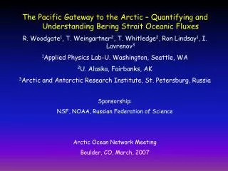
The Pacific Gateway to the Arctic – Quantifying and Understanding Bering Strait Oceanic Fluxes R. Woodgate1, T. Weingartner2, T. Whitledge2, Ron Lindsay1, I. Lavrenov3 1Applied Physics Lab-U. Washington, Seattle, WA 2U. Alaska, Fairbanks, AK 3Arctic and Antarctic Research Institute, St. Petersburg, Russia Sponsorship: NSF, NOAA, Russian Federation of Science Arctic Ocean Network Meeting Boulder, CO, March, 2007
Science Issues Confidence Level Mass Flux: ~0.8 +/- 0.2 Sv M, S: reasonable, IV: modest Freshwater Flux: M, S: low, IV: poor 2500 ± 300 km3/yr (2005) (33% of the Arctic FW influx) Heat Flux: M, S: low, IV: poor 2-5 x10²⁰ J/yr (large regional melting potential) Dynamics: Mean: reasonable Pacific-Arctic sea level D~0.7 m S,IV: poorWinds (60% of the flow variance) S,IV: good Ecologically significant: Mean, S, IV: poor Nutrients, C, seds & biota to western Arctic ecosystems
We have missed: • Stratification (a problem for most Arctic shelves) • Coastal currents • Nutrients (nitrate) • Comprehensive cross-strait coverage (problematic due to past political & $$ constraints) • This IPY project addresses these issues
Bering Strait Influences: • Stratification of the Arctic Ocean • Biological Production of the Chukchi Sea and western Arctic Ocean • Regional ice conditions (Chukchi Shelf and possibly Chukchi Cap) • The Global Hydrologic Cycle • The MOC and North Atlantic Boundary currents (possibly) • And responds to: • Upstream forcing over the Bering Sea shelf and basin • & Gulf of Alaska (salt, freshwater, nutrients) • 7. Steric variations between the Arctic and Pacific.
80 km 2007-2009 Measurements: Seven, year-round moorings (serviced annually) to capture: 1.) Major water masses and coastal currents 2) Stratification (ISCAT) and ADCPs 3) Nitrate and Fluorescence (ISUS nitrate analyzers on 3 moorings) 4) Cross-strait pressure fluctuations 5) Complete cross-strait coverage 6) CTD, nutrients on annual mooring services cruises, 7) Remote sensing (SST, altimetry, and QuikSCAT)
Data Management Plan Data types (available annually): Hourly: currents, temperature, salinity, nitrate, fluorescence, ice thickness (via ADCP), bottom pressure Hydrography: CTD and nutrients (annually) Satellite SST: when possible Satellite altimetry & QuikSCAT: open water season Data disposition (after quality control): Project Website: http://psc.apl.washington.edu/BeringStrait.html JOSS
Logistics Mooring Servicing & CTD Cruises: Russian Naval Hydrographic vessel: Sever (possibly Khromov or other in 2008) Synergies NOAA: Russian-American Long-term Census of the Arctic (2008) Possible collaborations between N. Pacific ARGO program and Arctic Ocean measurements to examine Pacific-Arctic thermosteric variations.