Download
1 / 19
190 likes | 343 Views
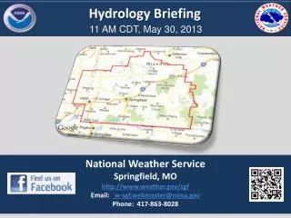
Hydrology Briefing. 11 AM CDT, May 30, 2013. National Weather Service Springfield, MO http://www.weather.gov/sgf Email: w-sgf.webmaster@noaa.gov Phone: 417-863-8028. NWS Springfield . Forecast Highlights. Weather Prediction Center Fronts / Pressure / Weather. Tonight.

E N D
Hydrology Briefing 11 AM CDT, May 30, 2013 National Weather Service Springfield, MO http://www.weather.gov/sgf Email: w-sgf.webmaster@noaa.gov Phone: 417-863-8028
NWS Springfield Forecast Highlights
Weather Prediction Center Fronts / Pressure / Weather Tonight Slow eastward progress of cold front will allow several rounds of rain to develop over the Ozarks Friday Saturday
Rainfall Forecast Through Weekend 7am Today - 7 am Sunday
Flash Flood Watch In Effect Through Saturday Morning
River Flooding Concerns Spring and Elk River Basins
Contingency River Outlook Baxter Springs Contingency Outlook FS on Saturday 30-31 Feet Crest on Sunday
Contingency River Outlook Spring River at Waco Contingency Outlook FS Late Friday night/early Saturday Morning 27-28 Feet Crest Saturday night
Contingency River Outlook Spring River at Carthage Contingency Outlook FS on Saturday Morning 16-16.5 Crest on Saturday
Contingency River Outlook Shoal Creek near Joplin Contingency Outlook FS on Saturday Morning 16-16.5 Crest late Saturday and early Sunday (double crest)
Contingency River Outlook Elk River at Tiff City Contingency Outlook FS on Saturday Afternoon 23-24 Feet – Crest late Saturday / early Sunday
Contingency River Outlook James River at Galena Contingency Outlook FS on Friday Night 31-32 Feet – Crest late Saturday evening
Contingency River Outlook Sac River at Caplinger Mills Contingency Outlook FS on Saturday Morning 22-26 Feet – Crest late Saturday evening
Contingency River Outlook Marmaton River Near Nevada Contingency Outlook FS on Saturday Morning (already in Flood Warning) 24-25 Feet – Crest late Monday
Contingency River Outlook Little Osage near Horton Contingency Outlook FS on Saturday (already in Flood Warning) 43-44 Feet – Crest late Saturday and Monday (double crest)
Contingency River Outlook Big Piney at Fort Wood Contingency Outlook FS late Friday/early Saturday 17-18 Feet – Crest late Saturday
NWS Springfield Forecast Highlights
Decision Support Briefing Resources NWS Springfield: www.weather.gov/sgf Rainfall Forecast: http://www.wpc.ncep.noaa.gov/qpf/qpf2.shtml Storm Prediction Center:www.spc.noaa.gov Social Media: https://www.facebook.com/US.NationalWeatherService.Springfield.gov
Hydrology Briefing Noon, May 30, 2013 For questions and additional information: NWS Springfield, MO http://www.weather.gov/sgf Email: w-sgf.webmaster@noaa.gov Phone: 417-863-8028