Download
1 / 55
550 likes | 785 Views
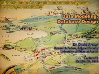
Introduction to Geographic Information Systems Fall 2013 (INF 385T-28620) Data Modeling, Database Design Dr. David Arctur Research Fellow, Adjunct Faculty University of Texas at Austin Lecture 11 October 31, 2013. You are here. Food is there. Well, now it’s there. Outline.

E N D
Introduction to Geographic Information Systems Fall 2013 (INF 385T-28620) Data Modeling, Database Design Dr. David Arctur Research Fellow, Adjunct Faculty University of Texas at Austin Lecture 11 October 31, 2013
You are here Food is there Well, now it’s there
Outline INF385T(28620) – Fall 2013 – Lecture 11 The design process Describing a system of viewpoints Developing use cases GIS design stages Conceptual design Normalization example Database diagrams Building the database Prototype to production
Best practices: iterative, incremental development Planning, Cost-Benefit, Risk Management Ideas, Use Cases, Requirements Analysis, Design and Evaluation Maintenance, Evaluation Development, Quality Control and Evaluation Note: This is only an illustration – your experience may differ! Deployment INF385T(28620) – Fall 2013 – Lecture 11
Best practices: iterative approach • Focus on current issues • Short iterations better reflect near-term internal and external environment • Resolve misunderstandings early • Resolve analysis, design and implementation disparities early • More accurate overall project status • Workload better distributed across life cycle • Medium- to long-term changes in environment factored in more easily through spiral approach INF385T(28620) – Fall 2013 – Lecture 11
Starting out • Define the project • Get to know the client • Stakeholders and decision makers • Build the design team • Analyst • Subject matter experts • Users • Inventory tasks, products, data • Identify model • Develop Use Cases • Inventory data • GIS Design Seminar • Teach client GIS concepts and design methods • Introduce yourself and the design team • Set realistic expectations for the GIS system • Alleviate fears and concerns INF385T(28620) – Fall 2013 – Lecture 11
Building a System… of Viewpoints Community Objectives Business aspects: purpose, scope and policiesWhat for? Why? Who? When? Enterprise Viewpoint Abstract/Best Practices Information sources and models What is it about? Types of services and protocols How does each bit work? Information Viewpoint Computational Viewpoint Implementation/Development Solution types: distribution infrastructureHow do the components work together? Engineering Viewpoint Implementation system: hardware, software, distribution With what? Technology Viewpoint INF385T(28620) – Fall 2013 – Lecture 11 Viewpoints in “Reference Model - Open Distributed Processing (RM-ODP)” ISO/IEC 10746
Notify Owners Use cases • A description of a task you want the system to perform • Add new water service, record parcel sale • Basis of all analysis and design • Start simple; expand with detail later • Analysis of use cases yields data, interfaces, applications • Use cases can: • Capture existing work flows • Define new applications • Help understand alternative and pathological work flows Use case Data GIS Database INF385T(28620) – Fall 2013 – Lecture 11
Emergency Call Center Document locations of flooding Operations & MaintenanceStaff Manage flood control structures Produce flood maps Geocode & map call list GIS Analyst Use case diagrams System boundary • Show the actor/use case relationships • System architecture • Data flows, coordination • Develop with users • During meetings, interviews • Clean up and refine later • Graphical notation is helpful, but the use case document is the most important artifact Actor and name Use case and name INF385T(28620) – Fall 2013 – Lecture 11
Use Case Name Description:Actors:Pre-conditions:Post-conditions: Flow of events:- business rules- user actions, responses Exceptions:Alternates: Example use case • Some context: For emergency response application, assume a set of use cases focused on exchanging information leading to creating, updating, and posting flood maps to interested agencies. • Each use case is documented according to a template, such as: INF385T(28620) – Fall 2013 – Lecture 11
Example use case • Use case: Flooding Information & Response • Description: The call center receives and documents citizen calls related to flooding during storm events. The information is geocoded, mapped, and provided to the Water District’s Operation & Maintenance staff, which makes decisions to manage control structures to mitigate flooding. • Actors: Emergency Response Call Center, GIS Analyst, Operations & Maintenance Staff. • Pre-conditions: The database of critical water facilities has been created. The Emergency Call Center has been activated for a storm event. Water district staff are operating under emergency operating procedures. • Post-conditions: Status change notices are sent to the relevant agencies registered to receive updates. INF385T(28620) – Fall 2013 – Lecture 11
Use case primary scenario • Citizen places a call to the Emergency Call Center hotline. • Call center staff document location and description of flooding problem. • GIS analyst receives and geocodes locations from the call center, producing a map of call locations. • Call reports are symbolized based on flooding issue. Maps are produced and handed off to the operations staff. • Operations & Maintenance staff review maps of flooding incidents and make decisions for operating control structures, gates, and pumps. INF385T(28620) – Fall 2013 – Lecture 11
Are we finished yet? • What layers will you need based on the use case? • Where will you get these layers? • Are there any changes that can be made to the business process? INF385T(28620) – Fall 2013 – Lecture 11
Using the use cases • From the set of use cases developed, the functional requirements and interfaces can be fleshed out. • From an understanding of the collaborators and stakeholders involved in the use cases, appropriate data sources and maintenance authorities can be determined. • From a comparison of all the use cases, redundant information and tasks can be discovered and minimized. • From an examination of potential alternate scenarios, pathological situations can be anticipated and mitigated. • BUT… beware the use case time sink • You cannot completely and correctly document all the use cases for a reasonably complex system in your lifetime • Keep it simple, and start prototyping as soon as you can – this will further inform the use cases and keep your project moving INF385T(28620) – Fall 2013 – Lecture 11
GIS Design INF385T(28620) – Fall 2013 – Lecture 11
Conceptual model Key Logical model Business practices Project Feature collection Physical model Roads Network table Rail Topology Boundaries Relationship table table Designing the database Collect information, identify desired themes and sources Map themes to GIS database elements: define database entities and organization Complete data organization, build full schema, test and refine INF385T(28620) – Fall 2013 – Lecture 11
GIS design practice • Think about the GIS features represented by thematic layers, and about the integrity and behavior of those features-- • Parcels are represented as polygons. • Parcels share geometry with boundaries. • Parcels do not overlap. • … etc. INF385T(28620) – Fall 2013 – Lecture 11
Conceptual design • Entities, general relationships, important attributes • Sketches • ER/UML conceptual diagrams • Spreadsheets • Often reconstruct from existing systems/datasets • Very important for complex projects • Very useful to communicate with domain experts/business people INF385T(28620) – Fall 2013 – Lecture 11
Conceptual design • Purpose and usage of GIS • Data sources • coverages, shapefiles, CAD, etc. • compilation scale and accuracy • Spatial representation • raster, vector, surface, address • Attributes • required fields, types of measurement • Relationships • network, topological, general INF385T(28620) – Fall 2013 – Lecture 11
Key Conceptual design It is important to understand what you want to achieve from the outset • Symbology and labels • what symbols at which scales • text presentation on the map • Spatial reference • projection and datum • the largest area mapped • required detail and resolution • Special design cases, for example: • condominium parcels • parcel annotation INF385T(28620) – Fall 2013 – Lecture 11
Water Use Application Hydrology Utilities Boundaries Roads Diagramming themes • Classic layer diagrams • Organize data into logical units • Focus on common dataelements to help determine: • Attributes • Associations • Spatial relationships INF385T(28620) – Fall 2013 – Lecture 11
Annotation Boundaries Lots Parcels PLSS Monument PLSS Quarter PLSS Section PLSS Township Inventory existing data Target data layers Legacy data INF385T(28620) – Fall 2013 – Lecture 11
Annotation Boundaries Lots Parcels PLSS Monument PLSS Quarter PLSS Section PLSS Township Inventory existing data • Model database schema from existing data • Bridge existing data with current technology, for example: Target Data Layers Legacy data GIS Database • Boundaries hold survey attributes • Coverage parcel polygons only exist for regions INF385T(28620) – Fall 2013 – Lecture 11
Lecture 11 Database Design INF385T(28620) – Fall 2013 – Lecture 11
Files, databases, and GIS • Data files contain text or other data in arbitrary formats • Data tables contain records with fields (attributes, data items) identified by a primary key • Relational Database Management System (RDBMS or just DBMS): • creates and maintains relationships between data tables • allows one or more users to create or edit data in the tables • allows users to sort, select, and retrieve information using QUERIES and REPORTS • GIS adds a spatial dimension to databases, by integrating location and geometric shape information with the tables INF385T(28620) – Fall 2013 – Lecture 11
Ab Cd Ef xz 11 12 24 12 32 12 17 53 ed vg kl op 34 9 11 46 4 9 2 2 R A X G w f c v Relational databaseA formal information model called “relational” • Tables can have formal & ad hoc relationships, based on: • Rows and columns • Known column types • Relationships • SQL language and operators • Relational is based on a simple, generic model with many implementations (MS Access, IBM DB2, Oracle, MS SQLServer, and many others) INF385T(28620) – Fall 2013 – Lecture 11
Data tables Organized into columns, rows, and cells (like a spreadsheet) Columns = attributes = fields = data items Rows = records Cells = values Attribute or Column Record or Row Cell or Value INF385T(28620) – Fall 2013 – Lecture 11
Defining columns To define a column or attribute, you must specify the column name and type All DBMS’s support basic types: • Number (integer, float, decimal) • String (text) • Boolean (Yes/No) • Date Many DBMS (SQL-99) and GIS systems support additional types (BLOB, XML, time series, …) INF385T(28620) – Fall 2013 – Lecture 11
Primary key The field or combination of fields that identifies each and every record uniquely within a table Note: Primary key is more often arbitrary, meaningless to users; main purpose is to be unique
Water use permit example • Paper-based application form required for permit to withdraw surface or ground water
Sample data for water use permits Avg Gallons/Day Max Gallons/Day Withdrawal Code Application ID Source Name Source Code Use Codes Owner INF385T(28620) – Fall 2013 – Lecture 11
Water use codes INF385T(28620) – Fall 2013 – Lecture 11
Relational organization • Tables should be organized according to basic rules of relational design for most efficient use. • Normalization is a series of steps followed to obtain a database design that allows for efficient access and storage of data in a relational database. These steps reduce data redundancy and the chances of data becoming inconsistent. • 3NF or BCNF are the usual standards for relational database design, however performance and convenience may drive toward de-normalization. INF385T(28620) – Fall 2013 – Lecture 11
Database normalization steps • First Normal Form (1NF) eliminates repeating groups by putting each into a separate table and connecting them with a one-to-many relationship. • Second Normal Form (2NF) eliminates functional dependencies on a partial key by putting the fields in a separate table from those that are dependent on the whole key. • Third Normal Form (3NF) eliminates functional dependencies on non-key fields by putting them in a separate table. At this stage, all non-key fields are dependent on the key, the whole key and nothing but the key. • Boyce-Codd Normal Form (BCNF) is sometimes applied as a stronger form of 3NF in which every determinant of a functional dependency within a relation must be a candidate key for the schema. • Fourth Normal Form (4NF) separates independent multi-valued facts stored in one table into separate tables. • Fifth Normal Form (5NF) breaks out data redundancy that is not covered by any of the previous normal forms. source - http://www.hyperdictionary.com/dictionary/database+normalisation INF385T(28620) – Fall 2013 – Lecture 11
First normal form - NOT • Do you see any groups of repeating columns? • What’s wrong with that? • Can you think of a case where this is okay? • How would you reorganize to fix this? INF385T(28620) – Fall 2013 – Lecture 11
First normal form Primary key Foreign keys • The Use Code columns can be removed from the main table (A), and made into rows of a separate table (B), keyed by ActID. (compare with previous slide) • (C) is a lookup table for use code descriptions. B C Primary key A INF385T(28620) – Fall 2013 – Lecture 11
Relationship cardinality • With this design, one ActID can have any number of use codes, and any one use code can be associated with many ActID’s • This is called a Many-to-Many (M:M) relationship • This is much more space-efficient for data storage • One record in the Use Code Descriptions table (C) can be associated with many records in the ActID-Use Codes table (B) • This is called a One-to-Many (1:M) relationship • You may also have relationships with fixed cardinalities, such as 1:1, 1:2, 1:0..5, etc. • Cardinality of 1:0 generally means “nulls are allowed” INF385T(28620) – Fall 2013 – Lecture 11
Second normal form - NOT • Do you see any dependencies between non-key columns and a partial key? • If the primary key were compound and included an OwnerID, there could be such a dependency between Owner and OwnerID • What’s wrongwith that? • What wouldyou do to fix this? Compound key INF385T(28620) – Fall 2013 – Lecture 11
Second normal form • Remove the non-key data to a separate table and link to it • … and clean up the data while you’re at it! • Spelling, abbreviations, punctuation • Firstname Lastname vs. Lastname, Firstname INF385T(28620) – Fall 2013 – Lecture 11
Third normal form - NOT • Do you see any functional dependencies among non-key fields in the table below? • Need we ask again: what’s wrong with this? • How would you reorganize to fix this?
Third normal form • Remove the source description to a separate table, and join using the source code field • This will reduce duplication of data (and errors) INF385T(28620) – Fall 2013 – Lecture 11
Is that all there is to it? • This table is NOT in Third Normal Form: • The PostalCode field is dependent on the City and ST fields • To place this table in 3NF, a separate table would be created for the City and ST fields, and joined using the PostalCode field • But this is generally not done with address & postal codes… WHY?
Normalization tradeoffs • When would you expect to normalize tables? • For primary data entry and updates; easier to set up and manage data integrity validation • Such as name and address subfields • To support more kinds of ad hoc queries • When would you expect to denormalize? • For presentation of data to users • To reduce the number of table-joins for faster performance • Queries are known and fixed • Better performance for web publishing • Database views are often used to flatten relationship structure for read-only access INF385T(28620) – Fall 2013 – Lecture 11
Lecture 11 Database diagramming INF385T(28620) – Fall 2013 – Lecture 11
Database diagramming: conceptual / logical overview • Database relationships and cardinality can be diagrammed for prototyping and documentation • The “*” on an associationlink means “many” 1 * * * Owners Applications Use Codes * 1 Use Code Descrips INF385T(28620) – Fall 2013 – Lecture 11
1 * * * Owners *OwnerID FirstName LastName Phone StreetAddr City State PostalCode Applications *ApplicationID OwnerID ApplicationType ProjectLocation BusinessName BusinessType … Use Codes *RowID UseCode ApplicationID * 1 Use Code Descrips *UseCode Description Database diagramming:Entity-Relationship (E-R) or Unified Modeling Language (UML) INF385T(28620) – Fall 2013 – Lecture 11
Normalization tradeoff: referential integrity • Suppose you removed a record from the Owner table • What should be done with the related records from the Applications table? • Would this be easier or harder to manage than with the de-normalized design on slide 33, “Sample data for water use permits”? • The more tables are interconnected by relationships, the greater the need to support referential integrity within your applications • A DBMS’ default support for referential integrity may be very basic, such as to place Nulls in associated foreign key fields, but only when a relationship is declared INF385T(28620) – Fall 2013 – Lecture 11
Lecture 11 Building the database INF385T(28620) – Fall 2013 – Lecture 11