Download
1 / 32
320 likes | 343 Views
Explore how historical Australian land cover changes affect climate using modeling experiments with the CSIRO GCM. Learn about methods to represent land cover data in the GCM and implications for climate impacts. Acknowledge financial support from Meat & Livestock Australia and the Australian Research Council for this research.

E N D
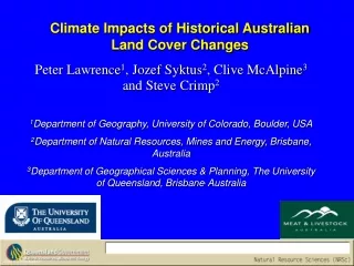
Climate Impacts of Historical Australian Land Cover Changes Peter Lawrence1, Jozef Syktus2, Clive McAlpine3 and Steve Crimp2 1Department of Geography, University of Colorado, Boulder, USA 2Department of Natural Resources, Mines and Energy, Brisbane, Australia 3Department of Geographical Sciences & Planning, The University of Queensland, Brisbane, Australia Slide 1 – Introduction
Motivation for this talk • Relevance to stage 3 of C20C • Need for a significant effort/progress to increase realism of simulated vegetation/hydrology & climate interactions for climate change and seasonal prediction work • Not a simple task to change/update land cover characteristics in GCM and still produce good climatology
Talk Outline • Description of the problems associated with update of land surface parameters in AGCM • Representing historical Australian land cover changes in the GCM • Overview of land cover change experiments with CSIRO GCM • Results from climate modelling experiments • Implications of the climate impacts of Australian Land Cover Change Acknowledgement of financial assistance from Meat & Livestock Australia & Australian Research Council. Results from Ph.D. thesis completed by Peter Lawrence Slide 2 – Talk Outline
Why are climate models needed for climate and land cover? • Given the complexity of the climate system there are many interacting phenomena effecting climate • Historical climate records have many other sources of climate variability and change that interact with land cover effects • Climate modelling allows the climate effects of land cover change be isolated and examined independently of these other sources Slide 4 – Need for Climate Models
Land Cover and Climate Interactions and Feedbacks Slide 6 – Land Cover Climate Impacts
New land surface conditions described by vegetation mapping and satellite imagery • Model vegetation types (Simple Biosphere) derived for Australia from AUSLIG mapping of current day vegetation and Globally from International Geosphere Biosphere Program (IGBP) Mapping • Mean monthly Surface Reflectivity (Albedo) derived from MODerate resolution Imaging Spectroradiometer (MODIS) satellite imagery. • Mean monthly Leaf Area Index (LAI) derived from Pathfinder AVHRR • All three are used to generate land surface parameters that describe monthly dynamics of: Solar radiation; Deep rooted transpiration; and Surface roughness Slide 10 – Current Land cover representation
Representing Land Cover Data in the CSIRO GCM • The spatial scale of the land cover data (1 - 8 km) was much finer than the land surface parameters of the CSIRO GCM (~180 km) • The land cover changes in radiation budgets, transpiration rates and surface roughness needed to be calculated as GCM land surface parameters • New land surface parameter generation techniques produced relatively fine scale vegetation, monthly albedo, and monthly LAI data and differences between current and pre-clearing land cover • Aggregation rules used to take generate GCM parameters from fine scale parameters Slide 14 – Incorporating Land cover data in CSIRO GCM
Incorporating Fine Scale Land Surface Data in GCM Parameters Slide 15 – Land Surface Parameter Methods
Control simulations with old and new modern land surface characteristics were compared in term of seasonal mean skill for various fields. It took a lot of effort to get climatology close to that of original model!
Historical Australian Land Cover Change in CSIRO GCM How are the changes in Australian land cover since European settlement described ? • Studies by Graetz, et al. 1995 and Barson, et al. 2000 used the Australian pre European Vegetation mapping of AUSLIG with Landsat MSS and TM satellite imagery • Australian land cover change in both studies were divided into the Intensive Landuse Zone and the Extensive Landuse Zone • Changes in the Intensive Landuse Zone were principally structural changes in vegetation from clearing forests and woodlands to replace with crops, pastures and urban areas • For the study land cover changes restricted to vegetation changes in the Intensive Landuse Zone since European settlement Slide 8 – Historical Australian LCC
Australian Historical and Recent Land Cover Change • AUSLIG Structural Changes in Australian Vegetation 1788 – 1990 • Barson, et al. 2000 Recent Australian Land Cover Change from Landsat TM satellite imagery 1990 – 1995 Slide 9 – Land cover change maps
Pre European land surface conditions extrapolated from current day land surface with historical vegetation mapping • Model vegetation types (Simple Biosphere) derived from AUSLIG mapping of pre European vegetation • Mean monthly LAI extrapolated from current monthly LAI of remnant natural vegetation in the immediate neighbourhood • Mean monthly Albedo extrapolated from current monthly Albedo of remnant natural vegetation in the immediate neighbourhood • Again all three are used to generate land surface parameters that describe monthly dynamics of: Solar radiation; Deep rooted transpiration; and Surface roughness Slide 16 – Extrapolating Pre-Clearing Land cover
Australian Historical Land Cover Mapping • AUSLIG Current (1990) Vegetation mapped in Land Cover Classes • AUSLIG Pre-European (1788) Vegetation mapped in Land Cover Classes Slide 17 – Land Cover Mapping
Australian Historical Land Cover Change Mapping • AUSLIG Current (1990) Vegetation mapped in the Simple Biosphere Classes of Model • AUSLIG Pre-European (1788) Vegetation mapped in Simple Biosphere Classes Slide 18 – SiB Land Cover Mapping
Summary of Australian Historical Land Cover Change Impacts on GCM Surface Parameters • CurrentAustralian albedo was marginally higher, with south west Western Australia consistently higher, and eastern Australia higher in summer but with mixed differences in winter • Current Australian LAI was significantly lower, with south west Western Australia significantly lower in summer and marginally higher in spring, and eastern Australia consistently lower, with marginally closer values in southern areas in spring • Current Australian stomatal resistance was marginally higher, with south west Western Australia significantly lower, south eastern Queensland marginally higher and eastern New South Wales marginally lower • Current Australian surface roughness was significantly lower Slide 19 – Summary of Parameter Changes
Land Cover Change and Climate modelling experiments • Experiment 1 – Use CSIRO GCM to model climate for 1969 – 2000 with current land surface conditions • Experiment 2 – Use CSIRO GCM to model the climate for the same period with pre European land cover • Remove other sources of of climate variability by prescribing the same observed sea surface temperatures and sea ice distribution from in both experiments for modelling period • Compare climate between the two experiments • Attribute differences in climate with changes in land surface processes that have resulted from land cover changes Slide 7 – Land Cover Sensitivity
CSIRO Mk3 AGCM Model • Atmosphere Grid: T63 (1.88o x 1.88o) 18 levels - hybrid ,p Semi-Lagrangian moisture transport UKMO convection (Gregory & Rowntree) Liquid water clouds (Rotstayn) • Land surface Soil model - 6 levels Temperature, water, ice 9 soil types 13 land surface and/or vegetation types Snow-cover model - 3 layers
rs - min stomatal resistance LAI – leaf area index z0 – roughness length α – canopy albedo ε – canopy emissivity δ – fraction of canopy Parameters required for the vegetation description
saturated moisture content wilting moisture content field capacity moisture content matrix potential hydraulic conductivity z0 – roughness length α – soil albedo soil density specific heat Soil Model 6-layers for moisture and temperature Parameters required
Conclusions on Australian Historical Land Cover Change Impacts on GCM Surface Parameters • Australian land cover change modified the Australian continental and regional land surface properties of surface albedo, leaf area index, surface roughness, and stomatal resistance • These changes impacted on: surface radiation budgets; canopy resistance to transpiration; canopy moisture storage capacity; canopy interception rate for precipitation and dew; and boundary layer turbulence • The differences in CSIRO GCM land surface parameters between pre-clearing and current Australia, however, were smaller in magnitude than the differences between the original CSIRO GCM parameters and the new satellite derived land surface parameters Slide 22 – Conclusion of Parameter Changes
Climate Impacts of Australian Land Cover Change • Statistical analysis was performed to assess the Australian continental and regionalmodelled climate impact of historical Australian land cover change. • The only statistically significant changes in average Australian climate were for austral summer (DJF), which was warmer (+0.15 C, p = 0.00) and dryer (-0.09 mm/day, p = 0.05) • Regional analysis showed statistically significant changes in average climate for south east Queensland, where summer was warmer (+0.15 C, p = 0.00) and dryer (-0.31 mm/day, p = 0.00), and spring was cooler (-0.33 C, p = 0.02) • Eastern New South Wales, where summer was warmer (+0.4 C, p = 0.00) • and south west Western Australia, where it was overall cooler (-0.35 C, p = 0.00), with summer cooler (-0.32 C, p = 0.00), autumn cooler (-0.7 C, p = 0.01), winter wetter (+0.24 mm/day, p = 0.01), and spring cooler (-0.32 C, p = 0.02). Slide 23 – Climate Impact Results
Implications of the Climate Impacts of Australian Land Cover Change • Statistically significant DJF warming and drying modelled over south east Queensland, corresponds with strong drying trends over the last 50 years • This region and the areas to the north and west, continue to be actively cleared, accounting for the majority of current land clearing occurring across Australia • Statistically significant increase in JJA precipitation over south west Western Australia was opposite to the observed drying trends of the last 100 and 50 years. • This showed the increased JJA latent heat fluxes over agricultural land had the potential to increase precipitation, supporting the observations of Ray et al. (2003). • This suggested the strong drying trend over south west Western Australia has been in response to large scale circulation changes, rather than historical land cover change. Slide 32 – Implications of Results
Australian Land Cover Change: Clearing 1990 - 1995 Trends in Annual Rainfall1950 - 1999
Conclusions • Changes in land cover result in regional and seasonal changes in surface conditions which can only be realistically described with current satellite observation and historical extrapolation • The differences in the satellite-derived land surface properties and the original CSIRO land surface parameters are larger than the differences described for Australian land cover change • Changes in surface conditions have strong regional and continental impacts on modelled Australian climate • The climate changes result from direct impacts from changes in surface fluxes, and indirect impacts from changes in atmospheric circulation, precipitation induced soil moisture feedbacks, and cloud induced short wave radiation feedbacks • The climate impacts of human induced land cover changes need to be incorporated into Australian climate change assessments Slide 34 – Conclusions