WEB BASED DEVICE INDEPENDENT MOBILE MAP APPLICATIONS. THE m-CHARTIS SYSTEM
University of Patras Computer Engineering and Informatics Department 26500 Patras, Greece. Computer technology Institute 26500 Patras, Greece. WEB BASED DEVICE INDEPENDENT MOBILE MAP APPLICATIONS. THE m-CHARTIS SYSTEM John Garofalakis Theofanis – Aristofanis Michail Athanasios Plessas.

WEB BASED DEVICE INDEPENDENT MOBILE MAP APPLICATIONS. THE m-CHARTIS SYSTEM
E N D
Presentation Transcript
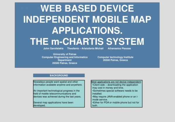
University of Patras Computer Engineering and Informatics Department 26500 Patras, Greece Computer technology Institute 26500 Patras, Greece WEB BASED DEVICE INDEPENDENT MOBILE MAP APPLICATIONS. THE m-CHARTIS SYSTEM John Garofalakis Theofanis – Aristofanis Michail Athanasios Plessas BACKGROUND Nowadays people want spatial and other information available anytime and anywhere. An important technological progress in the field of mobile telecommunications and devices was achieved during the last years. Several map applications have been developed. • Most applications are not device independent: • Client side – downloading the application may cost in money and time. • Sometimes special software needs to be installed. • May require JAVA enabled phone or an i-mode service. • Either for PDA or mobile phone but not for both.
THE m-CHARTIS SYSTEM DEVICE INDEPENDENCE • The m-CHARTIS application allows mobile users to navigate to city maps and to access information that an administrator has inserted into the system with the use of a desktop computer. • The administrator may: • Insert, delete and modify cities into the system. For a new city the administrator may provide general information (historical details etc) and the maps (digital geographic data) which are in the form of digital text files that contain coordinates. • Insert, delete and modify categories. Points of interest that will be placed on the maps are classified in categories. For example museums or restaurants. • Insert, delete and modify a point of interest with a mouse click on the map and give info about it. For example archeological museum (info: address, phone number, opening hours etc). • The mobile part of the application allows the mobile users to access the information that has been imported in the system. • User features: • Select one of the available cities. • View the general information about the city that the administrator has imported in the system. • Navigate through the map of the city. The user may start navigating from pre-specified points. During navigation he is able to change the size of the map and the zoom level. • Mobile devices that belong to a different category, but also devices of the same category have different capabilities and face different constraints that affect graphics quality and user interaction. • Constraints: • Screen size and resolution. • Number of colors, compared to desktop monitors. • Limited processing power and storage space. • Low data transfer rates, although 3G networks are already introduced to improve the situation. • Not functional interaction with the user. • In our application we take into consideration handhelds’ constraints and capabilities. • Our approach: • Web based approach (simple web pages) – storage and processing of data takes place at the server’s side (low processing power and storage space constraints). • XHTML Mobile Profile pages – all devices equipped with a browser can access them. Almost all modern devices have this capability. • No dependence on the connection service (WAP 2.0, i-mode etc). • Pages designed to have the smallest possible size (low transfer rate and high cost constraints). • Possibility to change the size and the zoom level of the maps (adaptation to handheld device screen capabilities).
SCREENSHOTS Screenshots for the mobile part of the application were taken with smartphone Qtek 8020. Navigation Page • In order to create the map, the system applies mathematical transformations to the coordinates of the digital geographical data. Scaling and resizing can be achieved without loss of information or quality. • Search for points of interest. The user may search for all points that belong to a category or for a specific point giving its name as keyword. When a point is found and selected the user is transferred in the respective part of the map and can read information about the point. • Search for a specific street, giving as keyword the name of the street or part of it. If the street is found the user is transferred to the respective part of the map. • Guidelines followed for the design of the pages: • Same style for all pages. • Each page is divided in discrete parts: links, main informational content, input forms. • Representative titles. • Small pages in order to avoid scrolling. • Automatically changing of entering text method. For example, when numerical input is required in a form, the input of the device is automatically changing to numeric (when this feature is supported by the device and the browser).
Search Point Pages FUTURE WORK REFERENCES • We intend to do the following: • Evaluation and user assessment of the application. • Improvements based on the conclusions of the evaluation. • Addition of new features such as finding the shortest path from one location of the map to the other. • Kaikkonen, A., Roto, V., Navigating in a Mobile XHTML Application. • Paelke, V., Reimann, C., Rosenbach, W., A Visualization Design Repository for Mobile Devices. • XHTML Guidelines for Creating Web Content, 2005, Nokia Corporation. • XHTML Mobile Profile and CSS Reference, 2003, Openwave Systems.