Download
1 / 50
560 likes | 1.02k Views
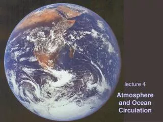
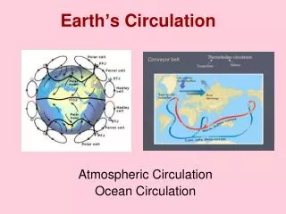
Earth’s Circulation. Atmospheric Circulation Ocean Circulation. Circulation is the way Earth moves ocean water and atmosphere. General Circulation of the Atmosphere: start with surface winds. Surface Winds: Follow Pressures. Flow high to low Coriolis Friction. First step – naming winds.

E N D
Earth’s Circulation Atmospheric Circulation Ocean Circulation
Circulation is the way Earth moves ocean water and atmosphere
General Circulation of the Atmosphere: start with surface winds
Surface Winds: Follow Pressures • Flow high to low • Coriolis • Friction
Trade WindsFlow tothe Intertropical Convergence Zone Hadley Cells • Touch at ITCZ • Rising air over Doldrums • Fed by Easterly Trade Winds
Trade Winds Carry Dust Mali Dust Plume blowing from the east
Classroom Resource Watch trade winds flow from east to west, Different visuals of flow of moisture
Classroom Resources Watch ITCZ move north and south Sahel: at the margin of the ITCZ, so some years lots some little
A big cause of deserts is descending air, right under subtropical high
Classroom Resource Watch westerly winds flow from west to east Different visuals of flow of moisture
Polar Front: zone of storms from convergence of westerly winds and polar easterly winds
Polar Easterlies - Flowing from Polar High to Polar Front (low)
Continents break up the high pressures and make reality look more like circulation cells
“center” of the precipitation peaks are the belts of low pressure: ITCZ and the 2 polar fronts
For dry Southwest toget winter rains, need: • Winter time for jet stream to shift south
For SW to get winter rains, need: • Meridional pattern • The “trough” to be over SW
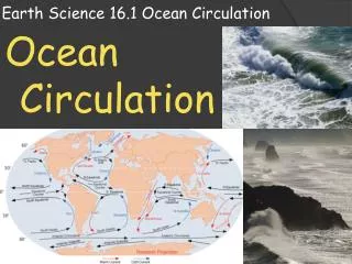
Surplus in Tropics moved to higher latitudes by warm currents
Classroom Resources Gulf Stream 3D perspective
What would happen if Gulf Stream slowed or didn’t go far enough? Gulf stream & North Atlantic Drift Classroom Resource
“The Day After”: decades not days Classroom Resource
Cold Currents: Upwelling & Rich Nutrients result in Marine Resources
Classroom Resources Focus on Peru to introduce El Nino Movie with labels
ENSO: El Nino Southern Oscillation “Normal” or more typical (La Nina is the more normal state) Trade winds push warm water & storms to East Pacific
Part of the “Walker Cell” Trade winds and warm water supplies energy (storms) to Northern Australia and Indonesia, while Peru is dry from descending air
ENSO: El Nino Southern Oscillation • Trade winds decrease • warmth & storms move eastward against South America • Upwelling ceases • Marine food chain collapse
On Average 7 yrs apart ENSO- red
Online Resources El Nino/La Nina Visualizations http://serc.carleton.edu/NAGTWorkshops/visualization/collections/elnino_lanina.html Oceanography Animations http://serc.carleton.edu/NAGTWorkshops/visualization/collections/oceanography.html Ocean Upwelling and Circulation http://serc.carleton.edu/NAGTWorkshops/visualization/collections/circulation_upwellings.html Ocean Surface Currents http://serc.carleton.edu/NAGTWorkshops/visualization/collections/surfacecurrents.html
Circulation is the way Earth moves ocean water and atmosphere