Download
1 / 21
210 likes | 401 Views
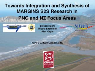
Towards Integration and Synthesis of MARGINS S2S Research in PNG and NZ Focus Areas. Steven Kuehl Nicola Litchfield Alan Orpin April 5-9, 2009 Gisborne, NZ. Workshop goals and products. Delineate the key results from the two S2S focus sites

E N D
Towards Integration and Synthesis of MARGINS S2S Research in PNG and NZ Focus Areas Steven Kuehl Nicola Litchfield Alan Orpin April 5-9, 2009 Gisborne, NZ
Workshop goals and products Delineate the key results from the two S2S focus sites Identify the outstanding scientific gaps to fulfill the program goals Demonstrate the wider potential of our results to the understanding of source-to-sink systems globally Documenting the societal relevance of our results Identifying future research goals and opportunities
TWO CONTRASTING SEDIMENT DISPERSAL SYSTEMS Fly Waipaoa Understanding Earth surface processes that transfer material from Source to Sink How do they operate? What is transported? How much is transported? How quickly is it transported? How are the segments of the systems linked? How have the systems changed through time?
COMPARISON OF DISPERSAL SYSTEMSFlyWaipaoa Climatic setting wet tropical temperate Basin size 75,000 km2 2,200 km2 Sediment Discharge large (108 t/y) moderate (107 t/y) Manipulation small (+35%) large (+550%) Lowland floodplain long tidal reach trivial tidal reach River mouth delta, mangroves strand plain Discharge events unrelated to ocean correlated to ocean Gravity flows saltwater also freshwater (fluid mud) (hyperpycnal flows) Shelf sedimentation clinoform prograde basin infill Tectonic setting foreland basin fore-arc basin Offshelf loss ~3% ~15% Offshelf seds mostly carbonate mostly siliciclastic
Better view of PNG clinoformmodern sedimentation over old clinoform 400 m Courtesy of Rudy Slingerland and Neal Driscoll
Longer-term stratigraphic record Prograding sequences topped by shelf-edge delta and drowned barrier reef Tcherepanov et al. (2008)
4. Last post-glacial Waipaoa Shelf Shallow Structure - Chirp Holocene Isopachs A/C Gerber et al., submitted
avalanche debris Quaternary shelf fill Quaternary basin fill Imbricate thrust faults Deformation front Courtesy of Josh Mountjoy MCS profile, Tuahine Ridge Courtesy of Alan Orpin 1 km Active uplift 2 km Active uplift MCS profile, Poverty slope 3 km
BUILDING A PREDICTIVE AND HOLISTIC UNDERSTANDING FOR SOURCE TO SINK STUDIES FROM PROCESS TO MARGIN-SCALES • BREAK-OUT GROUP REPORT HIGHLIGHTS • Active feedback b/w observations and models, CSDMS, model results inform need for/direction of data collection, determination of landscape trajectories • Equifinality – multiple different events that can create the record, use modelling to distinguish • Bridging timescales, production and storage areas • Transfer knowledge gained from WSS into other systems • Linking models b/w and across S2S systems – uplands, floodplain, coastal, offshore, biogeochemistry
What is CSDMS? • An integrated community of experts to promote the quantitative modeling of earth-surface processes: 265 members, 135 Institutions, 22 countries, 8 working groups or focus research groups • Cyber-infrastructure to distribute Model, Data and Educational Repositories: 52+58 models (235,000 lines of code in 22 languages); 32 model initialization or boundary condition global databases; >100 ppt presentations, lecture materials & movie simulations. • Middleware to couple dynamical models, at specific temporal and spatial scales: CSDMS Framework consists of CCA architecture and services (Babel, Ccaffine, Bocca, SIDL, PETSc), and OpenMI Interface Standards, to allow for multiple open-source languages in a HPC environment. • Partnerships with related computational programs, field campaigns and laboratory experiments: e.g. ESMF, CCSM, CCA, OpenMI, CSTMS, CCMP, OMS, MARGINS, CZO, HIS, NCED, LOICZ, NOPP S2S MARGINS, NZ, 2009
Moisture Precipitation NCAR: 75x75 km, 1hr Moisture Precipitation NCAR: 37x37 km, 1hr S2S MARGINS, NZ, 2009
Modular Modeling SedFlux Modeling Schema Boundary Condition Acquisition/ Generation Model Resolution; Processes; Upscaling Field/Lab Validation Error Error Propagation; Uncertainty helps to quantify Geoscience knowledge in terms of: Uncertainty, Variability, Error, Precision, Accuracy, Confidence S2S MARGINS, NZ, 2009
“One of the exciting outcomes of the meeting was the synergy identified between carbon and sedimentary cycles, carried out within the S2S framework”
Community Consensus • benefit of process-related lines of inquiry with sediment studies • benefit of exploring closer relationship with the carbon community • S2S-type studies in other focus areas of scientific and societal relevance (e.g., Arctic) These approaches could be incorporated under the new MARGINS program, but might also prosper under other program directions.
Future Directions The importance of tectonics in the production of sediment and accommodation space, across a range of timescales raises the question of the appropriateness of timescales when working in areas with high tectonic activity. Punctuated tectonic and high-frequency sediment responses are avenues for future work.
Short-Term Goals Filling gaps in S2S Science- e.g, tidal and lower Fly floodplain, longer term record, integration and synthesis proposals Workshop to plan summary volume - holistic overview and synthesis “S2S Text” Smaller working group meetings focused (e.g., Carbon and Arctic Science) Integration with CSDMS
Fly Tidal River – The Missing Link Tides extend 300 km to Obo Classic tide-dominated delta at river mouth Courtesy of Sergio Fagherazzi Obo Courtesy of Bill Dietrich
What is CSDMS? • An integrated community of experts to promote the modeling of earth-surface processes. • Protocols for the library of community-generated, continuously evolving, open software. • Cyber-infrastructure to distribute software tools & models in aid of applied and education uses. • Partnerships with related scientific programs, providing strong linkage between predictions and observations. Modeling Planet Earth (CIG, CSDMS, CCSM) CCSM CSDMS CIG CSDMS