Download
1 / 10
140 likes | 408 Views
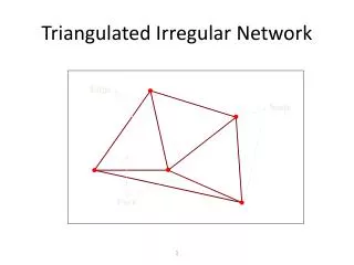
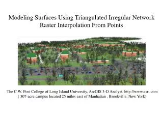
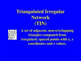
Triangulated Irregular Network ( TIN ). A set of adjacent, non-overlapping triangles computed from irregularly spaced points with x, y coordinates and z values. Surface Concepts. Discrete vs. Continuous features Discrete features; roads, land ownership, Continuous features; elevation,

E N D
Triangulated Irregular Network(TIN) A set of adjacent, non-overlapping triangles computed from irregularly spaced points with x, y coordinates and z values.
Surface Concepts • Discrete vs. Continuous features • Discrete features; • roads, • land ownership, • Continuous features; • elevation, • Rainfall data, • Pollution concentration
What is a TIN ? • Tin data structure based on two basic elements to form a continuous faceted surface. • Points with x,y,z values • Series of edges
What is a TIN ? (cont.) • The triangles are as equi-angular as possible • Ensures that any point on the surface is as close as possible to a node • The triangulation is independent of the order the points are processed
Components of a TIN • Nodes • Edges • Trangles
What is a Lattice ? • A surface interpretation of a grid • Equally spaced sample points • Referenced to a common origin • Constant sampling distance in the x and y directions
TIN in ArcInfo Arc: TINARC Usage: TINARC <in_tin> <out_tin> {POLY | LINE | POINT | HULL} {PERCENT | DEGREE | Z_FACTOR}