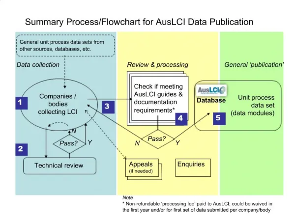
Download

1 / 30
300 likes | 316 Views
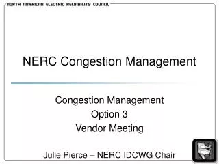
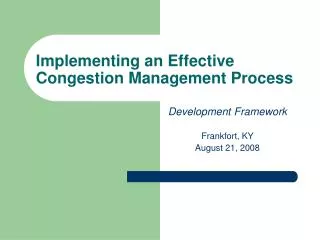
Summary of the WILMAPCO Congestion Management Process. Prepared for T3 Webinar September 18, 2007. Presentation Outline. Summary of CMP Process How is the CMP Used in Operations, Long-Range Planning, and Project Prioritization? Challenges/Future Activities. WILMAPCO Region.

E N D
Summary of the WILMAPCO Congestion Management Process Prepared forT3 WebinarSeptember 18, 2007
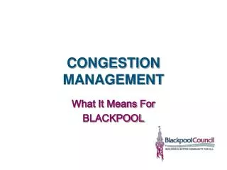
Presentation Outline • Summary of CMP Process • How is the CMP Used in Operations, • Long-Range Planning,and Project • Prioritization? • Challenges/Future Activities
WILMAPCO Region Pennsylvania Philadelphia New Jersey Maryland Baltimore Washington D.C
WILMAPCO CMS Timeline 1997: First CMP produced by WILMAPCO 2000: Formation of the WILMAPCO CMP Subcommittee 2001: Revised CMP produced 2002-2005: CMP produced annually
WILMAPCO 4-Step CMP Process: Overview Regional Planning Process (MTP, TIP, etc….)
CMP Road Network • Represent 25% of Roads • Carries 86% of Daily VMT Network made up of all classifications of Minor Arterial and higher
Step 2: Congestion Definition and Identification Performance Measures: Roadway Volume/ Capacity Ratio Segments operating at LOS E and (V/C ratio greater that 93% Capacity) Intersection Level of Service (LOS) Intersections functioning at LOS E and F (V/C greater than 90% Capacity)
Step 2: Congestion Definition and Identification, cont’d. Performance Measures: Roadway Volume/ Capacity Ratio Segments operating at LOS E and (V/C ratio greater that 93% Capacity) Intersection Level of Service (LOS) Intersections functioning at LOS E and F (V/C greater than 90% Capacity) Percent under posted speed: Arterial Segments operating at greater than 60% BELOW posted speed Freeway Segments operating at greater than 30% BELOW posted speed
Step 2: Congestion Definition and Identification, cont’d. Performance Measures: Roadway Volume/ Capacity Ratio Segments operating at LOS E and (V/C ratio greater that 93% Capacity) Intersection Level of Service (LOS) Intersections functioning at LOS E and F (V/C greater than 90% Capacity) Percent under posted speed: Arterial Segments operating at greater than 60% BELOW posted speed Freeway Segments operating at greater than 30% BELOW posted speed Transit Level of Service (Load Factor) Routes with V/C ratio greater than 100% of capacity (LOS E & F)
Selection of Identified Corridors
Step 2, cont’d: Selection of Identified Corridors • - Group consensus • Captures major movements • - Areas with significant congestion densities (multiple measures impacting corridor)
Step 3 – Strategy Evaluation • Individual Corridor Analysis • CMP “Toolbox” • Area-Wide Mitigation Strategies • Corridor Solution Matrix • TIP Analysis
Step 3 – Strategy Evaluation, cont’d. • Individual Corridor Analysis • CMP “Toolbox” • Area-Wide Mitigation Strategies • Corridor Solution Matrix • TIP Analysis Strategy #1: Eliminate person trips or reduce VMT during peak hours(Land Use, Congestion Pricing, TDM) Strategy #2: Shift Trips from Automobile to Other Modes(Transit, Bicycle and Pedestrian Improvements) Strategy #3:Shift Trips from SOV to HOV Auto/Van (Rideshare, HOV Facilities, Parking Management) Strategy #4:Improve Roadway Operations (Arterial and Intersection Operations, Access Management, ITS) Strategy #5:Add Capacity
Step 3 – Strategy Evaluation, cont’d. • Individual Corridor Analysis • CMP “Toolbox” • Area-Wide Mitigation Strategies • Corridor Solution Matrix • TIP Analysis
Step 3 – Strategy Evaluation, cont’d. • Individual Corridor Analysis • CMP “Toolbox” • Area-Wide Mitigation Strategies • Corridor Solution Matrix • TIP Analysis
Step 3, cont’d. 2005 CMP Summary- Solution Matrix
Step 3 – Strategy Evaluation, cont’d. • Individual Corridor Analysis • CMS “Toolbox” • Area-wide Mitigation Strategies • Corridor Solution Matrix • TIP Analysis • Project Name • Project Type From • Strategy List • Year Scheduled for Construction • Project Cost
Step 4: System Monitoring • Trend Analysis: • Travel Speed Changes by Segment Since 2000 • Current AADT • AADT Changes Since 1998 • Truck Volumes along CMP Network • - Transit Ridership Performance
Step 4: System Monitoring, cont’d. • Data Inventory: • Participation Data from TMA. • ITS Infrastructure (Coord. Signals, Traffic Cameras, VMS) • Park & Ride / Park & Pool Inventory and Usage • Transit Ridership by Route and Capacity Analysis • Non-Motorized Facilities
How Has the CMS Helped Operations and Long-Range Planning? • 1. Involve operating community in strategy selection process • 2. Data collection / trend analysis of strategies • 3. Transit Operations planning • 4. Project prioritization for TIP & RTP • 5. Assessing developer contributions for transportation Improvements
Transit Operations Planning - Source of data for transit operations decisions- Used in review of annual route performance- helps prioritize where to add / cut service
ITS Infrastructure
Park & Ride Facilities Usage and Capacity data for: 1996 1998 2000 2003 2006 2007
Assessing Developer Contributions forTransportation Improvements • CMS used when reviewing land use plans • Assess adequate developer costs for improvements for: - Intersection improvements - Transit stops - Sidewalks
How Has the CMS Helped Operations and Long-Range Planning? Data Collection/Trend Analysis • Demonstrated need for better data collection- Travel Time data- Transit usage- Location of ITS infrastructure- Park & Ride/Park & Pool usage • Results: - Funding set aside in UPWP for annual data collection - Helps establish trends in measuring effectiveness of mitigation strategies
How Has the CMS Helped Operations and Long-Range Planning? • CMP corridors used in TIP & RTP project prioritization • Scoring system gives higher priority to • projects that have been recommended • in the CMS
Project Prioritization Process • Evaluates transportation projects using measurable • criteria based on the goals of our Long-Range Regional • Transportation Plan (RTP). • Projects are “scored” using criteria based on RTP goals • CMP CorridorsHigh AADT AreasHigh Transit Use Areas • Transportation Justice Areas 1. Air Quality Impacts2. Environmental Justice Areas 3. Safety(Crash Rate) 1. Freight Corridors2. Econ. Development Areas 3. Developer Contributions
Project Prioritization Process, cont’d. “Problem Prioritization” • Aids in Project Development Projects
Thank You! Daniel S. Blevins Principal Transportation Planneremail: dblevins@wilmapco.org For more CMP material, visit our website at http://www.wilmapco.org