H-03
Potential Impacts of Hurricane Flooding in the National Capital Region: What if Hurricane Sandy Made Landfall in the Chesapeake Bay?. H-03.

H-03
E N D
Presentation Transcript
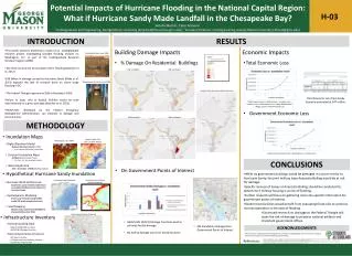
Potential Impacts of Hurricane Flooding in the National Capital Region: What if Hurricane Sandy Made Landfall in the Chesapeake Bay? H-03 Amelia Martin1, Celso Ferreira21Undergraduate Civil Engineering, George Mason University (amarti14@masonlive.gmu.edu); 2Assistant Professor, Civil Engineering, George Mason University (cferrei3@gmu.edu) INTRODUCTION RESULTS • This poster presents preliminary results of an undergraduate research project investigating possible flooding impacts on Washington, D.C. as part of the Undergraduate Research Scholars Program (URSP). • Sea level rise puts DC at increased risk for flooding (Baecheret al. 2012) • $50 billion in damage caused by Hurricane Sandy (Blake et al. 2013) exposed the lack of research done on storm surge flooding in DC. • The Federal Triangle experienced 200-yr flooding in 2006. • Failure to asses risks to federal facilities would be seen internationally as a gross oversight (Baecheret al. 2012). • HAZUS-MH, developed by the Federal Emergency Management Administration, can estimate % damage and economic loss. Economic Impacts BuildingDamage Impacts Constitution Ave, June 2006 • % Damage On Residential Buildings • Total Economic Loss 1M Inundation 2M Inundation Department of Justice, June 2006 Impacts from Hurricane Sandy Scenario Total Economic Loss from Sandy Scenario estimated at $47 million. Total Economic Loss = Building Loss + Contents Loss + Inventory Loss + Relocation Loss + Capital Related Loss + Wages Losses + Rental Income Loss • Government Economic Loss 3M Inundation 4M Inundation METHODOLOGY • Inundation Maps Water Depth Grid (1m Constant Raster) Washington, D.C. DEM • Digital Elevation Model • National Elevation Dataset (USGS) • 1 arc second (30 meter) resolution • Constant Inundation Maps • ArcMap(Spatial Analyst Tools) • 1m, 2m, 3m, 4m constant rasters • Water Depth Grid • Grid = [Constant] – [DEM] (ArcMap Spatial) Government Economic Loss = Building Loss + Content Loss CONCLUSIONS • On Government Points of Interest • Hypothetical Hurricane Sandy Inundation • While no government buildings would be damaged in a storm similar to Hurricane Sandy, the joint military base Anacostia-Bolling would be at risk for damage. • Specific analysis of levees at Anacostia-Bolling should be conducted to determine if military housing is at risk of flooding. • Further research will focus on gathering more site-specific information for government points of interest. • Government facilities would benefit from evaluating flood risks to continue normal operations in the case of flooding. • Continued research on drainage to the Federal Triangle will asses the risk of damage to priceless national artifacts and important government offices. Hurricane Storm Surge Numerical Model Hurricane Sandy Modified Storm Track • Hurricane Wind and Pressure • Asymmetric parameterized model based on modified (shifted ) best track data for Hurricane Sandy • Hydrodynamic Modeling • Storm surge simulated using ADCIRC model (2D-depth integrated version) • Flood Mapping • Model results converted to NAVD88 and interpolated based on DEM. Government Points of Interest • Infrastructure Inventory • HAZUS-MH (GOV1) Damage Functions used to estimate facility damage • No facility damage occurs for Sandy Scenario • General Building Stock • Default HAZUS-MH Inventory • HAZUS-MH Damage Functions • Government Points of Interest • DC Atlas All-in-One • 31 Department and Embassy Facilities • DC GIS Real Property Tool • 4M Inundation damages four Government Points of Interest ACKNOWLEDGMENTS This research is supported by the George Mason University Undergraduate Research Scholars Program. Research will continue and will be funded through Fall 2013. Baecher, G.., Galloway, G.E., Link, L.E. & Brubaker, K.L. (2012) Flood threat to the US national capital region. Flood Risk Management: Science, Policy and Practice: Closing the Gap pp. 212 -213. CRC Press. Blake, E.S., Kimberlain, T.B., Berg, R.J., Cangialosi, J.P. & Beven II, J.L. (2013) Hurricane Sandy. National Hurricane Center. (Images) National Capital Planning Commission, DC Department of the Environment, DC Office of Planning, DC Water and Sewer, Federal Emergency Management Agency, U.S. General Services Administration, and Smithsonian Institution. Federal Triangle Stormwater Drainage Study. Rep. N.p., 6 Oct. 2011. References: