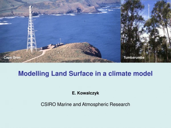
Download
1 / 31
310 likes | 459 Views
Simulate Urban-induced Climate Change Via EOS Observations and Land Surface Model. Dr. Menglin Jin, Meteorology Dept, U University of Maryland, College Park Dr. Christa D. Peters-Lidard NASA GSFC. December 2003. Acknowledgements – Funded by NASA EOSIDS and NASA GSFC DDF. Outline:

E N D
Simulate Urban-induced Climate Change Via EOS Observations and Land Surface Model Dr. Menglin Jin, Meteorology Dept, U University of Maryland, College Park Dr. Christa D. Peters-Lidard NASA GSFC December 2003 Acknowledgements – Funded by NASA EOSIDS and NASA GSFC DDF
Outline: • Rationale and Objectives • How to simulate urban • Observed Modifications of Urbanization Regions • Model Results for urban physical processes • Summary and future direction Dr. Menglin Jin Univ. of Maryland, College Park
1. Rationale and Objectives Simulating urbanization in GCM/RCM is important to understand, project, and predict urban impacts on climate change Problem: Land surface models coupled for GCM or regional models, do not simulate urban. For example, NCAR Community Land Model (CLM), NASA land model, GSFC land surface model, etc Objectives:Develop urban scheme in land surface model Needs:Need to knowwhat is urban how to simulate urban Basic idea:Optimally combine satellite data into urban model. Satellite observations can help (a) better identify urban features and (b) improve model’s surface parameters Dr. Menglin Jin Univ. of Maryland, College Park
Question 1: Is urban region important enough for us to simulate in a GCM? • (a) Is urban region big/significant enough? • (b) Are urban physical processes unique enough? Question 2: How to simulate urbanization? Dr. Menglin Jin Univ. of Maryland, College Park
Human Density of 1998 (Source: Ame. Association for the Advancement of Science) Dr. Menglin Jin Univ. of Maryland, College Park
MODIS Observed Urban and Built-up • 1000 household can make Tair higher about 2ºC than surround regions • (Oke , 1976, Torok et al. 2002)
2. How to Simulate Urban? Land Surface Energy Budget: (1-α)Sd +LWd-εσTskin4 +SH+LE + G= 0 Dr. Menglin Jin Univ. of Maryland, College Park
2. How to Simulate Urban? Urbanization Modifies Surface Energy Budget: (1-α)Sd +LWd-εσTskin4 +SH+LE + G= 0 Dr. Menglin Jin Univ. of Maryland, College Park
2. How to Simulate Urban? Urbanization Modifies Surface Energy Budget: (1-α)Sd +LWd-εσTskin4 +SH+LE + G= 0 Urban add new physical processes Dr. Menglin Jin Univ. of Maryland, College Park
50km 3.1 Urbanization changes surface temperature (Tskin) Urban heat island effect Daytime MODIS Nighttime 50km 50km
3.2 MODIS Observed Global urban heat island effect Dr. Menglin Jin Univ. of Maryland, College Park
Comparison of skin temperature for urban and nearby forests MODIS Cities have higher Tskin than forests
3.3 Urbanization changes surface albedo (MODIS) Dr. Menglin Jin Univ. of Maryland, College Park
Urban region NIR Albedo VIS The decrease of urban albedo is mainly caused by the decrease of reflectance at NIR
3.4 Urbanization changes surface emissivity (MODIS) 50km 50km
Zonal Averages from MODIS Urban albedo is lower than that of cropland Urban emissivity is lower than that of cropland
3.5. Urbanization changes atmospheric conditions MODIS Aerosol Optical Depth Dr. Menglin Jin Univ. of Maryland, College Park
Aerosol decreases surface insolation Total solar radiation decreased by aerosol = 20Wm-2 (Based on model of Ming-Dah Chou of NASA GSFC)
(1-α)Sd +LWd-εσTskin4 +SH+LE + G= 0 SH, LE, and G cannot be directly observed from satellite. Need to use model framework to examine their changes. Dr. Menglin Jin Univ. of Maryland, College Park
water Conceptual NCAR CLM-Urban Model If land cover Is urban Urban model type: y n Bare soil Original trees Road/Building roofs Suburban Human-grass Urban-water body Existing CLM Urban scheme Dr. Menglin Jin Univ. of Maryland, College Park
Use MODIS observed surface properties into model Dr. Menglin Jin Univ. of Maryland, College Park
MODIS15_A2 Leaf Area Index (LAI) over Houston regions Dr. Menglin Jin Univ. of Maryland, College Park
MODIS11_L2 Emissivity_BAND 32 over Houston regions Dr. Menglin Jin Univ. of Maryland, College Park
variable Control run Case1 run LAI Albedo-shortwave Albedo-visible emissivity Heat capacity Soil moisture Table for properties modified for Case 1 run 0.5 1.5 Control run – 0.25 Control run – 0.15 0.92 0.96 1.5*control run Set as zero at first layer Dr. Menglin Jin Univ. of Maryland, College Park
4. CLM-urban model results Ground Temperature Urban increase ground temperature by 1-3ºC, with the largest increase occurring at local daytime
4.2 CLM-urban model results Surface air temperature • Urban increases land surface 2m surface air temperature, • at a lower rate than its effects on ground temperature/skin temperature • maximum at nighttime!
4.3 Urban Model Results Absorbed Solar Radiation Urban absorbs more Solar radiation
4.3 CLM-Urban Model Results Urban increase of SH can be as high as 15Wm-2, with maximum at local afternoon.
4.3 CLM-Urban Model Results Urban increase upward longwave radiation
4.3 CLM-Urban Model Results Urban reduces ground flux
Summary • Satellite observations are extremely useful for understanding and • simulating urbanization in climate models. 2. Urbanization needs to be included in GCM’s land surface model, in order to accurately reflect human impacts on global land climate system. 3. We need more accurate urban land cover, building density, and population information for simulating urban in global and regional scales. Dr. Menglin Jin Univ. of Maryland, College Park