Download
1 / 35
350 likes | 571 Views
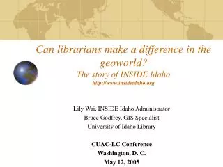
Can librarians make a difference in the geoworld? The story of INSIDE Idaho http://www.insideidaho.org. Lily Wai, INSIDE Idaho Administrator Bruce Godfrey, GIS Specialist University of Idaho Library CUAC-LC Conference Washington, D. C. May 12, 2005. Outline.

E N D
Can librarians make a difference in the geoworld? The story of INSIDE Idahohttp://www.insideidaho.org Lily Wai, INSIDE Idaho Administrator Bruce Godfrey, GIS Specialist University of Idaho Library CUAC-LC Conference Washington, D. C. May 12, 2005
Outline • Traditional library collections (Paper, microfiche,CDs) • Why GIS in the libraries? • How did we get started? • Securing Funding sources • What is INSIDE Idaho? • Pre-clearinghouse - Where we were • Idaho Clearinghouse - Where we are going • Clearinghouse Demo (by Bruce Godfrey)
Traditional map library collection • Federal Depository Library collection (Geologic, mining, forest service, CIA maps) • USGS, AMS, BLM, NIMA Depository maps • Air photos • Purchased maps • Gift map collections • Mostly paper format, with the exception of Open-File maps on microfiche, and some CDs from Census Bureau, USGS, EPA, and NASA
Maps added (Depository) 2000: 1781 2001: 1797 2002: 1090 2003: 1284 2004: 1169 Maps used: 2000: 3917 2001: 4008 2002: 3170 2003: 1343 2004: 642 Maps loaned: 2000: 262 2001: 196 2002: 81 2003: 119 2004: 43 Maps cataloged: 2000: 245 2001: 95 2002: 523 (LandSat, etc) 2003: 644 (LandSat, etc) 2004: 48 Annual average maps budget: (2000-2004) $2000-$500 Tangible Map collection statistics
Why GIS in Libraries? • Libraries are appropriate facilities for the management and distribution of GIS maps and data (Paper/CD-ROM, and Digital.) • They are neutral, unbiased institutions, and part of an established nationwide infrastructure (FDLP). • Libraries are proficient in collection development, cataloging, access and preservation issues.
How did we get started? • Digital geospatial data in CD-ROM format arrived in libraries as part of the FDLP depository items • Frustration with not being able to make them available to the public due to the lack of mapping software • A desire to be involved in the ever-changing way of disseminating government information
Where we were • Most geospatial data were scattered and stored in local computer stations of individual agencies or academic units in various locations of the state, not accessible to the public. • Used a variety of techniques and technologies and may or may not have provided documentation for each dataset. • The result of these disparate efforts: • Similar datasets available from different websites, or local computer servers. • Difficult to determine if differences exist (lack of metadata). • Duplicate efforts and waste of money and energy.
What is INSIDE Idaho? • Interactive Numeric Spatial Information Data Engine • Contents: • Geodata • Numeric data • Atlas/Maps • Interactive Mapping • Metadata • Training • Links to other relevant sites
IGIAC GIS Consortium Organizational Chart INSIDE Idaho Interactive Numeric & Spatial Information Data Engine, 1999-2000 Project Director Idaho Depository Libraries IGIAC GIS Consortium GIS Specialist Technical Consultant for Software Management Technical Consultant for Hardware Management Geography Forestry Agriculture Computer Science Library
Personnel • Project administrator • GIS Specialist • Consultants • Faculty advisors • Student assistants • University IT support
Administrative Aspects • Secure grants • Organize the project team • Plan and organize tasks • Email and monthly meetings • Assign tasks and hiring workers • Budget management • Periodic reports to the funding agencies
Secure Funding sources ($$$) • Idaho State Board of Education Technology Incentive Grant (1996) • University of Idaho Research Office Seed Grant (1999, 2003) • Institute of Museum and Library Service Leadership Grant earmarked by Congressional Appropriations (1999-2002) • FGDC “Don’t Duck Metadata” grants (USGS) (1999-2005) • Other contributions
Tasks • Purchase hardware/software • Design user-friendly interfaces • Collect non-proprietary data • Create metadata • Collaborate and cooperate with GIS agencies in the state • Participate in statewide GIS users meetings
INSIDE Idaho – Clearinghouse • The Idaho Geospatial Committee (IGC) (EO 2001-07) unanimously approved INSIDE Idaho website as the State of Idaho’s official geospatial data clearinghouse (May 30, 2002). • The clearinghouse encompasses organizations, standards, people, data and technology which work together to facilitate cooperation and partnerships through the sharing, discovery, and use of spatially enabled data. • It promotes the idea of, and technologies that facilitate, a distributed clearinghouse architecture. • As a critical component of the Idaho Geospatial Data Implementation Plan (I-Plan), INSIDE Idaho performs as the official state data distribution clearinghouse for all framework data themes.
Search/Browse Search/Browse Response Response Download/Interact Download/Interact Download/Interact Harvestmetadata Harvestmetadata Harvestmetadata Download/Interact Geospatial One Stop Portal Distributed architecture State Clearinghouse Federal Agency State Agency Local Govt. Higher Ed.
Clearinghouse – Goals & Objectives • To facilitate the discovery and use of GIS data • Search data with a single query. • Provide data in easily accessible formats. • Insure that public funds used to create spatial data are not wasted • Reduce duplication of effort. • Insuredata that exists and can help solve societal problems is in the public domain and easily accessible.
Clearinghouse - Vision • Every dataset accessible to every potential user • A documented custodian for every dataset created and included on the clearinghouse website (metadata) • A website that is cooperatively developed and actively maintained in conjunction with innovative tools and services • Providing leadership and expertise in the storage, support, training, archival, and distribution of Idaho’s digital geospatial and numeric data
2004 Orthoimagery County name# downloadsBlaine 1873Canyon 1783Camas 1675Ada 1115Latah 1110Kootenai 968Nez Perce 942Idaho 933Bannock 926Elmore 911 State Totals [10/11/2004 – 4/30/2005] # downloads 31743 [157/day]TB transferred 9.3 [47 Gb/day]
Who are INSIDE Idaho users? • Students, faculty and researchers at higher education institutions • GIS professionals at state, local, and federal government agencies • Government officials • Business and industry sectors • K-12 teachers and students • Private citizens
Clearinghouse – What it took to get here • A lot of hard work! • Determination, perseverance, creativity and dedication • Technology • Using what’s currently available • Acting as a facilitator/statesman • Locate/use/share data • Building relationships/partnerships – trust • Continuously promoting the ‘Vision’
Where we are going • Continue to: • Promote a consistent data sharing architecture • Employ new technologies • distributed architecture • serving gigantic raster datasets • Secure stable and permanent funding
Acknowledgement • Institute of Museum and Library Services National Leadership Congressional Appropriation (1999-2002) • USGS-FGDC “Don’t duck metadata” grants, 1999-2005 • USGS Framework Data Coordinator, Tracy Fuller • Idaho Dept. of Water Resources • Idaho Transportation Dept. • Idaho GIS State Coordinator, Nathan Bentley • University of Idaho Library and Information Technology Services
Contacts • Lily Wai, INSIDE Idaho Administrator lwai@uidaho.edu 208-885-5858 • Bruce Godfrey, GIS Specialist bgodfrey@uidaho.edu 208-885-6463 • This presentation can be viewed at: http://inside.uidaho.edu/whatsnew/whatsnew.htm#Events