Download
1 / 41
410 likes | 522 Views
Join us for a web conference dedicated to the MMIRE (Model Minimum Inventory of Roadway Elements) concept. This session aims to present the MMIRE guidelines, discuss their application, and gather feedback on roadway alignment and segment variables. Learn about collecting critical roadway data, utilizing safety analysis tools, and improving decision support systems in safety programs. Your participation is crucial for informing the development of standardized definitions and inventory data. Standby for Q&A sessions and handout materials focused on enhancing roadway safety.

E N D
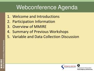
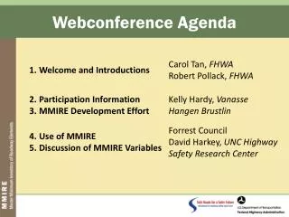
Participation Information • Phone lines will be muted during initial presentations (*1 to un-mute) • You can submit questions/comments electronically • Phone lines will be open during discussion (mute your phone when not speaking) • Handouts for use during discussion portion
Purpose of Webconference • Present MMIRE Concept • Discuss Uses of MMIRE • Obtain Feedback on Roadway Alignment and Segment Variables • Importance to your efforts • Difficulty to collect
MMIRE Concept • Standardized Definitions…But Not a Standard • Dictionary of critical roadway data variables that are required to make more effective and efficient safety improvement decisions • Similar to Model Minimum Uniform Crash Codes (MMUCC), MMIRE will be a guideline, not a requirement
MMIRE Development Effort • AASHTO Strategic Highway Safety Plan • Management: improve information and decision support systems • International Scan • White Paper
Overview of Broad Strategies • Increase support for safety programs and safety information systems • Define “good inventory data” and move toward the use of performance measures • Make it easier to collect, store, and use all types of safety data • Increase the use of safety analysis tools • Link safety data to non-safety data
Proposed MMIRE Variables • Documents development process and includes working matrix • 180 data elements • www.mmire.org
Structure of MMIRE I. Roadway Segment Descriptors I.a. Segment Location/Linkage Variables I.b. Segment Roadway Classification I.c. Segment Cross Section I.c.1. Surface Descriptors I.c.2. Lane Descriptors I.c.3. Shoulder Descriptors I.c.4. Median Descriptors
Structure of MMIRE (cont) I. Roadway Segment Descriptors (cont) I.d. Roadside Descriptors I.e. Other Segment Descriptors I.f. Segment Traffic Flow Data I.g. Segment Traffic Operations/Control Data II. Segment Alignment II.a. Horizontal Curve Data II.b. Vertical Grade Data
Structure of MMIRE (cont) III. Road Junctions III.a. At-Grade Intersection/Junctions III.a.1. At-Grade Intersection/Junction General Descriptors III.a.2. At-Grade Intersection/Junction Descriptors (Each Approach) III.b. Interchange and Ramp Descriptors III.b.1. General Interchange Descriptors III.b.2. Interchange Ramp Descriptors
What MMIRE Could Help You Do • Use the New Safety Tools • Interactive Highway Safety Design Model (IHSDM) • Tools for designers, planners and safety engineers to compare alternative roadway designs and safety treatments • SafetyAnalyst • Advanced tools to identify most promising locations for treatment and choose the best treatment
What MMIRE Could Help You Do Use the New Safety Tools (cont) Highway Safety Manual AASHTO will publish first edition in 2009 Compilation of current safety knowledge and safety prediction tools for two-lane rural roads, rural multilane roads, and urban suburban arterials. Other road-class tools to be added in future editions
What MMIRE Could Help You Do Enhanced Problem Identification These examples require inventory files containing full population of roadway elements (e.g., segments, intersections, curves, ramps) -- cannot be done with just crash data as done today. E.g., better selection of high-priority intersections by comparison of crash rate within intersection categories (e.g., within all signalized intersections with entering volumes between X and Y)
What MMIRE Could Help You Do Enhanced Problem Identification (cont) Selection of urban signalized intersections with highest number of pedestrian crashes in the jurisdiction (or highest ped crash rate per entering vehicle or pedestrian) Selection of high-priority horizontal curves by crash rate within roadway class (e.g., most hazardous curves on two-lane rural roads)
What MMIRE Could Help You Do Enhanced Problem Identification (cont) Selection of roadway corridors on urban interstates with highest large-truck crash rates Identification of interchange ramps with highest large-truck crash rates Any other identification/selection within specified type of roadway element
What MMIRE Could Help You Do Enhanced Targeting of Specific Treatments Selection of all horizontal curves on two-lane rural roads with speed limit of 55 and degree of curve greater than 10 degrees for low cost treatment (e.g., chevrons or advanced pavement markings) Selection of locations where raised pavement markers are most likely to reduce crashes (i.e., rural two-lane roads with AADT > 15,000 vpd and degree of curve < 3.5 deg and four-lane freeways with AADT > 60,000 vpd – NCHRP Report 518).
Current Effort • Compare Proposed Elements and Attributes to: • Other databases • Variables states are already collecting • Lead State Program to Pilot the Implementation of MMIRE • Refine Elements and Attributes : MMIRE Version 1.0
Today’s Topics… I. Roadway Segment Descriptors II. Segment Alignment
Organization of Discussion Our Goal Present proposed items to you Feedback from you on importance of each element re your safety programs/decisions Feedback from you on what will be difficult to collect Possible solutions from you We then look for lead states who have collected them FHWA looks for new methods to collect Thus, we will concentrate on variables most states do not collect
Organization of Discussion (cont) Variables Usually Not Collected Compared MMIRE elements to inventory databases in 24 states For segment and alignment variables, no state (of these 24) has collected 23 of the 97 variables Roadside inventory, rumble strips, edgeline/pavement markings, traffic counts for motorcycle/peds/bikes Of the remaining 74 variables, 29 are collected by at least 1/3 of the 24 states (Discuss these only briefly) Will concentrate on 68 with no or little current use
Not To Be Discussed in Detail I. Roadway Segment Descriptors I.a. Segment Location/Linkage Variables 1. County 2. City/Local Jurisdiction 3. Route Number 4. Street Name 5. Section End-Points Descriptors 6. Section Identifier Section Length Highway District Governmental Ownership
Not To Be Discussed in Detail • I.a. Segment Location/Linkage Variables (continued) • 10. Type of Governmental Ownership • 11. Route Signing • 12. Route Signing Qualifier • 13. Coinciding Route Indicator* • 14. Coinciding-Route Primary Route Number* • 15. Direction of Inventory • *These are often not recorded but are very important
Not To Be Discussed in Detail • I.b. Segment Roadway Classification (4 of 5 – 5th optional) • 16. Functional Class • 17. Rural/Urban Designation • 18. Federal Aid/ Route Type • 19. Access Control
Not To Be Discussed in Detail I. Roadway Segment Descriptors (cont) I.c. Segment Cross Section I.c.1. Surface Descriptors (4 of 8) 21. Surface Type 24. Total Surface Width 25. Pavement Roughness 27. Pavement Condition I.c.2. Lane Descriptors (3 of 15) 29. No. of Thru Lanes 30. Average Thru Lane Width 37. HOV Lanes
Not To Be Discussed in Detail I. Roadway Segment Descriptors (cont) I.c. Segment Cross Section I.c.3. Shoulder Descriptors (5 of 11) 44. Right Shoulder Type 45. Right Shoulder Total Width 47. Left Shoulder Type 48. Left Shoulder Total Width 53. Curb Presence I.c.4. Median Descriptors (3 of 8) 55. Median Type 56. Median Width 57. Median Barrier Type
Not To Be Discussed in Detail I. Roadway Segment Descriptors (cont) I.d. Roadside Descriptors (0 of 5) I.e. Other Segment Descriptors (e.g. Terrain type, Bridge File Linkage – 1 of 6) 68. Terrain Type (e.g., Mountainous, Level) I.f. Segment Traffic Flow Data (3 of 14) 74. Average Daily Traffic Volume 75. AADT Year 77. Percentage Truck or Truck AADT
Not To Be Discussed in Detail I. Roadway Segment Descriptors (cont) I.g. Segment Traffic Operations/Control Data (6 of 12) 88. One/Two-Way Operations 89. Speed Limit 91. On-Street Parking Presence 92. On-Street Parking Type 94. Truck Route Designation 95. Toll Facility?
Not To Be Discussed in Detail II. Segment Alignment II.a. Horizontal Curve Data (0 of 8) II.b. Vertical Grade Data (0 of 5)
Remainder of Discussion… We will present elements to be discussed (i.e., those with no or limited coverage by the 24 states) by MMIRE structure group. For each group, you provide two “votes” “Which elements are very important to your safety program/decisions?” “Which elements will be very difficult to collect?” (You can vote for more than one each time) Those with highest importance and difficulty will be discussed first (i.e., Do any of you collect them and if so, how?) Remainder will the be discussed if time allows
For More Detailed Discussion I.b. Segment Roadway Classification • Operational Class I.c.1 Surface Descriptors 22. Surface Friction 23. Surface Friction Date 26. Pavement Roughness Date 28. Pavement Condition Date
For More Detailed Discussion I.c.2. Lane Descriptors 31. Exclusive Left Turn Lane Presence 32. Exclusive Left Turn Lane Length 33. Exclusive Right Turn Lane Presence 34. Exclusive Right Turn Lane Length 35. Auxiliary Lane Presence/Type 36. Auxiliary Lane Length 38. HOV Lane Types 39. Reversible Lanes 40. Presence/Type of Bicycle 41. Width of Marked Bicycle Lane or Bike Path 42. Width of Wide Curb Lane 43. Number of Peak Hour Lane
For More Detailed Discussion I.c.3. Shoulder Descriptors 46. Right Paved Shoulder Width 49. Left Paved Shoulder Width 50. Shoulder Rumble Strip Presence 51. Rumble Strip Type 52. Sidewalk Presence 54. Curb Type
For More Detailed Discussion I.c.4. Median Descriptors 58. Median (Inner) Paved Shoulder Width 59. Median Shoulder Rumble Strip Presence 60. Median Rumble Strip Type 61. Median Left Turn Lane Type 62. Median Left Turn Lane Width
For More Detailed Discussion I.d. Segment Roadside Descriptors 63. Roadside Clearzone Width 64. Sideslope Roadside Rating 65. Roadside Rating 66. Driveway Information 67. Roadside Hardware Descriptors
For More Detailed Discussion I.e. Other Segment Descriptors 69. Bridge Descriptors for Bridges in Segment 70. RR Grade Crossing Descriptors for Crossings in Segment 71. Number of Signalized Intersections in Sections 72. Number of Stop-Controlled Intersections in Sections 73. Number of Uncontrolled/Other Intersections
For More Detailed Discussion I.f. Segment Traffic Flow Data 76. AADT Annual Escalation Percentage 78. Total Daily Two-Way Pedestrian Count/Exposure 79. Bicycle Count/Exposure 80. Motorcycle Count or Percentage 81. Hourly Traffic Volumes (or Peak and Off-Peak AADT) 82. K-Factor 83. Future AADT 84. Future AADT Year 85. Directional Factor 86. Percent Combination Trucks – Daily Average 87. Percent Single Unit Trucks – Daily Average
For More Detailed Discussion I.g. Segment Traffic Operations/Control Data 90. School Zone Indicator 93. Roadway Lighting 96. Edgeline Presence/Type 97. Centerline Presence/Type 98. No Passing Zone Code/Passing Permissibility 99. 85th % Speed
For More Detailed Discussion II.a. Horizontal Curve Data 100. Curve Identifiers and Linkage Variables 101. Curve Feature Type 102. Horizontal Curve Length 103. Horizontal Curve Length (Including Spiral) 104. Curve Superelevation or Superelevation Adequacy 105. Horizontal Transition/Spiral Curve Presence 106. Horizontal Curve Intersection/Deflection Angle 107. Horizontal Curve Direction
For More Detailed Discussion II.b. Vertical Grade Data 108. Grade Identifiers and Linkage Variables 109. Vertical Alignment Feature Type 110. Percent of Gradient 111. Grade Length 112. Vertical Curve Length
Next Steps • Additional Webconferences Jan-Feb 2009 • Intersections • Interchanges and Ramps • Lead State Program • Final Report: Summer 2010 • For additional information, contact: • Carol Tan: carol.tan@dot.gov • Bob Pollack: robert.pollack@dot.gov
MMIRE Website www.mmire.org • Presentation from this webconference • Discussion forums