Download
1 / 16
160 likes | 413 Views
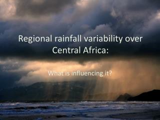
Geostatistical approach to Estimating Rainfall over Mauritius. Mphil/PhD Student: Mr.Dhurmea K. Ram Supervisors: Prof. SDDV Rughooputh Dr. R Boojhawon. Objectives of Research. Analyse qualitatively and quantitatively the spatial distribution of rainfall over Mauritius.

E N D
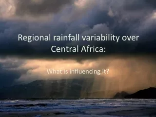
Geostatistical approach to Estimating Rainfall over Mauritius Mphil/PhD Student: Mr.Dhurmea K. Ram Supervisors: Prof. SDDV Rughooputh Dr. R Boojhawon Estimating Rainfall
Objectives of Research • Analyse qualitatively and quantitatively the spatial distribution of rainfall over Mauritius. • Develop models for predicting values of rainfall at other locations from available measured rainfall values using geostatistics coupled with regression models. • Generate digital results that can eventually be used in Geographical Information Systems (GIS). Estimating Rainfall
Importance of modelling • Precipitation measurements are unevenly distributed over a region and even less in a mountainous areas. • One of the fundamental problem in hydrology is to estimate precipitation at unmonitored site using data from available surrounding precipitation stations. • Hydrological models require precipitation fields on grid systems and in digital form. Estimating Rainfall
Background work Study particularly aim at modelling the long-term variations in the distribution where the monthly mean values of precipitation for the period 1971-2000 are analysed for each month, i.e. for January till December using geostatistics. Estimating Rainfall
Geostatistics Rainfall is also affected by elevation of an area and also by prevailing atmospheric conditions Rainfall is such a variable whose structure depends on direction (anisotropic). Need for another method whereby this anisotropic behavior can be modeled. Most common technique is geostatistics Special branch of statistics developed by George Matheron (1963) (Centre de Morphologie Mathematique). Estimating Rainfall
VARIOGRAM It is the principle tool of geostatistics The variogram is a measure of how quickly things change on the average. The variogram gives an insight of the geometry and continuity of the variable The variogram is a function of direction, i.e. it characterizes the dependence that exist between variables at different points in space The underlying principle : on the average, two observations closer together are more similar than two observations farther apart. Estimating Rainfall
Exploratory data analysis • Analyze data for trend, outliers and skewness. • Outliers observed for most of the months. • No significant trend over short interval but trend exist over long period. • Data found to be skewed. Square root and log transformation applied to normalize data. Modelling is carried out using raw data, outlier removed data and detrended and transformed data Estimating Rainfall
Model Approaches • Basic geostatisitics model: • Raw data • Outlier removed • Transformed data • Detrended data model: • Raw data • Outlier removed • Geostatistical- topographical model Estimating Rainfall
Results (1) • More accurate estimates obtained from detrended data model. • Better estimates for winter months. • High error values limited to less than 25 % of the stations. Models yield very good estimates for 75 % of stations. • No improvements in estimates when removing outliers. Estimating Rainfall
Results (2) • Comparing with the rainfall volume calculated at the Mauritius Meteorological Services shows that actually the long term mean monthly rainfall, for 1971-2000, has been underestimated for most of the months using the isohyetal analysis. Estimating Rainfall
Challenges • Optimize variograms particularly for summer months to improve accuracy of models • Derive values of humidity, wind speed and direction, pressure and temperature on a regular grid from few available stations. Estimating Rainfall
Limitations • Very few stations on mountainous areas. • Availability of finer resolution Digital Elevation Model . • Effective estimation of missing rainfall data. Estimating Rainfall
Future Works (1) • To develop individual model templates for different weather systems. • Include atmospheric variables such as pressure, temperature, humidity and wind speed and directions as additional parameters in the models. • Besides using Ordinary Kriging and regression models, use cokriging to incorporate the secondary variables. Estimating Rainfall
Future Works (2) • Model using a smaller number of stations. This aims at removing redundant, rain gauges and their relocation. • Implement precipitation forecasting models using artificial neural networks techniques. Estimating Rainfall
Conclusions • Geostatistics turned is a very good approach for estimating rainfall. • Accuracy of model estimates depends on degree of optimisation of variograms. Estimating Rainfall
Acknowledgements • University of Mauritius for providing logistic support. • Mauritius Research Council for funding this study. • Mauritius Meteorological Services for providing required data. Estimating Rainfall