Download
1 / 53
530 likes | 554 Views
Don't be caught off guard by unexpected weather events. Stay prepared by monitoring long-range forecasts, hazardous weather outlooks, and timely warnings. Learn how to make contingency plans and take necessary precautions.

E N D
Don’t be Surprised bythe Expected! • Sometimes warnings are issued without prior notice. • How can you be prepared? • By monitoring forecasts and discussions.
Outlooks • 1. Long Range -- Usually 2 days or more. • E.g. Hurricane crossing Puerto Rico. • Winter Storm forming over the Gulf of Mexico. • 2. Provides opportunity to make contingency plans. • 3. Outlooks discuss the uncertainty of longer range predictions.
Outlooks • Outlooks are issued as Special Weather Statements (SPS) for weather events. • Hazardous Weather Outlook (HWO) – issued daily to cover 7 days – mainly for EMA planning. • It is used to highlight potential for • High Winds • Excessive Heat • Wind Chill • Winter Storms • Severe Weather Threat • Flood Potential
Watches • This means that hazardous or severe weather is a possibility, NOT a certainty. • A "WATCH" is a long range prediction and is typically issued from 3 to 48 hours before the hazard is expected. • If the storm becomes imminent or more certain, the watch will be upgraded to a "WARNING".
Watches • Flood (FFA) - issued a few to 24 hours in advance. • Severe Thunderstorm (WCN) - 3 to 6 hours in advance. • Tornado (WCN) - 3 to 6 hours in advance. • Winter Storm (WSW) - 12 to 48 hours in advance. • High Wind (NPW) - 12 to 48 hours in advance. • Lake Effect Snow (WSW)- 12 to 48 hours in advance. • Wind Chill (NPW)- 12 to 48 hours in advance. • Excessive Heat (NPW)- 12 to 48 hours in advance.
Warnings A WARNING is generally issued when a dangerous weather event is expected, imminent or occurring • Issued for life-threatening weather events. • Issued when the hazardous weather is imminent, or occurring. • Lead times vary depending on the type of hazardous weather • A rule of thumb: the more localized a weather hazard, the less lead time.
Warnings • Flash Flood (FFW)- 1 to 3 hours • Flood – County (FLW)- 1 to 6 hours • Flood – River points (FLW)- 6 to 12 hours. • Tornado (TOR)- 0 to 20 minutes • Severe Thunderstorm (SVR)- 0 to 20 minutes • Blizzard or Winter Storm (WSW)- 6 to 36 hours • Lake Effect Snow (WSW)- 6 to 24 hours. • High Wind (NPW)- 6 to 24 hours. • Wind Chill (NPW)- 6 to 24 hours. • Excessive Heat (NPW)- 6 to 24 hours.
Advisories • 0 to 24 hours (Occurring, imminent or high probability). • Event considered an inconvenience but could threaten life and property if proper precautions are not taken. • Issued for winter weather, wind, flooding, and fog.
Advisories • Wind (NPW) - 6 to 24 hours • Flood Advisory (FLS) - 0 to 12 hours • Wind Chill (NPW)- 6 to 24 hours • Excessive Heat (NPW)- 6 to 24 hours • Dense Fog (NPW)- 6 to 24 hours • Lake Effect Snow (WSW)- 6 to 24 hours
Statements • Statements are issued to provide updates on on-going or expected weather hazards. • Short Term Forecasts (NOW) • Flash Flood (FFS) • Flood (FLS) • Special Weather (SPS) • Severe Weather (SVS) • River (RVS) • Drought (ESF) • Flood Potential (ESF) • Public Information (PNS)
Short Term Forecasts (NOW) The primary product to get the latest weather information during an ongoing (non-severe) weather event. • Issued for all types of hazardous weather. • Focuses on the next 1 to 6 hours of the event. • Thunderstorms, rain, snow and ice, fog, high winds. • Also used to provide forecasts of the beginning and ending of precipitation events. • The short term forecast will have the latest information on an on-going weather event!
CAN PREDICT 0 to 1 hour - Development and movement of t-storms 1 to 3 hours - Movement of thunderstorm systems 3 to 12 hours - Movement of fronts and upper level disturbances CAN’T PREDICT 0 to 1 hour - Exact location of tornado, downburst or hail 1 to 3 hours - Movement of individual thunderstorms 3 to 12 hours - Movement of thunderstorm systems Short - Term Forecast Length vs. Accuracy
Miscellaneous • State Forecast Product (SFT) • Record Report (RER) • Local Storm Report (LSR) • Precip/Temp Table (HYD, RTP) • Public Zone Forecast (ZFP) • Climate message (CLI and CLM)
Miscellaneous • Civil Emergency Message (CEM) • Civil Danger Warning (CDW) • Local Area Emergency (LAE) • Shelter in Place (SPW) • Evacuation Warning (EVI) • Hazardous Material Warning (HMW) • Law Enforcement Warning (LEW) • 911 Telephone Outage (TOE) • Earthquake Report (EQR) • Earthquake Warning (EQW)
Zone Forecasts 1 to 3 days • Forecast zones are areas of similar weather • Zones can be grouped if weather is same in the zones • Zones are generally county-by-county.
CAN PREDICT 12 to 48 hours - Movement and Development of large storms, general impact and threatened areas CAN’T PREDICT 12 to 48 hours - Exact timing or location of storm, intensification, impact and dissipation Zone and State Forecasts Length vs. Accuracy
Extended Forecasts • 3 to 7 days • Broad brush • Not too many details • General idea of what’s coming
CAN PREDICT 6 to 10 days - General global patterns, temperature and precipitation with respect to normal CAN’T PREDICT 6 to 10 days - Exact temps and precipitation amounts, timing of global pattern changes Long Range Outlook Length vs. Accuracy
Forecast Discussions • Used by forecasters to give reasoning behind the forecast • Often uses contractions and jargon • Can be a wealth of information • At times includes information about equipment outages (radar), hydrology, marine, fire weather If you’re feeling technical...
Forecast Discussions • AREA FORECAST DISCUSSION • NATIONAL WEATHER SERVICE CHARLESTON WV • 1029 AM EST WED JAN 10 2007 • .SHORT TERM /REST OF TODAY/... • ALLOWED THE ADVISORY TO EXPIRE. COVERAGE/INTENSITY OF SNOW SHOWERS IS DECREASING ON 88D LOOP. EXPECT THIS TO CONTINUE WITH PASSAGE OF H850 THERMAL TROUGH AND APPROACH OF SURFACE HIGH...CUTTING OFF NW FLOW. STILL A FEW ONGOING FLURRIES IN CENTRAL MOUNTAIN COUNTIES. SEE SOME CU DEVELOPMENT WEST OF THE MOUNTAINS...AS NEUTRAL TO WEAK COLD ADVECTION WILL CONTINUE INTO THE AFTERNOON FOR A BIT. TWEAKED TEMPERATURES DOWN A DEGREE OR TWO UP NORTH BASED ON MORNING SOUNDINGS AND LAMP...READINGS TO THE SOUTH LOOK GOOD. • .PREV DISCUSSION... /ISSUED 603 AM EST WED JAN 10 2007 • / AVIATION /12Z-12Z/... • SNOW SHOWERS CONTINUE THIS MORNING WITH 3 MAIN BANDS NOW SET UP...ONE NEAR BKW THAT HAS BEEN MOVING THROUGH WITH VARYING RESTRICTIONS FOR VISIBILITY. A SECOND BAND IS NORTH OF CRW AND LOOKS AS IF IT WILL REMAIN NORTH OF THE SITE. A THIRD BAND IS NOW MOVING THROUGH LHQ TO EKN AND IS IMPACTING PKB/CKB/EKN. BASED ON SATELLITE...THIS BAND SHOULD EXIT PKB AROUND 13Z...AND PULL OUT OF CKB AROUND 14Z AND EKN AROUND 15Z.
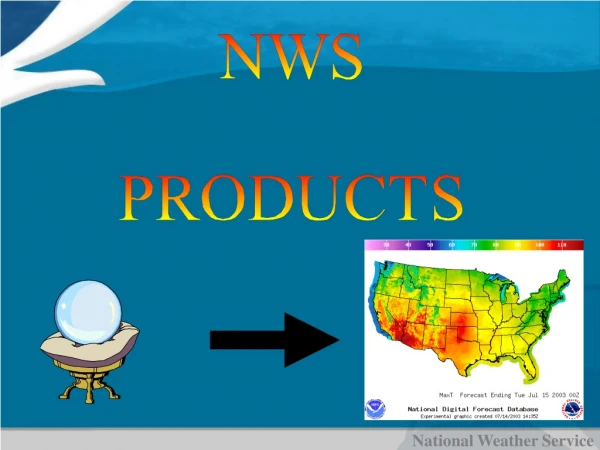
Internet products • Tour our websites for additional text and graphical products at: • www.weather.gov • New forecast digital database available for all users.
Accessing the National Digital Forecast Database (NDFD) at the local level
»»»»»»»»»»»» »»»»»»»»»»»» »»»»»»»»»»»» »»»»»»»»»»»» »»»»»»»»»»»» »»»»»»»»»»»» »»»»»»»»»»»» Traditional Forecasting Process National CentersModel Guidance • Schedule Driven • Product Oriented • Labor Intensive Field OfficesType Text Products National CentersGenerate Graphical Products U.S. Drought Monitor Threats Assessments TODAY...RAIN LIKELY. SNOW LIKELY ABOVE 2500 FEET. SNOW ACCUMULATION BY LATE AFTERNOON 1 TO 2 INCHES ABOVE 2500 FEET. COLDER WITH HIGHS 35 TO 40. SOUTHEAST WIND 5 TO 10 MPH SHIFTING TO THE SOUTHWESTEARLY THIS AFTERNOON. CHANCE OF PRECIPITATION 70%. Excessive Heat Products MARYLAND EASTERN SHORE EASTON PTCLDY CLOUDY PTCLDY PTCLDY SUNNY PTCLDY60/52 63/54 65/47 55/40 55/37 50/33POP 20 POP 20 POP 20 POP 20 POP 10 POP 10
New Forecasting Process National Centers Model Guidance • Interactive • Collaborative • Information Oriented Grids Local Digital Forecast Database Field Offices National Centers Collaborate Data and Science Focus NWS Automated Products User-Generated Products National Digital Forecast Database TODAY...RAIN LIKELY. SNOW LIKELY ABOVE 2500 FEET. SNOW ACCUMULATION BY LATE AFTERNOON 1 TO 2 INCHES ABOVE 2500 FEET. COLDER WITH HIGHS 35 TO 40. SOUTHEAST WIND 5 TO 10 MPH SHIFTING TO THE SOUTHWESTEARLY THIS AFTERNOON. CHANCE OF PRECIPITATION 70%. Digital Text Graphic Voice
From Text to 3Ds: Digital, Detailed and Displayable TraditionalProcess TODAY...RAIN LIKELY. SNOW LIKELY ABOVE 2500 FEET. SNOW ACCUMULATION BY LATE AFTERNOON 1 TO 2 INCHES ABOVE 2500 FEET. COLDER WITH HIGHS 35 TO 40. SOUTHEAST WIND 5 TO 10 MPH SHIFTING TO THE SOUTHWESTEARLY THIS AFTERNOON. CHANCE OF PRECIPITATION 70%. New Forecast Process TODAY...RAIN LIKELY. SNOW LIKELY ABOVE 2500 FEET. SNOW ACCUMULATION BY LATE AFTERNOON 1 TO 2 INCHES ABOVE 2500 FEET. COLDER WITH HIGHS 35 TO 40. SOUTHEAST WIND 5 TO 10 MPH SHIFTING TO THE SOUTHWESTEARLY THIS AFTERNOON. CHANCE OF PRECIPITATION 70%. MARYLAND EASTERN SHORE EASTON PTCLDY CLOUDY PTCLDY PTCLDY SUNNY PTCLDY 60/52 63/54 65/47 55/40 55/37 50/33POP 20 POP 20 POP 20 POP 20 POP 10 POP 10
National Digital Forecast Database Gives Customers What They Want The public, emergency managers and city planners use Internet graphic products for detailed forecasts • More weather data • Higher resolution forecasts • Visual displays of probability • User-defined products create business opportunities Different Products for Different Customers Commercial weather companies & emergency managers use grids to generate tailored products TODAY...RAIN LIKELY. SNOW LIKELY ABOVE 2500 FEET. SNOW ACCUMULATION BY LATE AFTERNOON 1 TO 2 INCHES ABOVE 2500 FEET. COLDER WITH HIGHS 35 TO 40. SOUTHEAST WIND 5 TO 10 MPH SHIFTING TO THE SOUTHWESTEARLY THIS AFTERNOON. CHANCE OF PRECIPITATION 70%. Radio stations & public read text forecasts
Overview of Access Methods • Complete dataset in GRIB2 via FTP/HTTP • Selected datasets via Web Services. • Graphical and text products and services on NWS websites • File names/details available at: http://www.nws.noaa.gov/ndfd/technical/technical.htm • Experimental services available now
Digital Forecasts • Detailed Gridpoint forecasts • Traditional Text forecasts • General Digital Forecast • Graphical Digital Forecast
NWS Detailed “Gridpoint” Forecasts • Click on a specific location on map and get a specific forecast for a 5 mile radius of that location. • Forecast temperature, snowfall amount, rainfall, fog amount differ between the hills and valleys. • Valleys often foggier and colder on clear, calm nights than the hills. • More snow falls on the hills versus valleys. • Afternoon temperatures colder on hills versus valleys. • New “gridpoint” forecasts will reflect these differences!! Forecasts include: • Text forecast out to 7 days • Forecasts graphs • Hourly tabular forecast information