Download
1 / 30
300 likes | 420 Views
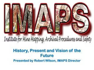
History, Present and Vision of the Future Presented by Robert Wilson, IMAPS Director. What we do…. IMAPS is an IUP Institute focused on preserving large format paper and digital mine maps.

E N D
History, Present and Vision of the Future Presented by Robert Wilson, IMAPS Director
What we do… • IMAPS is an IUP Institute focused on preserving large format paper and digital mine maps. • IMAPS mission is to develop knowledge and expertise in archiving, digitally recording, and geographically referencing historical coal mine maps, as well as initiating new mine safety protocols based on the existence of digital mine map data products.
Who we are… • IUP Participating Units: Geography & Regional Planning; IUP Libraries; Safety Sciences; Geosciences; Computer Science; Mathematics; • Partners: Senator Arlen Spector; US Dept. of Interior, Office of Surface Mining (OSM); Pennsylvania Dept. of Environmental Protection (PADEP); CONSOL Coal, Inc.; Rosebud Mining, Inc. • Current staff includes Director, Graphics and IT support staff, 18 graduate students (6 on full assistantship, 4 on half assistantship and 10 hourly), and 2 undergraduate hourly students
History • The Institute for Mine Maps, ArchivalProcedures, and Safety (IMAPS) was established in July 2007, with JohnBenhart, Jr. as director • The impetus of the Institute was the large collection of materials donated to IUP by the Rochester & Pittsburgh Coal Company, and Consolidated Coal from the late 1990s through 2005 – especially the collection of large-format mine maps • An interdisciplinary group of faculty and staff has fashioned the vision for IMAPS as a locus of knowledge and expertise on large format mine maps, all mine mapping, and geospatial databases, as well as associated topics (history, culture, etc.) • To date, IMAPS has been supported by funding from US Office of Surface Mining (OSM), US Congress, PA Department of Environmental Protection (PADEP), PASSHE, PA Department of Community & Economic Development (DCED), PA Geological Survey (PGS), the National Science Foundation (NSF) ,and private corporations for a total of over $900,000
IMAPS has become a recognized entity at IUP, and has strengthened the University’s connection to industry and the community at large
Our Objectives… • Develop procedures for digitally recording (scanning) large format mine maps • Develop and test geo-referencing methods for coal mine maps • Assess the horizontal accuracy of geo-referenced historical mine maps • Information analysis to determine appropriate metadata regarding maps • Integrate geo-referenced mine maps with national/state geospatial data • Review of Bureau of Labor Statistics data • Evaluate current mine safety and response training • Pilot stage…moving towards full implementation (depends upon funding situation) ** Items in red are in progress
What we have accomplished… • Scanned over 10,500 mine maps • Captured extensive metadata for all of the scans • Built the capacity to “ramp up” production • 2 high end workstations – speeds processing of large images • Grants and in-kind dollars for student workers • Grants for additional equipment (roll scanner, vacuum table, 3 additional work stations) • Strengthened relationship with DEP/OSM
Large Format Mine Maps… • 40-100+ years old, mostly canvas, most up to 13-14 feet long some much longer • Contain large amounts of very important information, but…. • Difficult to preserve, store, and access • - The “missing link” of abandoned mine land information • At least 1,300 in Pennsylvania • - Around 350 in IUP’s R&P collection • Approximately 30,000 maps in the R&P Collection • Current funding focused on scanning these maps
Currently employ 20 Student Workers Working 350 hours per week - Intake/Metadata Collection - Scanning - Metadata Entry - Application Development
Cruse Scanner Stapleton Library - Indiana University of Pennsylvania
ImagePro GXT Scanner • - Scans up to 56” wide documents • Length depends on system memory and dpi settings • up to 48 bit true color • 600 dpi resolution and 9600 dpi enhanced
Why is IMAPS important… • It will improve the safety of all future coal mining in Pennsylvania… • by decreasing the risk that coal operators will encounter unknown abandoned mines • by providing needed information about the accurate location of abandoned mines (maps) that will be part of improved safety training and emergency response • It will improve services to the citizens of the Commonwealth of Pennsylvania • Mine Subsidence Insurance programs • Community Planning • It will provide training and experience in high-growth, high-demand fields for Pennsylvania students • Geospatial Technology has been identified by the federal government as a “high-growth industry” • It will contribute to economic development in the Commonwealth • Information useful for re-mining, reclamation and new mining; as well as other types of development
Vision of the future… • Almost real-time accessibility to a web-based, searchable, locationally-accurate mine map database • Improved mine safety and permitting processes • An invaluable resource for emergency response • In-demand technology education for Pennsylvania students (Geospatial/GIS) • A beneficial and valuable resource to the private sector • A national model for dealing with mine maps • Myriad future applications (3-D visualization, modeling)
13th & Phila. Sts. 1575503.674 ft. E 473059.449 ft. N 6th & Phila. Sts. 1579659.912 ft. E 472883.539 ft. N 6th & Maple Sts. 1579698.912 ft. E 469554.859 ft. N PAMAP Imagery, Indiana, PA 2006 ** NAD83 State Plane PA South Zone Coordinate System
Indiana County, PA PAMAP County Orthophoto Mosaic Georeferenced Large Format Mine Maps
Ernest, PA – Overlay of Mine Map and PAMAP Orthophotography
Ernest, PA – Overlay of Mine Map and PAMAP Orthophotography
Example of Horizontal Accuracy Determination of Georeference Procedure – Ernest, PA * Red feature locations and positions derived from historical large format mine maps; Green positions derived from field GPS data collection undertaken by IUP G&RP students
Example of Horizontal Accuracy Determination of Georeference Procedure – Ernest, PA * Red feature locations and positions derived from historical large format mine maps; Green positions derived from field GPS data collection undertaken by IUP G&RP students
GPS Position Verification, Ernest, PA: IUP Geography & Planning Students
GPS Position Verification, Ernest, PA: IUP Geography & Planning Students
Example of Horizontal Accuracy Determination Pilot Project Results – Ernest, PA * Red feature locations and positions derived from historical large format mine maps; Green positions derived from field GPS data collection undertaken by IUP G&RP students
Example of Horizontal Accuracy Determination Pilot Project Results – Ernest, PA
Current Request… • Further develop and test geo-referencing methods • Address quality and accuracy components • Further develop previous work in Indiana County • Integrate geo-referenced mine maps with national and state geo-spatial programs • Continue current level of support provided to DEP/OSM for scanning and metadata collection efforts • Pilot a functional, searchable online mapping system