Download
1 / 32
320 likes | 498 Views
GIS at MIT. Lisa Sweeney lsweeney@mit.edu Head, MIT GIS Services http://libraries.mit.edu/gis/. MIT GIS Services. Individual & classroom GIS support General workshops Loan GPS units Access to GIS data: Geodata Repository MIT GeoWeb & ESRI ArcMap Interface. MIT Geodata Repository.

E N D
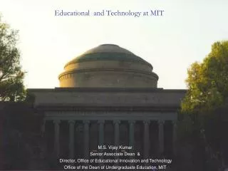
GIS at MIT Lisa Sweeney lsweeney@mit.edu Head, MIT GIS Services http://libraries.mit.edu/gis/
MIT GIS Services • Individual & classroom GIS support • General workshops • Loan GPS units • Access to GIS data: Geodata Repository • MIT GeoWeb & ESRI ArcMap Interface
MIT Geodata Repository ESRI ArcMap with MIT built tool: Must have ESRI software installed MIT GeoWeb: Access through any web browser A diverse, international collection of GIS data maintained by MIT GIS services. Data is stored in an Oracle database. 2 access points: Released 2008 Released 2002
MIT Geoweb http://web.mit.edu/geoweb
MIT Geoweb http://web.mit.edu/geoweb Search, view & retrieve geospatial data
MIT Geoweb http://web.mit.edu/geoweb Search, view & retrieve geospatial data View metadata
MIT Geoweb http://web.mit.edu/geoweb • Search, view & retrieve geospatial data • View metadata • Search the • MIT Geodata Repository,
MIT Geoweb http://web.mit.edu/geoweb • Search, view & retrieve geospatial data • View metadata • Search the • MIT Geodata Repository, • MIT print map collection, Biology
MIT Geoweb http://web.mit.edu/geoweb • Search, view & retrieve geospatial data • View metadata • Search the • MIT Geodata Repository, • MIT print map collection, • Harvard Geospatial Library, Biology
MIT Geoweb http://web.mit.edu/geoweb • Search, view & retrieve geospatial data • View metadata • Search the • MIT Geodata Repository, • MIT print map collection, • Harvard Geospatial Library, • MassGIS collections Biology
MIT Geoweb http://web.mit.edu/geoweb • Search, view & retrieve geospatial data • View metadata • Search the • MIT Geodata Repository, • MIT print map collection, • Harvard Geospatial Library, • MassGIS collections • with one easy search Biology
MIT Geoweb http://web.mit.edu/geoweb • Search, view & retrieve geospatial data • View metadata • Search the • MIT Geodata Repository, • MIT print map collection, • Harvard Geospatial Library, • MassGIS collections • with one easy search • No specialized software or plugins required • – only need a web browser Biology
MIT Geoweb http://web.mit.edu/geoweb • Search, view & retrieve geospatial data • View metadata • Search the • MIT Geodata Repository, • MIT print map collection, • Harvard Geospatial Library, • MassGIS collections • with one easy search • No specialized software or plugins required • – only need a web browser • Uses Oracle/ArcSDE/Geoserver/Openlayers Biology
MIT Geoweb http://web.mit.edu/geoweb • Search, view & retrieve geospatial data • View metadata • Search the • MIT Geodata Repository, • MIT print map collection, • Harvard Geospatial Library, • MassGIS collections • with one easy search • No specialized software or plugins required • – only need a web browser • Uses Oracle/ArcSDE/Geoserver/Openlayers • A foundational model for the OpenGeoportal collaborative work being led by Tufts Biology
MIT Geodata Repository Dramatic increase in the number of users with the introduction of MIT Geoweb
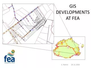
MIT Geodata Repository Supporting projects around the world
GIS Services provides support across all areas of MIT Center for Transportation and Logistics Computer Science & Artificial Intelligence Lab Science, Technology & Society Physics Nuclear Engineering Biological Engineering Design Laboratory Operations Research Chemical Engineering Center for International Studies Office of the Arts Lincoln Laboratory The Broad Institute Alumni Association Health Sciences & Technology Office of Environment, Health & Safety IS&T Libraries OEIT Office of Development Services Urban Studies and Planning Earth Atmospheric and Planetary Sciences Civil & Environmental Engineering Architecture Economics Mechanical Engineering Aeronautics and Astronautics Political Science Mathematics Engineering Systems Division Center for Real Estate Development Sloan School of Management Electrical Eng & Computer Science Sea Grant College Program Management MIT Energy Initiative Division of Comparative Medicine Picower Institute for Learning & Memory Program in Media Arts Sciences Technology and Development Program Biology
OpenStreetMap (OSM) Mapping Parties • Teach the community about • GPS
OpenStreetMap (OSM) Mapping Parties • Teach the community about • GPS • Open geodata
OpenStreetMap (OSM) Mapping Parties • Teach the community about • GPS • Open geodata • Contributing data
OpenStreetMap (OSM) Mapping Parties • Teach the community about • GPS • Open geodata • Contributing data • Community mapping
OpenStreetMap (OSM) Mapping Parties • Teach the community about • GPS • Open geodata • Contributing data • Community mapping • A growing international data source
OpenStreetMap (OSM) Mapping Parties • Teach the community about • GPS • Open geodata • Contributing data • Community mapping • A growing international data source • http://www.openstreetmap.org/
A few examples of MIT research utilizing geospatial information
GIS and GPSNew Orleans http://nola.mit.edu/wiki/Classes_and_Projects#Class_Projects Image Source: http://commons.wikimedia.org/wiki/File:Leyland_double_decker_bus.JPG
Using GIS and GPS to help promote safe water H20 1B: Safe Water for 1 Billion people: http://web.mit.edu/watsan/ Safe Water World http://globalchallenge.mit.edu/teams/view/210
Cartagen http://cartagen.org/find/cambridge,-ma Cartagen is an MIT Media lab project that renders OSM and other data in a HTML5 Canvas element dynamically on the client-side.
Geospatial.mit.edu • Ongoing projects: • Smart city and smart grid • Anti-counterfeiting in supply chains • Grid computing • Geonumerics research in multicore • Integration of 3 research labs: • MIT Auto-ID Lab and Geonumerics Group • MIT Center for GRID Computing • MIT Intelligent Engineering Systems Lab Working to advance geospatial capabilities and address the “Big Data Problem” Their integrated mission is to deploy a next generation open source geospatial platform, which provides more granular analytic capabilities and faster processing for complex queries by utilizing parallel processing capabilities (grid computing, GPU, and multicore).
A few more examples • Reconstructing sea surface temperatures over the last 10,000 years • Mapping industrial zones in Boston for potential redevelopment planning • Development of a landslide hazard map for the island of Puerto Rico • Cognitively inspired direction giving • Office rent and labor availability in the Chicago Metro Area • Energy consumption and smart growth in Massachusetts • Mapping access to safe water in Ghana
Collaboration = key • Sharing • Ideas • Best practices • Instructional materials • Geoportal development • Software • Metadata • Data • and much more
For more examples of GIS at MIT visit: http://libraries.mit.edu/gis/examples/giscitations.html Lisa Sweeney lsweeney@mit.edu Head, MIT GIS Services http://libraries.mit.edu/gis/