Download

1 / 60
620 likes | 817 Views
ATMOSPHERIC FORCES or Why Does the Wind Blow?. 1 2 3 4. Air motion is well described by the Navier-Stokes equation,. Acceleration = Pressure gradient force + Coriolis force + Friction force.

E N D
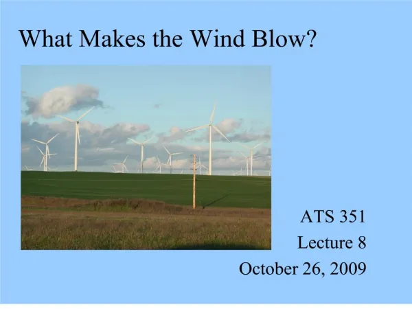
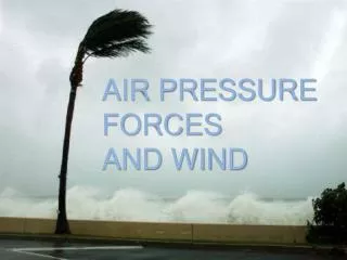
ATMOSPHERIC FORCES or Why Does the Wind Blow?
1 2 3 4 Air motion is well described by the Navier-Stokes equation, Acceleration = Pressure gradient force + Coriolis force + Friction force.
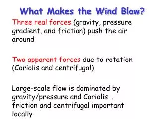
The change in pressure measured across a given distance is called a "pressure gradient". PG = change in pressure / distance The pressure gradient results in a net force that is directed from high to low pressure and this force is called the "pressure gradient force".
PGF points at a right angle to the local isobar or height contour line. It also points from high pressure to low pressure (or high heights to low heights). The closer the isobars or height contours, the greater the PGF magnitude. Larger PGF result in stronger winds, so strong winds are associated with closely spaced contour lines.
Reasons for pressure variation: • Pressure differences are ‘forced’ by uneven absorption of solar radiation at the Earth's surface. (remember P=ρ*R*T, pressure = density x constant x temperature) • warmer air is less dense and typically exerts less pressure than cooler air • however, for a given surface pressure, a column of cold air will decrease in pressure with height more rapidly than will a warm column of air (see next slide for example) • Moisture content of air also affects pressure • the greater the amount of water vapor, the less dense the air will be, and the less pressure it will exert • Wind develops as a result of spatial (i.e. horizontal) differences in atmospheric pressure. • Wind speed tends to be at their greatest during the daytime when the greatest spatial extremes in atmospheric temperature and pressure exist.
Coriolis Force - an artifact of the earth's rotation. V = wind speed Ω = earth angular velocity, 7.27 x 10⁻⁵ φ = latitude Once air has been set in motion by the pressure gradient force, it undergoes an apparent deflection from its path, as seen by an observer on the earth. This apparent deflection is called the "Coriolis force" and is a result of the earth's rotation. The Coriolis force is zero at the equator.
An air parcel initially at rest will accelerate from high pressure to low pressure because of the pressure gradient force (PGF). As the air parcel begins to move, it is deflected by the Coriolis force (to the right in the northern hemisphere, to the left in the southern hemisphere). Coriolis force always acts at 90° to the wind motion. As the wind gains speed, the deflection increases until the Coriolis force equals the pressure gradient force. This balance is called geostrophic balance. The geostrophic wind blows parallel to contours. (Note: friction is not a component!) What hemisphere is depicted in this figure?
FRICTION • The surface of the Earth exerts a frictional drag on the air blowing just above it. • This friction can act to change the wind's direction and slow it down -- keeping it from blowing as fast as the wind aloft. • The difference in terrain conditions directly affects how much friction is exerted. • For example, a calm ocean surface is pretty smooth, so the wind blowing over it does not move up, down, and around any features. • By contrast, hills and forests force the wind to slow down and/or change direction much more.
Net result is that surface winds blow across isobars! This cross-isobar flow allows the surface wind to spiral into low pressure and out of high pressure.
Surface wind crossing isobars is known as “Ekman turning” or “Ekman pumping”. It is due to friction. Ekman turning has two results: 1. Surface winds around high and low pressure systems are determined: winds spiral cyclonicinto Low Pressure and anticyclonicout of High Pressure 2. Surface winds are oriented approximately 45° to right of geostrophic wind at surface. Top of “Ekman layer” is defined where v wind component is zero. (And thus wind is now geostrophic).
Another consequence of Ekman turning is the response of the upper-atmosphere to the low-atmosphere surface layer. Low pressure system: convergence at surface, divergence aloft High pressure system: divergence aloft, convergence at surface upper level surface
We have now seen three very important force balances in the atmosphere. We will see a fourth soon. PGF = Coriolis force Geostrophic balance (Earth turning) PGF = Centripetal force Cyclostrophic balance (Tornado) PGF = gravity Hydrostatic balance PGF = CO + Friction Ekmann Balance (PBL)
Summary: What is wind? Simply a balance of forces acting on air parcels Geostrophic wind: case where pressure gradient force is equally and oppositely balanced by coriolis force. Resulting wind blows parallel to isobars / height contours At the surface, friction force induces a drag and creates imbalance between PGF & CF. Resulting wind crosses isobars, diverging from high and converging into low pressure
Local wind circulations During day, land and ocean heat up differently (why?) By afternoon, land is warmer than ocean Warm air has lower pressure than cold air (assume density remains constant) A local pressure gradient sets up and air moves from H to L, resulting in a sea breeze At night, land cools down faster than ocean, reversing the pressure gradient Wind blows off shore, resulting in land breeze Sea Breeze Land Breeze Land Breeze
Valley Breeze • During the day the air close to the mountain sides becomes warmer than the surrounding air, thus lowering pressure relative to the cooler air at the same height over the valley. • This warm air rises up the mountains and is replaced by air from within the valley. • So during the day valley air moves up the mountain sides. Warmer, local low pressure Cooler, local high pressure
This process leads to clouds and rain in the mountains in the summer, particularly in the late afternoon.
Mountain Breezes • At night the sides of the mountain cool down and cool air is pulled down by gravity. • In the morning, the coldest air is, therefore, often found within the valley.
The large volcanoes on the Big Island of Hawaii are the source of strong nighttime mountain breezes
Circulation scales • We know that weather is essentially nothing more than moving air (& the accompanying heat & moisture transport) • We also know that air parcels are acted on by several forces, the net result being motion: • pressure gradient, Coriolis, friction, gravity • To help us understand air motion, we categorize “disturbances” by size and time
Understanding global-scale atmospheric motion is important because it shows us how and why the planet is divided into different zones, distinguished from one another by their typical weather and climate • These divisions of the global climate system have had a significant impact on thedevelopment of civilization on Earth, because climate has been more or less the same for the last 10,000 years or so • However, there are climatic fluctuations on timescales of years to decades that can have significant effects • On even longer timescales, we find that the atmospheric general circulation and climate have undergone very large fluctuations.
In a simplistic world model, heated air in the equatorial regions becomes less dense, more buoyant and rises. • At the same time, cold air in the Polar Regions becomes denser, heavier and sinks. • In the lower levels of the atmosphere, cold dense air from the Polar Regions flows towards the equator. It replaces the heated equatorial air. • A return flow of warm air at higher levels of the atmosphere completes this simple circulation model. • This type of “direct” circulation is called a Hadley Cell • Convergence is coming together. • Divergence is going apart. • Subsidence is sinking air.
The planet Venus rotates very slowly on its axis (a “day” on Venus is longer than a “year”!) So the general circulation of the lower atmosphere of Venus is essentially large Hadley cells on either side of the equator
The circulation in the northern and southern hemispheres is broken into 3 bands in each hemisphere The large-scale rising or sinking of air tells us (at least in general) where the rainiest and driest latitudes are:
Tropical Rainforest A dense evergreen forest occupying a tropical region with an annual rainfall of at least 2.5 meters (100 inches). Cover about 6% of earth’s land area
Temperate rainforest is defined as any forest in the mid-latitudes that receives more than 50-60 inches of rainfall a year. They are found along the Pacific coast of the USA and Canada (from northern California to Alaska), in New Zealand, Tasmania, Chile, Ireland, Scotland and Norway. They cover less area than tropical rainforests.
Westerlies and trade winds blow away from the 30 degrees latitude belt. Over broad regions centered at 30 degrees latitude, surface winds are light or calm. Air slowly descends to replace the air that blows away. Descending air warms and is dry. The subtropical deserts, such as the Sahara of Africa and the Sonoran of Mexico, occur under these regions of descending air.
A jet stream is a current of fast moving air found in the upper levels of the atmosphere. This rapid current is typically thousands of kilometers long, a few hundred kilometers wide, and only a few kilometers thick. Jet streams are usually found somewhere between 10-15 km (6-9 miles) above the earth's surface. The position of this upper-level jet stream denotes the location of the strongest SURFACE temperature contrast
Consequences of three large circulation scales: - Jet streams & fronts • There are two main jet streams at polar latitudes, one in each hemisphere, and two minor subtropical streams closer to the equator. • In the Northern Hemisphere the streams are most commonly found between latitudes 30°N and 70°N for the polar jet stream, and between latitude 20°N and 50°N for the subtropical stream. Technically the wind speed has to be higher than 90km/h or 55 mph to be called a jet stream.
Jet streams can be explained as follows: If two air masses of different temperatures meet, the resulting pressure difference is highest at altitude. If one of the air masses lies north of the other one, then the wind will not flow directly from the warm to the cold area, but is deflected by the Coriolis force and flows along the boundary of the two air masses. The wind speeds vary according to the temperature gradient, averaging 55km/h or 35 mph in summer and 120km/h or 75 mph in winter, although speeds of over 400km/h or 250 mph are known.
The general circulation serves to transport heat energy from warm equatorial regions to colder temperate and polar regions. Without such latitudinal redistribution of heat, the equator would be much hotter than it is whilst the poles would be much colder. • So far we have used a simple rotating earth with a smooth uniform surface to describe the general circulation of the atmosphere. • However, the earth does not have a uniform surface, and this fact plays an important role in modifying the pattern of airstreams.
Land and oceans absorb and reradiate heat differently. Consequently, land heats up rapidly and loses heat just as rapidly. In contrast, oceans distribute thermal energy through a much greater depth and take longer to change temperature. Northern Hemisphere Southern Hemisphere
Atmospheric circulation does not account for all the energy that needs to be redistributed to maintain the global energy balance. • Winds drive surface ocean circulation, and the cooling and sinking of waters in the polar regions drive deep circulation. • Surface circulation carries the warm upper waters poleward from the tropics. • Heat is disbursed along the way from the waters to the atmosphere. • At the poles, the water is further cooled during winter, and sinks to the deep ocean. • This is especially true in the North Atlantic and along Antarctica. • Deep ocean water gradually returns to the surface nearly everywhere in the ocean. • Once at the surface it is carried back to the tropics, and the cycle begins again. • The more efficient the cycle, the more heat is transferred, and the warmer the climate.
The Monsoon Circulation Monsoon is used to describe seasonal reversals of wind direction, caused by temperature differences between the land and sea. They occur in a number of countries around the world.
The Monsoon climate in Southeast Asia and India is most well known and most potent. • This circulation is known to bring about long drought periods from September to March. It is hard to grow crops during this period due to the lack of water. • The summer monsoon is known to do the opposite, bringing huge amounts of moisture from the Indian Ocean causing massive flooding in many areas.
During summer, the Tibetan Plateau acts like a gigantic exposed brick, absorbing summer heat and heating the atmosphere above it. Hot air rises, and cool, moist air—drawn in from over surrounding oceans—rushes in to replace it. That moist air is the source of monsoon rains. During the winter dry period, the airflow comes from high pressure to the north—the dry Himalayas and Siberia.
The two key ingredients for the Asian Monsoon are a large land mass and a large ocean – namely, southern Asia and the surrounding Arabian Sea and the Indian Ocean. About 60% of the earth's population live under the influence of the Asian monsoon climate.
The Mexican Monsoon (also known as the North American monsoon, the Southwest monsoon or Arizona monsoon)is a well-defined meteorological event • The Mexican Monsoon is a regional-scale circulation that develops over southwest North America during the months of July through September. • It is associated with a dramatic increase in rainfall that occurs over what is normally an arid region of North America.
Seasonal distribution of precipitation for southwestern North America. The largest peaks in mid-to-late summer rainfall (i.e., monsoonal)are found in northwestern Mexico. Note that northeastern Mexico and Texas display early summer/early fall precipitation peaks. Areas south of the broken line receive 50% of their annual rainfall during July, August and September (after Douglas et al. 1993).
Föhn wind • Called “chinook” in N. America (native word for ‘snow eater’) • The winds are caused by when a deep layer of prevailing wind is forced up, over, and down a mountain range. Graphic courtesy of USA Today