Download
1 / 9
90 likes | 278 Views
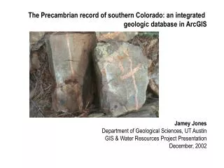
The Precambrian record of southern Colorado: an integrated geologic database in ArcGIS Jamey Jones Department of Geological Sciences, UT Austin GIS & Water Resources Project Presentation December, 2002. Objectives: merge “old school” field geology with digital mapping techniques

E N D
The Precambrian record of southern Colorado: an integrated geologic database in ArcGIS Jamey Jones Department of Geological Sciences, UT Austin GIS & Water Resources Project Presentation December, 2002
Objectives: • merge “old school” field geology with digital mapping techniques • merge both large- and small-scale geologic mapping with published geochronology and other analytical data • create an up-to-data, data-rich yet flexible map document within ArcGIS to aid geologists working in the Precambrian of Colorado (especially myself)
Why the Precambrian? • Rocks are extremely old but represent levels of exposure notseen in recent and modern tectonic environments (10 – 20+ km deep) • Relatively well exposed throughout the Rocky Mountains and southwestern U.S. • Possible ancient analogs for recent and modern mountain belts
Data Sources: • the geologic map of Colorado in ARC/INFO format (USGS OF-92-507) • DEM coverage of southern Colorado from the National Elevation Dataset • published and unpublished geochronologic and isotopic data for southern Colorado
Southern Colorado Wet Mts. Sangre de Cristo Mts. 500m contour interval
Analysis and Output: Yg Xg Mesoproterozoic magmatism Paleoproterozoic magmatism
Future directions: • expand database/coverage to entire state of Colorado and possibly all Rocky Mountains and southwest U.S. • expand scope of data to include other radiogenic systems, geochemical data, etc. • incorporate new and more detailed mapping into basemap • real-time digital mapping and data collection