Download

1 / 36
360 likes | 540 Views
The Dancing Plates: The Plate Tectonic Revolution. The Rock Cycle. igneous. melting, cooling. melting, cooling. baking, pressing. erosion, dep. sedimentary. metamorphic. baking, pressing. erosion, dep. Earth: Compositional Layers. Composition. Physical Characteristics. crust.

E N D
The Dancing Plates: The Plate Tectonic Revolution
The Rock Cycle igneous melting, cooling melting, cooling baking, pressing erosion, dep. sedimentary metamorphic baking, pressing erosion, dep.
Composition Physical Characteristics crust Brittle, solid Similar to mantle but with lighter metals lithosphere Solid, but behaves plastically asthenosphere mantle Mostly silica, magnesium, iron, with some other stuff Solid but flows slowly over long periods of time mesosphere Liquid outer core Mainly iron and nickel inner core core Solid Note: Lithosphere contains both crust and uppermost (brittle) layer of mantle
Focus your attention to interaction of brittle lithosphere and near-liquid asthenosphere
Why Do Ocean Basins and Continents Exist ? Answer: Isostasy (“Equal Standing”) Oceanic Crust Average Density: 3.0 g/cm3 Average Thickness: 7 km Maximum Age: 180 million years Continental Crust Average Density:2.7 g/cm3 Average Thickness: 35-40 Maximum Age: 4.0 billion years Note: Average Density of Mantle Material is 3.3 g/cm3 Both oceanic and continental crust are welded to lithospheric mantle (the hard, brittle, uppermost part of mantle to form lithospheric plates) Oceanic plates are heavier than continental plates !
Effects of Density: A block of continental lithosphere (containing continental crust plus uppermost ) stands higher than a block of oceanic lithosphere (containing oceanic crust) of the same dimensions Continental crust: 2.7 g/cm3 Oceanic crust: 3.0 g/cm3 Lithospheric mantle ~ 3.3 g/cm3 Lithospheric mantle ~ 3.3 g/cm3 Asthenosphere (near-liquid part of mantle) Oceanic lithosphere floats low on asthenosphere (forms basins) Continental lithosphere floats high on asthenosphere (forms continents)
Effect of Lithospheric Thickness: For a buoyant material, a thick block stands higher than a thin block Example: top surface of thick block of wood stands higher above water level than that of thin block of wood. However, the proportion of material standing above and below water mark is the same for all blocks. So, low density of continents combined with great crustal thickness make continents stand higher than ocean floors
Physiography of the Earth’s Surface We have explained why continents stand high and ocean basins stand low, but what about features within ocean basins ? Mid-Ocean Ridges Trenches These features are significant in understanding how oceans open and close
Interaction of Lithosphere and Asthenosphere Plates in a can Scum (Lithosphere) Lithospheric Plates Liquid Soup (Asthenosphere) Solids (Top of Mesosphere)
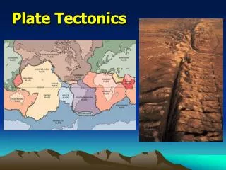
Several lithospheric plates are recognized on Earth’s surface Plate boundaries Divergent: plates move apart (e.g. down centre of Atlantic, and in south Pacific) Convergent: plates pushed toward one another (e.g. on west side of S. America) Transform: plates slide alongside one another (e.g. San Andreas fault)
Another aspect to consider in the Earth System: Rates of geologic processes Many geologic processes (including plate movements) occur over immense time scales Rule of thumb: on average, lithospheric plates move at about the rate that your fingernails grow (about 5 cm/yr). Took about 200 million years for Atlantic Ocean to reach its present dimensions (by the way, the Maritimes were connected to Africa just before this time !)
Divergent Plate Boundaries: Divergent plate boundaries are where seafloor spreading occurs, producing new oceanic crust. Material from mantle intruded into fractures as plates are move apart. New oceanic crust is made, so this type of boundary is said to be “constructive.” Upper crust of oceanic plate is made of basalt (aphanitic mafic rock) Lower part of crust is made of gabbro (phaneritic mafic rock) So same composition of magma (from molten mantle), but different textures. Ocean basins ultimately originate when continental landmasses split apart
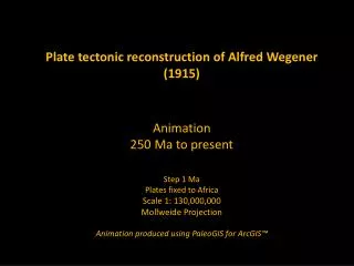
Early evidence of seafloor spreading 1. Jigsaw puzzle fit of continents (first noted by Alfred Wegener)
Early evidence of seafloor spreading 2. Fossil evidence Fossils of land organisms such as the lizard Mesosaurus and the fern Glossopteris distributed over multiple continents: how did they get from one continent to another ?
Early evidence of seafloor spreading 3. Distribution of old mountain belts Old mountains belts (Appalacians and Caledonides) now separated but if continents are fit together, mountain chains form a continuous belt
Early evidence of seafloor spreading 4. Flow indicators of glacial ice during ancient ice age (about 300 million years ago) -not to be confused with the last ice age that ended only about 10,000 years ago). Flow directions make more sense if continents are fit together
More recent evidence of seafloor spreading 1. Symmetry of magnetic stripes (defined by polarity of magnetic minerals in basaltic rock of seafloor) Symmetrical pattern of normal and reverse polarities on either side of a divergent boundary can only be explained if new crust was being formed and repeatedly split apart as magnetic field reversed
More recent evidence of seafloor spreading 2. Linear arrangement and relative heights of hotspot volcanoes (volcanoes produced by movement of plate over stationary magma plume from mantle) Note: heights of hotspot volcanoes are decreased with increasing distance from point of active volcanism (due to cooling and sinking of lithospheric material)
But how does seafloor spreading (divergence) start ? Hot plume in mantle upwarps lithosphere of continent Cracks develop (generally in a triple junction), forming rift valleys Zones where adjacent fractures connect allow further spreading to produce an ocean Failed arm ceases to spread (Bay of Fundy basin represents a “failed arm” of the Atlantic Ocean basin)
Red Sea-Gulf of Aden: An ocean basin in the making East African Rift will probably stop spreading and become a “failed arm” Future ocean basin
Convergent Plate Boundaries Zones where lithospheric plates move toward one another and where oceanic lithosphere is consumed back into the mantle. Because oceanic lithosphere is destroyed, convergent plate boundaries are commonly called “destructive” plate boundaries This process ensures that the Earth retains a constant volume (otherwise the Earth would be expanding- which we know isn’t happening !) When plate of oceanic lithosphere descends (is subducted) into the mantle, some material rises to surface to produce explosive volcanoes
Convergent Plate Boundaries At the surface, igneous rocks include pyroclastic deposits and rhyolite At depth, the magma cools slowly to produce granite. However, basalt can also occur (but this is a complication) In this case, magma does not come directly from mantle. Magma at a convergent boundary is produced by the partial melting of the downgoing (subducted) slab of oceanic lithosphere. In this process, silica in rocks of the subducted slab melts first. So the magma produced tends to be felsic (rich in light-coloured minerals such as quartz) and very sticky – this is why volcanoes at convergent boundaries are explosive.
Types of Convergent Plate Boundaries Oceanic-oceanic convergence -subduction of oceanic lithosphere under another plate of oceanic lithosphere -molten material from subducting slab rises to form an island arc (e.g. Japan) Oceanic-continental convergence -subduction of oceanic lithosphere under a continental lithosphere -molten material from subducting slab rises to form an continental arc (e.g. Cascades with Mt. St. Helens) Continent-continent collision -where two pieces of continental lithosphere meet (intervening ocean becomes completely closed) -continental lithosphere can’t be subducted, so basically shortens -Earth’s highest mountain belts produced in this way (e.g. Himalayas)
Evidence of Subduction • Existence of ocean trenches (deepest areas of the ocean) • -mark zones where oceanic lithosphere descends downward) • 2. Explosive volcanoes (partial melting of top of subducted slab produces thick, viscous magma)
Evidence of Subduction 3. Areas with most severe earthquakes (indicating severe compression and subsequent release of energy) -focal points of earthquakes are deeper inboard of the trench -the oblique array of earthquake occurrences that indicate the position of the descending slab is called a “Wadati-Benioff” zone (but you don’t have to remember this name).
Evidence of Subduction 4. Rocks of oceanic origin found high and dry in the largest mountain ranges Marine rocks of former ocean become wedged between the colliding plates and are uplifted in mountain range
Other geologic consequences of plate tectonics Clastic sediments are derived from wearing-down of mountains that ultimately owe their existence to the convergence of plates (remember how mountains are formed when stuff between plates gets crumpled). If a mountain chain is close to the sea a “clastic wedge” can form (more on this in next lecture): -conglomerates generally occur on land, close to the mountains -sands occur close to the shoreline -mud (silt + clay) is generally deposited offshore -beyond the reach of mud (i.e. where water is clear), limestone can be deposited on a “carbonate platform” Mountains (on land) Sea conglomerate sandstone siltstone/shale limestone
Other geologic consequences of plate tectonics Mountains (without volcanoes in this case) slate schist gneiss compression Compression created by converging plates, together with heating of rock as the crust is thickened and lowered downward produces regional metamorphism (metamorphic grade increases with depth)
Transform Plate Boundaries Zones where lithospheric plates move alongside one another No oceanic lithosphere is created or destroyed (sometimes called “strike-slip” boundaries) Most common in oceanic lithosphere of ocean basins (offset segments of divergent plate boundaries) Sometimes occur in continental lithosphere (e.g. San Andreas fault) No magma is generated in this type of boundary
Implications of Plate Tectonics So…Oceanic lithosphere is constantly being created at divergent plate boundaries, destroyed at convergent plate boundaries, and offset at transform plate boundaries Oceans are temporary features In the past 600 million years, Atlantic has opened, closed and reopened (we are now witnessing only the latest opening event)
Implications of Plate Tectonics While ocean basins are created and destroyed continents are too light to be subducted, so simply break apart and collide Continental Drift: 750 years ago to present
What Drives Plate Movement ? • Convection (plates move in response to convection in mantle) ? • Ridge push (plates pushed apart at divergent boundaries due to downward sliding of plates from top of mid-ocean ridge) ? • Slab pull (oceanic plates dragged down at convergent boundaries due to increasing density as they cool) ? • Or…combination of these ?
Back to Distribution of Rock Types As stated previously, different rocks do not occur randomly on the Earth’s surface. Rocks are distributed as they are because of Plate Tectonics. It is because of the distribution of certain rock types that geology-related health differ between geographic areas. Also, because different rocks types occur in different areas, geologic materials can be used to “fingerprint” geographic areas/localities in forensic cases.