Download

1 / 25
250 likes | 406 Views
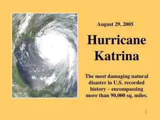
Hurricane Katrina Storm Surge Induced Flooding. and. Low-Lying New Orleans: How to Prevent Future Damages. Introduction. What is storm surge What happened during Hurricane Katrina Why New Orleans is vulnerable The future of New Orleans.

E N D
Hurricane KatrinaStorm Surge Induced Flooding and Low-Lying New Orleans: How to Prevent Future Damages
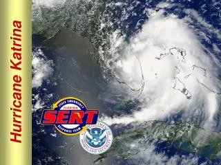
Introduction • What is storm surge • What happened during Hurricane Katrina • Why New Orleans is vulnerable • The future of New Orleans http://www.pbs.org/wgbh/nova/sciencenow/dispatches/images/050901-katrina2-l.jpg
What is a Storm Surge? • “Meteorological Residual” • Most dangerous phenomenon associated with hurricanes • Accounts for 70-90% of death & damage
What is Storm Surge? • Large change in sea level • Generated by extreme weather conditions • “Mound” of water driven toward shore by storm • Waves on top of surge devastate area • Water weighs 1000 kg/m3 – Immense potentially destructive power
Background • General Factors Contribute to Storm Surge • Storm Winds • Wave Run-Up • Low Pressure inside the storm • Astronomical Tides • Local Factors • Slope of Continental Shelf • Shape of Coastline • Elevation relative to sea level
Dangers of Surge • Devastating to low-lying coastal regions • Bay of Bengal - India • Galveston – Texas • Inland Surge • Lake Okeechobee, Florida • 1928-3m surge; Hurricane San Filippe • 1,836 people killed, massive flooding • Lake Pontechrain, Louisiana • 2005 ~8m; Hurricane Katrina • Death toll-unknown and still rising
BEFORE AFTER http://www.spaceimaging.com/gallery/hurricanes2005/katrina/NewOrleans/NewOrleans1.jpg
Before and After http://chattablogs.com/quintus/new_orleans1.jpg
Satellite Images After – August 30th Before – August 27th http://www.nasa.gov/images/content/126535main_neworleans_flood_0831.jpg
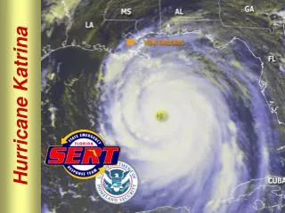
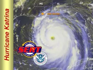
Storm Surge ~8 meters (25-28 feet) Water is STRONG! Pumping Stations flooded Lack of drainage in city Left helpless What Happened During Katrina?
What Happened During Katrina? • Channels/Canals • Lack of sea gates allowed water to flow deep into the city • Intense pressure from water and winds • Protective walls broke • Funneling • MRGO & Intracoastal Waterway • New Orleans Flood Map • http://mapper.cctechnol.com/floodmap.php
Why is New Orleans VulnerableBelow Sea Level • City averages 6 feet below sea level • Drainage of former swamp areas led to subsidence • Located between levees of Lake Pontchartrain and Mississippi River • Creates “bowl” effect http://en.wikipedia.org/wiki/Image:New_Orleans_Levee_System.gif
Why is New Orleans VulnerableDisappearing Wetlands and Barrier Islands • Wetlands and Barrier Islands are best natural defense against storm surges • For every mile of continuous wetland the height of a storm surge can be reduced 3 to 8 inches • Wetlands and Barrier Islands are naturally replenished with sediment from the flooding Mississippi Before and after Hurricane Katrina http://news.nationalgeographic.com/news/2005/09/images/050919_katrina_delta.jpg
Why is New Orleans VulnerableDisappearing Wetlands and Barrier Islands • Upriver Dams have reduced sediment in the river by up to 67% • Levees built around New Orleans channel the rivers flow far out into Gulf of Mexico • Wetlands and barrier islands being denied natural replenishment http://news.minnesota.publicradio.org/features/2003/08/14_hetlandc_morupdate/images/gavinspointdam_large.jpg
Why is New Orleans VulnerableDisappearing Wetlands and Barrier Islands • Over the last 50 years wetland loss has been about 60 square kilometers per year • Canal construction has allowed saltwater intrusion to freshwater marshes • Additional salinity kills native plants, which causes even more erosion http://www.whitehouse.gov/omb/budget/fy2005/images/corps-6.jpg
The Future of New OrleansRebuilding Current Structures • Restore New Orleans to Pre-Katrina before June 1st • Official start of hurricane season • Many building permits already given out http://ap.lancasteronline.com/5/new_orleans_levees Work continues, Wednesday, Nov. 30, 2005, at the 17th Street Canal floodwall that was breached after Hurricane Katrina in New Orleans. Government engineers performing sonar tests at the 17th Street Canal found exactly what independent investigators said they would, that steel reinforcements barely went more than half as deep as they were supposed to, a U.S. Army Corps of Engineers official said Wednesday. (AP Photo/Cheryl Gerber)
The Future of New OrleansSea Gates • Giant air-filled walls • Across Lake Pontchartrain’s two inlets • Considered since 1960’s • Used in Holland & Britain • Cost ~ $500 million-1 billion The Delta Project - Holland http://www.alumni.northwestern.edu/travel/holland-belgium-photos.html?action=viewPhoto&photoID=1115312046
The Future of New OrleansClosing/Covering Canals • Only keep heavily used canals open • Cover others (turn into culverts $$$) • Turn into parks/trails MRGO Today, only a slim line of broken marsh lies between the MRGO and Lake Borgne (top of frame). http://www.louisianasportsman.com/stories/2003/paradise-lost/future-of-mrgo.htm
The Future of New OrleansWetland Rehabilitation • Dredging of canals • Saltwater intrusion • Hand planting is costly http://www.pbs.org/journeytoplanetearth/images/1la2.jpg
The Future of New OrleansBarrier Islands • First line of protection • Shrinking rapidly • Coast 2050 http://www.earthsky.com/humanworld/shows.php?date=20051230
Coast 2050 http://www.coast2050.gov/barrier_island.htm
The Future of New OrleansOther Ideas • Move pumping stations • Drainage Systems • Contain Neighborhoods • Connect barrier Islands • Netherlands: Delta Works • Lowlands into parks http://www.globalsecurity.org/military/facility/new-orleans-flooding-pics.htm
Conclusion • New Orleans future is unclear • Will take multiple solutions to protect the sinking city • High cost and will take years to infiltrate http://www.globalsecurity.org/military/facility/new-orleans-flooding-pics.htm http://rst.gsfc.nasa.gov/Sect14/Sect14_10a.html
THANKS!!! Keith Erickson Rachel Kjos Chris Below Chris Dierich http://www.all4all.org/images/2005/09/2065.jpg