Climate
400 likes | 534 Views
Science Homework for Tuesday 5/8/2012 -Read I:4.1 and I:4.2 --Pages 112-131 -Complete the Outline Review Sheet --I:4.1 and I:4.2 --Due Friday 5/11/2012. Climate. What Causes Climate I: 4.1 And Climate Regions I: 4.2. Weather is day-to-day events.

Climate
E N D
Presentation Transcript
Science Homework for Tuesday 5/8/2012-Read I:4.1 and I:4.2--Pages 112-131-Complete the Outline Review Sheet--I:4.1 and I:4.2--Due Friday 5/11/2012
Climate What Causes Climate I: 4.1 And Climate Regions I: 4.2
Weatheris day-to-day events. • The weather may be cloudy and rainy one day and clear and sunny the next. • Weather refers to the condition of the atmosphere at a particular place and time. • Climate, on the other hand, refers to the average, year-after-year conditions of temperature, precipitation, winds, and clouds in an area. • Two main factors—temperature and precipitation—determine the climate of a region.
In general, climates of locations farther from the equator are cooler than climates of areas closer to the equator. • The sun’s rays hit Earth’s surface most directly at the equator. • At the poles, the same amount of solar radiation is spread out over a larger area, and therefore brings less warmth. The main factors that influence temperature are latitude, altitude, distance from large bodies of water, and ocean currents.
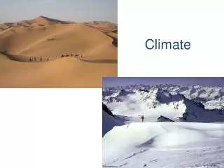
The latitude is the distance from the equator, measured in degrees. Earth’s surface can be divided into the three temperature zones shown below. The tropical zoneis the area near the equator, between about 23.5° north latitude and 23.5° south latitude. The tropical zone receives direct or nearly direct sunlight all year round, making climates there warm.
The In contrast, the sun’s rays always strike at a lower angle near the North and South poles. As a result, the areas near both poles have cold climates. These polar zonesextend from about 66.5° to 90° north and 66.5° to 90° south latitudes.
The temperate zonesare between the tropical and the polar zones—from about 23.5° to 66.5° north and 23.5° to 66.5° south latitudes. In summer, the sun’s rays strike the temperate zones more directly. In winter, the sun’s rays strike at a lower angle. As a result, the weather in the temperate zones ranges from warm or hot in summer to cool or cold in winter.
The temperature of the troposphere decreases about 6.5 Celsius degrees for every 1-kilometer increase in altitude. As a result, highland areas everywhere have cool climates, no matter what their latitude. At nearly 6 kilometers, the air at the top of Mount Kilimanjaro is about 39 Celsius degrees colder than the air at sea level at the same latitude.
The Oceans or large lakes can also affect temperatures. Oceans greatly moderate, or make less extreme, the temperatures of nearby land. Water heats up more slowly than land; it also cools down more slowly. --Therefore, winds from the ocean keep coastal regions from reaching extremes of hot and cold. Much of the west coasts of North America, South America, and Europe have mild marine climates, with relatively warm winters and cool summers.
The centers of North America and Asia are too far inland to be warmed or cooled by the oceans. Most of Canada and Russia, as well as the central United States, have continental climates. Continental climates have more extreme temperatures than marine climates. Winters are cold, while summers are warm or hot.
Many marine climates are influenced by ocean currents, streams of water within the oceans that move in regular patterns. In general, warm ocean currents carry warm water from the tropics toward the poles. Cold currents bring cold water from the polar zones toward the equator
The surface of the water warms or cools the air above it. The warmed or cooled air then moves over the nearby land. So a warm current brings warm air to the land it touches. A cold current brings cool air.
The main factors that affect precipitation are prevailing winds and the presence of mountains. Air masses can be warm or cool, dry or humid. The amount of water vapor in the air mass influences how much rain or snow will fall. Warm air can carry more water vapor than cold air can. When warm air rises and cools, water comes out of the air as precipitation.
In contrast, sinking cold air is usually dry. Because the air becomes warmer as it sinks, it can hold more water vapor. The water vapor stays in the air and little or no rain falls.
A mountain range in the path of prevailing winds can also influence where precipitation falls. When the wind hits the mountain--they are forced to rise up to pass over the mountains. The rising wind cools and its water vapor condenses, forming clouds. Rain or snow falls on the windward side of the mountains, the side the oncoming wind hits.
By the time the air reaches the other side of the mountains, it has lost much of its water vapor, so it is cool and dry. The land on the leeward side of the mountains-downwind-is in a rain shadow.
Have you ever noticed that it is cooler and more humid in a grove of trees than in an open field? The same factors that affect large climate regions also affect smaller areas. A small area with specific climate conditions may have its own microclimate. Inland mountains, lakes, forests, and other natural features can influence climate nearby, resulting in a microclimate.
You might think that Earth is closer to the sun during the summer and farther away during winter. If this were true, every place on Earth would have summer at the same time. Actually, when it is summer in the Northern Hemisphere it is winter in the Southern Hemisphere. So the seasons are not a result of changes in the distance between Earth and the sun.
Scientists classify climates according to two major factors: temperature and precipitation. They use a system developed around 1900 by WladimirKöppen (kep un). There are five main climate regions: tropical rainy, dry, temperate marine, temperate continental, and polar. Note that there is only one category of dry climates, whether hot or cold.
The tropics have two types of rainy climates: tropical wet and tropical wet-and-dry. Tropical wet climates are found in low-lying lands near the equator. If you look north and south of tropical wet climates on the map, you can see two bands of tropical wet-and-dry climates.
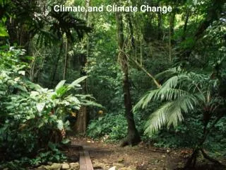
In areas that have a tropical wet climate, many days are rainy, often with afternoon thunderstorms. With year-round heat and heavy rainfall, vegetation grows lush and green. Dense rain forests grow in these rainy climates. Rain forestsare forests in which plenty of rain falls all year-round. Tall trees such as teak and mahogany form the top layer, or canopy, while smaller bushes and vines grow near the ground. There are also many animals in the rain forest, including colorful parrots and toucans, bats, insects, frogs, and snakes.
In the United States, only the windward sides of the Hawaiian islands have a tropical wet climate. Rainfall is very heavy—over 10 meters per year on the windward side of the Hawaiian island of Kauai. The rain forests in Hawaii have a large variety of plants, including ferns, orchids, and many types of vines and trees.
Tropical wet-and-dry climates get slightly less rain than tropical climates and have distinct dry and rainy seasons. Instead of rain forests, there are tropical grasslands called savannas. Scattered clumps of trees that can survive the dry season dot the coarse grasses. Only a small part of the United States—the southern tip of Florida—has a tropical wet-and-dry climate.
A climate is “dry” if the amount of precipitation that falls is less than the amount of water that could potentially evaporate. Because water evaporates more slowly in cool weather, a cool place with low rainfall may not be as dry as a hotter place that gets the same amount of rain. Dry regions often lie inland, far from oceans that are the source of humid air masses. Humid air masses from the Pacific Ocean lose much of their water as they cross the mountains. Little rain or snow is carried to dry regions.
In the U.S., much of the region lies in the rain shadow of the Sierra Nevadas and Rocky Mountains to the west.
Some deserts are hot and sandy, but others are cold or rocky. On average, arid regions, or deserts, get less than 25 centimeters of rain every year. Some years may bring no rain at all. Only specialized plants such as cactus and yucca can survive the desert’s dryness and extremes of hot and cold.
Large semiarid areas are usually located on the edges of deserts. A steppe is dry but gets enough rainfall for short grasses and low bushes to grow. For this reason, a steppe may also be called a prairie or grassland.
The Great Plains are the steppe region of the United States. Many kinds of short grasses and wildflowers grow here, along with scattered forests. Livestock grazing is an important part of the economy of the Great Plains. Beef cattle, sheep, and goats graze on the short grasses of the region. Farm crops include grains, such as wheat and oats, and sunflowers.
There are three kinds of temperate marine climates. Marine West Coast, Mediterranean, and Humid Subtropical Because of the moderating influence of oceans, all three are humid and have mild winters. Marine West Coast The coolest temperate marine climates are found on the west coasts of continents north of 40° north latitude and south of 40° south latitude. Humid ocean air brings cool, rainy summers and mild, rainy winters. Because of the heavy precipitation, thick forests of tall trees grow in this region, including coniferous, or cone-bearing, trees
In North America, the marine west coast climate extends from northern California to southern Alaska. In the Pacific Northwest of the United States, humid air from the Pacific Ocean rises as it hits the western slopes of the Coastal Ranges. As the air cools, large amounts of rain or snow fall on the western slopes.
A coastal climate that is drier and warmer than west coast marine is known as Mediterranean. The southern coast of California has a Mediterranean climate. This climate is mild, with two seasons. In winter, marine air masses bring cool, rainy weather. Summers are somewhat warmer, with little rain.
The warmest temperate marine climates are on the edges of the tropics. Humid subtropicalclimates are wet and warm, but not as constantly hot as the tropics. The southeastern United States has a humid subtropical climate. Summers are hot, with much more rainfall than in winter. Maritime tropical air masses move inland, bringing tropical weather conditions, including thunderstorms and occasional hurricanes, to southern cities such as Houston, New Orleans, and Atlanta.
Winters are cool to mild, with more rain than snow. However, polar air masses moving in from the north can bring freezing temperatures and severe frosts. Cotton was once the most important crop grown in this region. Other crops, including oranges, grapefruits, peaches, peanuts, sugar cane, and rice, are now more important to the economy.
Humid Continental Shifting tropical and polar air masses bring constantly changing weather to humid continental climates. In winter, continental polar air masses move south, bringing bitterly cold weather. In summer, tropical air masses move north, bringing heat and high humidity. Humid continental climates receive moderate amounts of rain in the summer. Smaller amounts of rain or snow fall in winter.
Humid Continental Shifting tropical and polar air masses bring constantly changing weather to humid continental climates. In winter, continental polar air masses move south, bringing bitterly cold weather. In summer, tropical air masses move north, bringing heat and high humidity. Humid continental climates receive moderate amounts of rain in the summer. Smaller amounts of rain or snow fall in winter. Much of the western part of this region—the Midwest—was once tall grasslands, but is now farmland. Farmers in the Midwest grow wheat, corn, other grains, and soybeans. These crops are used as food for people and for hogs, poultry, and beef cattle
Subartic The subarctic climates lie north of the humid continental climates. The world’s largest subarctic regions are in Russia, Canada, and Alaska. Summers in the subarctic are short and cool. Winters are long and bitterly cold.
Polar Climates The polar climate is the coldest climate region. Ice cap and tundra climates are found only in the far north and south, near the North and South poles. With average temperatures always at or below freezing, the land in ice cap climate regions is covered with ice and snow. Intense cold makes the air dry. Lichens and a few low plants may grow on the rocks.
Polar Climates The tundra climate region stretches across northern Alaska, Canada, and Russia. Short, cool summers follow bitterly cold winters. Because of the cold, some layers of the tundra soil are always frozen. This permanently frozen tundra soil is called permafrost. Because of the permafrost, water cannot drain away, so the soil is wet and boggy in summer.
Polar Climates It is too cold on the tundra for trees to grow. Despite the harsh climate, during the short summers the tundra is filled with life. Mosquitoes and other insects hatch in the ponds and marshes above the frozen permafrost. Mosses, grasses, lichens, wildflowers, and shrubs grow quickly during the short summers. Herds of caribou and musk oxen eat the vegetation and are in turn preyed upon by wolves.
Highlands Climates Remember that temperature falls as altitude increases, so highland regions are colder than the regions that surround them. Increasing altitude produces climate changes similar to the climate changes you would expect with increasing latitude. Climbing 1,000 meters up in elevation is like traveling 1,200 kilometers north. The climate in the higher mountains is like that of the subarctic: cool with coniferous trees. Animals typical of the subarctic zone—such as moose and porcupines—live in the mountain forest.