Download
1 / 36
360 likes | 517 Views
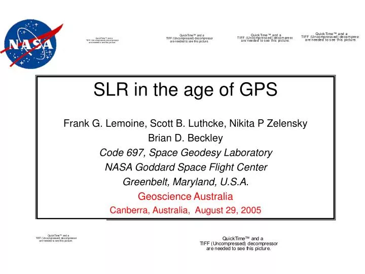
SLR in the age of GPS Frank G. Lemoine, Scott B. Luthcke, Nikita P Zelensky Brian D. Beckley Code 697, Space Geodesy Laboratory NASA Goddard Space Flight Center Greenbelt, Maryland, U.S.A . Geoscience Australia Canberra, Australia, August 29, 2005. Jason-1. CHAMP. ICESat. GRACE.

E N D
SLR in the age of GPS Frank G. Lemoine, Scott B. Luthcke, Nikita P Zelensky Brian D. Beckley Code 697, Space Geodesy Laboratory NASA Goddard Space Flight Center Greenbelt, Maryland, U.S.A. Geoscience Australia Canberra, Australia, August 29, 2005
Jason-1 CHAMP ICESat GRACE Over the past decade significant advances in the Global Positioning System (GPS), and GPS data processing algorithms and data distribution, have positioned this technology as the primary tracking to support Precise Orbit Determination (POD) in the new era of geodetic satellites. A new generation of geodetic missions all carry aboard a dual frequency codeless GPS receiver (BlackJack) as the primary tool for precise orbit determination (POD). They also carry an SLR Retroreflector.
Precision Orbit Determination (POD) is a fundamental component in meeting the science goals of geodetic spaceflight missions. For satellite radar and laser altimetry, POD enables science objectives such as the study of ocean, ice and land topography and surface change Additionally, in several other applications, such as reference frame and gravity field determination, science is derived directly from the POD. Conversely POD depends on accurate knowledge of the reference frame and good knowledge of the geopotential
GRACE These new missions must take advantage of the GPS tracking geometry and near continuous coverage to meet their aggressive orbit accuracy requirements – especially true for the low altitude missions such as GRACE and CHAMP. Jason-1 has a radial orbit accuracy goal of 1 cm ! The size of a dime!
Meeting the Challenge – Multiple Tracking Data Types TRACKING DATA FOR JASON-1 • GPS (dual frequency codeless BlackJack GPS receiver) • Satellite Laser Ranging (SLR), to a nine corner cube hemispherical Laser Retroreflector Array (LRA). • DORIS Doppler. • Altimetry Processing multiple data types is the key to high accuracy POD calibration and validation. DORIS beacon at Yarragadee
Reduced Dynamic accelerations are compensating for real physical force modeling error. GPS-based orbits accommodate more force modeling error.
Jason-1 POD Summary Statistics Cycle 9 (10-days) Orbit Difference – SLR/DORIS vs. GPS Can the GPS alone meet the Jason 1-cm goal? First glance at our GPS POD results might tempt you to say yes.
So, where does this leave the SLR in the world of POD? Is it more than just a backup ? It turns out that we need the SLR in order to fully exploit the GPS tracking. SLR provides an highly accurate, direct and unambiguous observation of the orbit. -This has proved necessary in fine-tuning the GPS-based orbit solutions. The GPS tracking is an indirect, ambiguous observation of the orbit. -This can be problematic, especially when fine-tuning the large GPS POD solution parameter set, and when sorting out systematic errors.
Nominal GPS POD Method • 30-hr solutions • IGS GPS precise orbits • 33 IGS stations • Double-difference LC ranges to account for clock errors • Ambiguity bias determination per pass ~2700 per 30 hr. arc • Trop. Scale factors estimated every hour per site. • “reduced-dynamic solution” • Covariance constrained along and cross-track periodic empirical accelerations estimated every: 90 – 20 minutes depending on application. • Need to determine optimal rate, correlation time and sigma • Drag coefficients estimated every 6 – 1.5 hours depending on application • Need to determine optimal rate. • Estimate phase center offset – need to determine which components • … and all the rest of the high-fidelity force and measurement modeling: • e.g. “box-wing” model, antenna orientation, telemetered attitude, phase windup …. • Jason: ~500.000 GPS DDLC obs. in 10 days vs. ~4000 SLR obs.
If SLR were not available we would have to determine the optimal GPS solution parameter set from the GPS tracking data residual and orbit overlap performance. As we move to a more “reduced dynamic” solution both the orbit overlap and GPS DDLC range residuals become more meaningless as an orbit precision and accuracy metric. Estimate more parameters get a better fit. Not necessarily a better orbit. Increasing the frequency of the empirical accelerations – Have less independent data for each set of parameters during overlap Simply follows the data “Waters down” orbit overlap metric.
POD Summary Statistics Over Several 30-hr. arcs. If you only had the GPS tracking could you guess which is the better orbit ? Which one is CHAMP, which one is Jason-1?
Can you figure it out now ? 1 is Jason-1 2 is CHAMP We need the SLR to discriminate between solutions and to ultimately fine-tune the GPS solutions to fully exploit the GPS tracking technology.
Can the GPS data alone “weed-out” gross systematic modeling errors? • First we can perform a little experiment: • - Use Jason-1 cycle 9 GPS solutions (ten 30-hr. solutions) • - Input a gross systematic modeling error • - Slightly rotate all of the GPS orbits – frame error • Re-determine the Jason-1 orbits • Using the GPS data alone, can you see the systematic error?
Jason-1 GPS Measurement Modeling Improvement GPS Antenna Phase Center Correction Map developed post-launch. Significant improvement in independent SLR fits: Cycles 8-24: -No APC Map, 2.3 cm; -With APC Maps, 1.7 cm. The 1 cm orbit: Jason-1 Precision Orbit Determination Using GPS, SLR, DORIS and Altimeter Data, Luthcke, S. B. et al., Marine Geodesy, 26(3-4), July-Dec, 2003.
AVERAGE ALTIMETER CROSSOVER RESIDUALS. Crossover residuals averaged over 5ºx5º bins for Jason cycles 8-24.
Jason-1 – TOPEX/Poseidon Mean Sea Surface Height: Verification Phase During the first 21 Jason repeat cycles, Jason and T/P were flying in formation sampling the same ground track separated by 72 seconds. This provided an unprecedented opportunity to isolate orbit and instrument differences between the two altimeters since the atmospheric and oceanic conditions at the geo-referenced locations virtually cancel enabling a more accurate measure of the global inter-mission instrument bias.
Jason-1 – TOPEX/Poseidon Mean Sea Surface Height: Verification Phase Two lessons emerge from the joint analysis of SLR, DORIS, GPS and altimeter data on Jason-1: (1) The GPS+ SLR Reduced dynamic orbits perform the best; (2) The DORIS+SLR Reduced dynamic orbits perform next best. We can demonstrate that these replacement orbits reduces the geographical signature of the orbit error. Moreover, we have validated an approach that will allow us to reprocess the entire Topex/Poseidon time series.
GDR based orbits GSFC replacement orbits Jason – T/P Mean SSH Effect of precision orbits on mean sea level determination Mean = 152.1 mm Sdev = 4.5 mm Improved agreement seen in lower left image results from improved TOPEX (SLR+DORIS RD) and Jason-1 (GPS+SLR RD) orbits. The improvement was achieved by using the more current ITRF2000 reference frame and associated station complement in the orbit computations, the GGM02C gravity field, and other improved force and measurement models.
Generating Radar Altimeter Climate Data Records For Global Mean Sea Level Estimates • Consistency Issues • Precise Orbit Ephemerides • terrestrial reference frame (ITRF). • gravity field (GRACE). • optimal tracking strategy (SLR, DORIS, GPS). • Geophysical Models. • Sea State Bias & Ionosphere. • Ground Retracking Philosophy • Continuous Long Term Monitoring • Tide Gauge Validation • land motion adjustment • Radiometer • GPS and VLBI • SSM/I • Significant Wave Height • NOAA deep ocean buoys
SLR provides a high accuracy, direct, unambiguous observation of the orbit. • SLR is absolutely necessary in realizing the full potential of the GPS tracking data • - Fine tuning solution parameterization • - Calibrating measurement system parameters • “weeding out” systematic errors • SLR and GPS in combination are essential to achieving the best possible orbits for applications such as Mean Sea Level Determination.
GSFC Topex/Poseidon Reduced Dynamic Replacement POE ITRF2000 vs. CSR95L02 RMS= 4.7 mm Ascending Tracks GSFC Reduced Dynamic (ITRF2000) - GDR (cy. 344-364) Descending Tracks GSFC Reduced Dynamic (ITRF2000) - GDR (cy. 344-364)
POD Methodology • NASA GSFC’s GEODYN precision orbit determination and geophysical parameter estimation software. • Simultaneously process a myriad of data types including radar and laser altimetry • Observations • GPS: double differenced ionosphere free phase (DDLC) • SLR, DORIS, altimeter crossovers • Stations: • ITRF2000 GPS, SLR and DORIS • 33 GPS station network (selected based on best performing and geographical distribution) • Phase center offsets modeled along with surface deformation • For GPS, tropospheric scale factor estimated every 60 min.
Jason-1 GPS-based reduced dynamic orbits demonstrate significant improvement in crossover performance.
Jason GPS+SLR Reduced Dynamic Orbits Tracking Data Fits (Cycle 9 Only)
Monitoring the Jason-1 Microwave Radiometer with GPS and VLBI Wet Zenith Path Delays D.S. MacMillan, B.D. Beckley, P. Fang VLBI and GPS Station Sites Jason-1 JMR is monitored using coincident wet zenith delay estimates from VLBI and GPS geodetic sites near altimeter ground tracks. The solid circles are older GPS sites, and the open circles are for sites that began observing after 1997. Two offsets have been observed centered about cycles 30 and 69. JMR - ECMWF JMR - GPS __________________________________________ cycle 30 -3.6 +- 0.2 mm -5.4 +- 0.7 mm cycle 69 -8.7 +- 0.4 mm -7.7 +- 0.8 mm Errors based on the RMS of the cycle values before and after offsets.
Wet path delay differences between JMR and TMR are largest in tropics and coastal areas where most tide gauge and calibration sites are located.