Download
1 / 21
210 likes | 352 Views
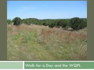
Walk for a Day and the WQPL. Hill Country Conservancy Greenways Inc. City of Austin LBJWC. Walk for a Day Proposed Regional Trail. Wildflower Center Involvement. WQPL Mission.

E N D
Hill Country Conservancy Greenways Inc. City of Austin LBJWC Walk for a Day Proposed Regional Trail
WQPL Mission To produce the optimum level of clean, high quality water from project lands to recharge the Barton Springs segment of the Edwards Aquifer.
Protect water quality and quantity Minimize soil erosion, vegetation loss and water contamination Minimize interference with land management and ecosystem services Protect sensitive areas including endangered species and karst features Priorities for Suitability Analysis
Karst Features Source: WQPL
Endangered & Threatened Species Source: TPWD & Audubon
Management Techniques Source: Wildflower Center
Weighted Overlay • Creeks & Streams • Karst Features • Karst Catchment Basin • Springs & Ponds • Endangered Species • Work Sites & Cultural Resources • Existing Roads • Property Boundary • Burn Unit Boundaries Suitability WQPL Suitability Map
Detail to the Design • Public Involvement • Trail Corridor Modification • Ground Survey of Trail Corridor
Weighted Overlay • Creeks & Streams • Karst Features • Karst Catchment Basin • Springs & Ponds • Endangered Species • Work Sites & Cultural Resources • Existing Roads • Property Boundary • Burn Unit Boundaries Suitability Proposed Trail Corridor
300 ft. wide 17 miles long 24 survey days 10 calendar weeks 520 volunteer hours Detail Area • 7 researchers, 50 ft. apart • 1-3 floaters to record data Ground Survey
300 ft. wide 17 miles long 25 survey days 10 calendar weeks • 7 researchers, 50 ft. apart • 1-3 floaters to record data Ground Survey
Hydrology Topography Endangered species • Hydrology • Endangered species Results-Areas of Concern
Possible solutions • Reroute • Surface trail • Raise trail • Physical barriers
Possible solutions • Reroute • Surface trail • Raise trail • Physical barriers
Possible solutions • Reroute • Surface trail • Raise trail • Physical barriers
Possible solutions • Reroute • Surface trail • Raise trail • Physical barriers
Possible solutions • Reroute • Surface trail • Raise trail • Physical barriers • Grate • Fence • Vegetative screen