Download
1 / 24
250 likes | 498 Views
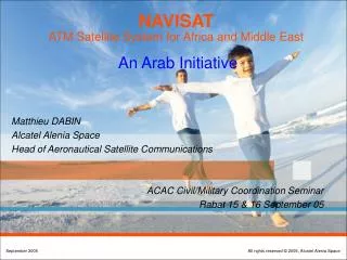
NAVISAT ATM Satellite System for Africa and Middle East An Arab Initiative. Matthieu DABIN Alcatel Alenia Space Head of Aeronautical Satellite Communications. ACAC Civil/Military Coordination Seminar Rabat 15 & 16 September 05. NAVISAT FEASIBILITY STUDY. OBJECTIVES

E N D
NAVISAT ATM Satellite System for Africa and Middle EastAn Arab Initiative • Matthieu DABIN • Alcatel Alenia Space • Head of Aeronautical Satellite Communications ACAC Civil/Military Coordination Seminar Rabat 15 & 16 September 05
NAVISAT FEASIBILITY STUDY • OBJECTIVES • In accordance with ICAO recommendations, taking into account existing systems and infrastructure, define and assess the economic feasibility of the most appropriate Satellite-Based Solutions for Aeronautical Navigation and Communication over Africa and Middle-East • RESULTS of the STUDY • Identification of the needs, definition of appropriate solutions, economic analysis Get all the elements to move forward !
Expression of Needs Existing Infrastructures Commitment & Support Existing Contacts Meeting Key Players & Countries - 1 Political support Technical support Figure of traffic Migration of existing NAVISAT System Analysis - 2 Iterative Consolidation Process Navisat Mission Navisat Operation Navisat Architecture Business Plan NAVISAT Economic Analysis - 3 System Design Profit Presentation Business case Business model Frequencies MTSAT& SDLS Experiences Tasks
NAVISAT ATM Mission & Services • Fixed Aeronautical Communication • Communication links between ground ATM facilities via satellite (VSAT) • Voice and Data Services • Mobile Aeronautical Communication • Communication links between Aircraft and Ground • Cockpit Services (Air Traffic Services, Airline Operational Communication) • Passenger Services : GSM telephony (phone, SMS), internet • Satellite Navigation Augmentation • Communication links between ground navigation system facilities (VSAT) • Broadcast of GNSS augmentation signal • Service Coverage : Africa and Middle East
FIXED COMMUNICATIONS MIDVSAT(Project) MAIN INTERNATIONAL VSAT NETWORKS (existing and under study) CAFSAT NAFISAT (Project) AFISNET SADC AFISNET
FIXED COMMUNICATIONS COMPLETENESS OF THE DATABASE International and national fixed links integrated in the database Only Internationalfixed links integrated in the database
MOBILE COMMUNICATIONS EVOLUTION OF VOICE SERVICES Numbers of VHF remote stations declared by countries in the questionnaires • Short-term trend is to extend VHF coverage by deploying remote VHF stations (Algeria, Egypt, ASECNA, etc.). • HF is still maintained in some areas, though it offers poor quality communications, as it is considered: • better than nothing outside VHF coverage areas, • cheap back-up to VHF in VHF coverage areas. • Provisions should however been considered for Satcom Voice services for non-routine COM in medium to long-term
SURVEILLANCE SCENARIOS COVERAGE IN 2010 Existing Radars Already planned Radar installation to be deployed before 2010 Additional new Radar installation to be deployed before 2010
RS-7 AE-1 RS-8 RS-6 RS-1 RS-5 RS-2 RS-3 RS-4 TRAFFIC FLOW Main Route Segments Addressed by Satellite
REVENUES FROM COCKPIT (MOBILE) COMMUNICATIONS DEFINITION OF HIGH REVENUES AREAS AND ROUTE SEGMENTS • Satellite-based ATS datalink services in AFI : • should be mainly used along routes segments • with medium/high traffic • and located in oceanic areas or in remote areas, where there are no or limited radar / VHF coverage • should include CPDLC and FIS services, plus ADS-C services where no radar/ADS-B deployment has been implemented or is planned • Satellite-based ATS datalink services in MID: • should be deployed and used all over Egypt and the Arabic peninsula, • should include only FIS and CPDLC services as the Radar coverage will be almost complete in this area • Satellite-based AOC services in AFI/MID: • are assumed to be used mainly over the routes segments and areas where Satellite-based ATSC services are provided and used
REVENUES FROM COCKPIT (MOBILE) COMMUNICATIONS ATSC SERVICES IN HIGH REVENUES AREAS AND ROUTE SEGMENTS
NAVISAT INFRASTRUCTURE Mobile User Segment System Breakdown 2 GEO SATELLITES Fixed User Segment
NAVISAT INFRASTRUCTURE • 3 orbital positions included in NAVISAT Filling (updated in 2005) with the following spectrum allocation • L band in the MSS for the provision of aeronautical safety communications • L band in RNSS in order to be part of the GNSS-1 • C band in the FSS for feeder links of the aeronautical mission and for traditional telecommunication services • Ku band in the FSS for traditional telecommunication services 17°E 20°E MSS : Mobile Satellite Service (up1626.5-1660.5/down1525-1559MHz) MS(R)S : Mobile Satellite Route Service (1646.5-1656.5/1545-1555MHz) RNSS : Radio Navigation Satellite Service (L1:1575.42MHz,L2:1227.5,L5:1176.45MHz) FSS : Fixed Satellite Service (C-band 3.4-4.2/5.8-6.7GHz Ku-band 10.9-12.7/13.7-14.5GHz) GNSS : Global Navigation Satellite System 36.5°E
NAVISAT COMPLEMENTARY MISSION • Two options consideredin the study • Baseline scenario • Core ATM Mission in L-band and partially using C/Ku capacity • Complementary telecom mission with capacity lease in C and Ku bands • ATM optimised scenario • Optimised spacecraft for ATM mission only in L and C bands
MOBILE AERO COMMUNICATION SYSTEM - Alternative High Reliability Architecture Traffic Shared Between 2 Satellites Distributed Ground Segment (Direct Access) 1 for N redundancy (instead of 1/2) Architecture more adapted to region
FIXED AERO COMMUNICATION SYSTEM (DVB-RCS OPTION) Ku Transponder with OBP to support Meshed & Star “Broadband” Network AmerHis System Architecture OBP : On Board Processor MCC : Mission Control Centre CSM : Communication System Monitoring NMC : Network Mgt Centre NCC : DVB-RCS Network Control Centre
NAVISAT Baseline Satellite • Aeronautical Mission Required Capacity (ROM) : • Fixed Communication (incl. Nav) : • 40-60MHz in C or Ku band • 37dBW C band, 47dBW Ku • Mobile Communication : • 4-6 MHz / 48dBW in L-band (safety services and passenger voice), • 30-50 MHz / 47dBW in Ku band (passenger broadband services) • Mission • ATM Mission • Complementary : Telecom • 2 satellites (17°E and 20°) • Satellite Characteristics • Platform Spacebus B3 • 1850 kg dry mass, 8.5 kW • C payload : 12 transponders, Intelsat Hemispheric coverage like, 1.3 kW • Ku payload : 12 transponders, 2.8 kW • AMSS payload : 2 transponders (1 global, 8 spots), 2kW • NAV payload : 2 transponders (L1, L5), 0.3kW
NAVISAT SATELLITE CONFIGURATION Satellite Spacebus B3 Bus height : 3.74m P/L DC Power Consumption : 6400 W S/C Power Need : 1500 W Solar Arrays : 4 panels Si / wing Batteries: Li-Ion (SAFT) Full chemical Propulsion S/C max dry mass : 1850 kg Launch Mass on Ariane 5 : 4100 kg (for life time: 15 years) Payload
NAVISAT ATM Optimised Satellite Alternative • Aeronautical Mission Required Capacity (ROM) : • Fixed Communication (incl. Nav) : • 40-60MHz in Ku band • 47dBW Ku • Mobile Communication : • 4-6 MHz / 48dBW in L-band (safety services and passenger voice), • 30-50 MHz / 47dBW in Ku band (passenger broadband services) • Mission • ATM Mission ONLY • 2 satellites (17°E and 20°) • Satellite Characteristics • Platform TBD • 1300 kg dry mass, 4,5kW • Ku payload or C-band payload : 3 Ku-band or 6 C-band transponders, 0.7kW • AMSS payload : 2 transponders (1 global, 8 spots), 2 kW • NAV payload : 2 transponders (L1, L5), 0.3kW
NAVISAT ATM OPTIMISED CONFIGURATION Satellite Italsat Platform P/L DC Power Consumption : 3000 W S/C Power Need : 1200 W Solar Arrays : 3 panels Si / wing Batteries: Li-Ion (SAFT) Full chemical Propulsion S/C max dry mass : 1300 kg Launch Mass on Soyous : 2900 kg (for life time: 15 years) Payload
Status – Next Steps Technical and Economical Feasibility study Technical Definition Set up of the financing / structure Set up of Business Model and Executive Summary Commitment of the key users Set up of Business Plan Manufacturing of space infrastructure NAVISAT Company incorporation Phase B Contract Promotion of the project IATA / Airlines /SITA / ARINC Potential investors / Banks (BAD, EIB…) Frequency coordination Filings / SuperGeo Implementationof terrestrial network infrastructure 2005 2006 …2007 2008/9
POSSIBLE STRUCTURE OF NAVISAT ENTITYFPI MODEL COMBINING EFFICIENTLY THE PUBLIC SERVICES AND PRIVATE MEANS • Funding Private Initiative (FPI) model : this model basically proposed to have the private sectors conducting a business implementation for the satisfaction of public services needs • Lesson learned from EGNOS and GALILEO model and story
Confident that satellite based systems will be a key piece of THE solution for Global Air Traffic Management Possible role of Military in this context … to be discussed Thanks for your attention