Download
1 / 51
510 likes | 757 Views
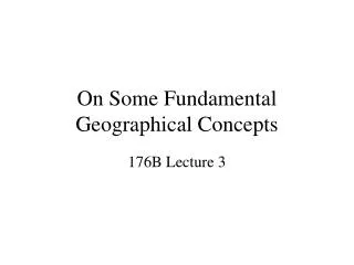
On Some Fundamental Geographical Concepts. 176B Lecture 3. Nystuen, J. D. (1963) “Identification of some fundamental spatial concepts”. Search for a common geographical terminology to eliminate redundancy Basics: Distance, pattern, relative position, site and accessibility

E N D
On Some Fundamental Geographical Concepts 176B Lecture 3
Nystuen, J. D. (1963) “Identification of some fundamental spatial concepts” • Search for a common geographical terminology to eliminate redundancy • Basics: Distance, pattern, relative position, site and accessibility • Advantages of abstract models and assumptions, e.g. isotropic surface
Geographic primitives • G = g (x, y, z, s, A, t) • [x, y, z] = f(l, f, d) • Geography also highly dependent upon model
GIS basic geometric functions • A GIS package must be able to move between • map projections • coordinate systems • datums • Ellipsoids • A GIS must be able to GEORECTIFY • Not always a simple task!
Address matching 2123 South Main St. Anywhere CA 93901 4,312,205mN 623,864mE 15N
Geographic information fundamentals • Volume • Dimensionality • Continuity
Volume • 1 meter pixel • 24 bit depth (8 bit R, 8 bit G, 8 bit B) • California 3rd largest State A=158,706 square miles • A= 411,046,653,039 square meters • N=9.865x10^10 bytes • 98 gigabyte image
Dimensionality • Simple geographic features can be used to build more complex ones. • Areas are made up of lines which are made up of points represented by their coordinates. • Areas = {Lines} = {Points}
Continuity • Attributes of the earth fall into different spatial “behaviors” over space and time • Many phenomena are best treated as continuous fields • E.g. air temperature, atmospheric pressure, population density • Others have distinct spatial extent or edges • E.g. census tracts, buildings, roads
Air Photos 1929 Discontinuous irregular rasters: resampling
Properties of Features • Size • Distribution/density • Shape • Scale • Orientation
Size: Resolution and Extent 10cm, 25cm, 50cm, 1m
Scale: RF vs. Detail Santa Barbara
Tobler’s First Law of Geography • “Everything is related to everything else but near things are more related than distant things” (Tobler, 1970) • Variation of (x1 – x0)2 • Spatial autocorrelation • Violates assumptions of statistics
Geographical relations • Among features • Contains/overlaps/intersects • Contiguity/Adjacency • Proximity • Trajectory • Within fields • Neighborhood relation • Pattern • Process
Raster overlay 0 1 = &
Contiguity http://www.clearproject.net/chapter10fig5.JPG (Clear Lake, Iowa)
Most important, process… • G = g (x, y, z, s, A, t) t0 t1 t2 t3
1930 1950 1970 1980 1990 TO FROM Dynamics