Introduction to gINT
Introduction to gINT. Gary Logan – Bentley Systems Orhan Essat Inanir - GEOgrup Insaat A.S. Agenda. Introduction to gINT software What is gINT? What problems does gINT address? gINT integration with other Bentley products gINT support for enterprise subsurface data management

Introduction to gINT
E N D
Presentation Transcript
Introduction to gINT Gary Logan – Bentley Systems OrhanEssatInanir- GEOgrupInsaat A.S.
Agenda Introduction to gINT software What is gINT? What problems does gINT address? gINT integration with other Bentley products gINT support for enterprise subsurface data management New release gINT V8i - What is included? How is gINT used in Turkey? Live Demonstration of local case study
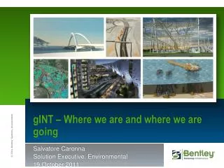
Brief overview of gINT Company started in 1986 by Salvatore Caronna Currently over 8000 licenses in 68 countries Acquired by Bentley in October 2009.
gINT Clients Transportation and Government Agencies • US Army Corps of Engineers(36 offices) • US Bureau of Reclamation(13 offices) • USDA NRCS (11 offices) • US Geological Survey • EPA • Federal Highways Administration(3 offices) • 6 Canadian Provincial Ministries of Transportation • Agriculture Canada • UK Local Authorities • Queensland Main Roads Department, Australia • Roads & Traffic Authority, NSW, Australia • NSW Department of Water and Energy, Australia • 32 US State DOTs (96 offices)
Who uses gINT- ClientsHundreds of consulting firms, large and small
gINT Clients Leading Consultants • AECOM (78 offices) • AMEC (73 offices) • ARUP (24 offices) • ARCADIS • ATC Associates (25 offices) • CDM (20 offices) • CH2M HILL (16 offices) • Conestoga-Rovers (18 offices) • Fugro (28 offices) • Golder Associates (56 offices) • Kleinfelder (39 offices) • MACTEC (23 offices) • Montgomery Watson Harza (22 offices) • PSI (56 offices) • Ramboll • RSK (6 offices) • Stantec (Secor) (22 offices) • Shaw Group (34 offices) • Terracon (80 offices) • Tetra Tech (28 offices) • URS Corporation (101 offices) • WSP (27 offices)
What is gINT • Used: • For data storage • For data validation • For data queries • For data reporting • Data sharing with other programs • gINT is a database manager and reporting engine for subsurface exploration
How subsurface data is managed • Paper • Excel • CAD • Database
Data Collection and Consolidation Electronic Field Data PDA Paper Data Other Software & Formats Lab Data
Types of subsurface data reports Borehole logs and well logs Data re-usability!
Types of subsurface data reports Fences, cross-sections/profiles Data re-usability!
Types of subsurface data reports Fences, cross-sections/profiles Data re-usability!
Types of subsurface data reports Lab reports, tables, graphs and summaries Sieve Analysis Tests Atterberg Limits Tests (Liquid and Plastic Limits) Moisture Content Density Determination (Cylindrical Method) Hydrometer Analysis Fine Specific Gravity Compaction (Proctor) Tests Unconfined Compression Consolidation Direct Shear Falling Head Permeability California Bearing Ratio (CBR) Concrete Testing Data re-usability!
Types of subsurface data reports Lab reports, tables, graphs and summaries Data re-usability!
Data re-usability! Complex reporting
Surfaces Support for TIN and GRID models
Associate site maps with projects drawings (DXF, LandXML, or hand drawn) Raster images
gINT - Central repository (Interoperability) • Powered by Bentley, but can be used as a central repository of subsurface data by a range of engineering software MicroStation PowerCivil InRoads MXROAD GEOPAK Geo Web Publisher
Reusing data Google Subsurface Modelling Web Based GIS Geological Modelling Automatic Report Creation
gINT – Bentley Interoperability • MicroStation/Navigator gINT can supply Logs and Fences (Profiles) to Microstation via DXF and DGN. Furthermore support for i-model provides the visualisation of 3D Borehole Stems Data re-usability!
gINT – Bentley Interoperability • MicroStation • InRoads • MXROAD • GEOPAK gINT can supply data for sub-surfaces: Bedrock, FILL, Water table, etc. For creating contours, isopach thematic maps (depths, soil classification) Volume cals: Rock cut, soil replacement Data re-usability!
gINT – Bentley Interoperability • MicroStation • InRoads • MXROAD • GEOPAK gINT can supply data for boring locations (site map), profiles, sections and 3D visualisation in GEOPAK Data re-usability!
gINT – Interfacing directly • Read only access to the gINT database model
gINT – Interfacing directly • Read only access to the gINT database model
gINT – Google Earth Interoperability gINT for Google Earth Create .kml files, harvest data, link to logs, reports and images Data re-usability!
gINT – ESRI Interoperability gINT for ArcGIS add-in View, report and query gINT data from ArcGIS Data re-usability!
Which product is right? gINT Logs (Logs Only) Entry Level Product Generates variations of borehole logs only gINT Professional Offers 9 report styles including 14 lab testing reports Ability to write and run gINT Rule Code Enhanced import/export functions MS Access based Includes gINT for ArcGIS gINT Professional Plus MS SQL Server based Includes gINT for ArcGIS
gINT Professional Plus Offers centralized data storage, multi-project reporting and dramatically extended querying power. Uses MS SQL Server back- end, not the MS AccessTM database used in the standard versions of gINT Enables users to enforce consistency across all data resources.
Reference Materials • gINT Web site http://www.bentley.com/enUS/Products/gINT/ • gINT OnDemandeSeminars:http://www.bentley.com/enUS/Corporate/Events/OnDemand/gINT+OnDemand+eSeminars.htm • Introducing gINT Solutions • 3D Visualization of gINT Subsurface Data in MicroStation • gINT and Google Earth
SummaryWhy gINT and a Good Database is Necessary • Centralizes control of your subsurface data (field and lab) • Standardizes storage and reporting • Improves data accuracy/quality (QA/QC) • Automates complex data management processes • Transforms raw data into information via reports • Eliminates redundant data entry • Data reusability: different reports, export, evaluation • Data reusability: interoperability with other software Capture Once, use many times
The Next Release gINT V8i – What is included? ProjectWise Integration: • Except for a few places where it was not appropriate, everywhere in gINT where a file can be opened or saved the user can select to use ProjectWise. • This gives a central repository for all files related to gINT which would be stored with all other files related to the user’s projects. • The most common uses for this feature by our users: • Electronic data files that are imported into the gINT database. • Raster images (photos, aerial photos, etc.) that are also imported into the gINT database. • Exported final reports from gINT: PDF, DGN, Excel, KML (Google Earth), and data for import to analysis programs.
gINT V8i • DGN (Bentley Design File) Export • Allows export of all reports and gINT drawings to MicroStation and many other programs that support DGN. • This supersedes the use of the gINT DXF (v12) export format that our users have been using for many years. The DGN export eliminates the main complaints of that format: Inaccurate font translations and the inability to set entity properties by level. • The most common use for this feature by our users is to import gINT reports into final design drawings, usually for roads and bridges. • ECW Support • Enhanced Compression Wavelet files are highly compressed raster images that are very fast to render. They are also geocoded, that is, the location of the image is embedded within the file.
gINT V8i • Coordinate Conversions • gINT has incorporated the MicroStation coordinate conversion libraries. • Allows users to specify a project coordinate system. Entering North and East coordinates generates corresponding WGS84 Latitude and Longitude and visa versa.
gINT V8i • AGS4 Support • In 1992 the UK Association of Geotechnical and Geoenvironmental Specialists (a trade organization; www.ags.org.uk) published the first version of a data interchange format for geotechnical and geoenvironmental investigations. gINT was the first program that supported it. • gINT has always supported upgrades to the format. Version 4 is no exception. • The format has spread to Ireland, Hong Kong, New Zealand, Australia, Singapore, and the Middle East and is required by consultants from these countries doing work throughout the world. • With many consultants and government agencies all work requires the use of the format.
gINT V8i – Deviated Boreholes gINT now supports boreholes where the bearing and plunge change with depth.
gINT V8i • European Numeric Data Entry • gINT does require that the user’s system regional settings be configured with a period as the decimal separator. The program will automatically changes those settings if they are not correct and return them to their original configuration on program termination. • Most continental European countries use a comma as the decimal separator. • Prior to the acquisition gINT had an option to output all reports using European numeric format. • This new capability gives the user the ability, if desired, to perform data entry with that format as well.
gINT V8i • Fence Drapes
gINT V8i – Fence Drapes Graphic that depict features in elevation along a line (straight, zigzagged, or curved) can be superimposed or “draped” over fence diagrams.
gINT V8i – Fence Drapes Fence drapes can be used to display: • Interpreted layered geometry • Seismic tests results (for example, shear wave velocities) • Existing features along an alignment (rivers, bridges, buildings, roads, etc.)