Download
1 / 37
370 likes | 546 Views
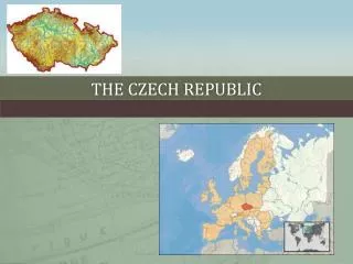
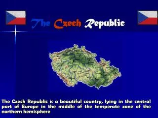
State map series in the Czech Republic and thematic maps for construction industry. Map = a shrunk image of the Earth ’s surface. The cartographic projection of points on the Earth ’s surface to the plane of maps is given by mathematical formulas. Maps according to the map scale:

E N D
State map series in the Czech Republic and thematic maps for construction industry Map = a shrunk image of the Earth’s surface. The cartographic projection of points on the Earth’s surface to the plane of maps is given by mathematical formulas. Maps according to the map scale: • large-scale maps: larger than 1 : 5 000, • medium-scale maps: 1 : 5 000 – 1 : 200 000, • small-scale maps: 1 : 200 000 and smaller.
Plan = a shrunk and generalized image of a small part of the Earth’s surface. The curvature of the Earth is neglected for the projection to the horizontal plane, i.e. no cartographic projection is used. A plan can be used for radius of an area shorter than 15 km (see lecture 1). Cartographic generalization = simplification of map contents which depends on the scale and the function of the map.
Maps according to the form: • analogue map – drawing on map sheets. • digital map – database in a computer, it usually makes possible to carry out various operations with data files.
Map contents: • planimetric component – position of an object is marked by an outline or by a map symbol (if the actual size of the object is not possible to draw in particular scale). Map symbols are scheduled in a list of symbols. • altimetry, • map lettering, • framework.
Altimetry Absolute heights and shapes of topographic surfaces are expressed by means of contour lines (the line connecting points with the same absolute height). Contour lines: 1. principal (the contour interval depends on the map scale), 2. thickened (for better plasticity of perception), 3. intermediate (dash line). The altimetry can be expressed also by peak elevations or by drop lines. Colours or a shading hill are used for geographical maps.
Map lettering - names on a map, texts in the list of symbols, mark of the map sheet, scale, legend etc. Framework - incloses the map drawing. The framework is often completed by a coordinate grid.
State map series in the Czech Republic • mapping and updating of the state map series are managed by the state through COSMC (Czech Office for Surveying, Mapping and Cadastre – Český úřad zeměměřický a katastrální) • www.cuzk.cz – map products and places where it is possible to buy them • maps are usually available both in analogue (old) and in digital (updated) forms. Sometimes the digital map is not updated, it is only a result of analogue map processing.
Large-scale maps • cadastral maps 1 : 2 880 • cadastral maps of decimal scales • derived state map 1 : 5 000 • state map 1 : 5 000
1. Cadastral maps 1 : 2 880 • these maps originated from maps of the „stable“ cadastre of the 19th century in Austrian Empire in Cassini-Soldner’s projection which were drawn from the 19th century to the twenties of the 20th century • 60% of contemporary cadastral maps • only the planimetry is displayed – administrative and property boundaries, • maps are used for a registration of proprietary relations • copies of maps are available in cadastral offices
2. Cadastral maps of decimal scales • 1:1 000, 1:2 000 a 1:5 000 • datum of Unified trigonometric cadastral net S-JTSK • maps were drawn from the thirties to the nineties of the 20th century • maps cover about 30% of the Czech Republic • planimetric maps – registration of proprietary relations (taxes) • copies of maps are available in cadastral offices
3. Derived state map 1 : 5 000 • planimetric component of the map is in black colour and originated from the cadastral maps and aerial survey photographs • altimetry is in brown colour and originated from the basic map 1:10 000 • maps are used for town and country planning • maps are available in cadastral offices
4. State map 1 : 5 000 • these maps have been compiled since 2001, • derived state maps 1:5000 should be replaced by these maps maps have 3 components: • cadastral component – on the basis of the digital cadastral map • altimetry – on the basis of ZABAGED • topographic component – on the basis of aerial survey photographs
ZABAGED = Fundamental Base of Geographic Data • digital topographic model of the Czech Republic on the basis of the basic map 1:10 000 • spatial information (planimetry, altimetry) + attributes (lettering and other information about objects) = 60 levels (layers) • the base is created in MicroStation graphics environment • photogrammetry is used for updating of survey data
Medium-scale maps = topographic maps Military maps (in Gauss-Krüger’s projection) and civil maps (in Křovák’s projection) have been developed since the end of World War II simultaneously in the Czech Republic. These maps differ in processing methods and in secrecy of some information (civil maps). This lecture is only concerned with the civil maps.
Medium-scale maps • basic map of the Czech Republic 1 : 10 000 • supplemented basic map 1 : 10 000 • new basic map 1 : 10 000 created on the basis of ZABAGED • basic map 1 : 25 000 • basic map 1 : 50 000 • new basic map 1 : 50 000 created on the basis of ZABAGED • basic map 1 : 100 000 • basic map 1 : 200 000
1. Basic map of the Czech Republic 1 : 10 000 • maps have been published since 1971 • planimetry – objects, residences, routes (ways), waters, boundaries of cadastral districts and administrative boundaries, growth and soil • altimetry is expressed by means of contour lines and drop lines • lettering – names on map, objects type designation, peak elevations and other information
2. Supplemented basic map 1 : 10 000 Prague and Brno – basic map contents is supplemented by names of streets, public spaces and bridges.
3. New basic map 1 : 10 000 created on the basis of ZABAGED • maps have been published since 2001 • digital processing of maps • maps content is supplemented, more colours are used
4. Basic map 1 : 25 000 Map contents of basic maps 1:10 000 are generalized.
5. Basic map 1 : 50 000 • planimetry, altimetry and lettering • the only basic map on which even abroad map contents are displayed (areas near boundaries) • various thematic maps are drawn on the basis of this basic map (some map components are supplemented), e.g. the basic map of water management, the road map, the geologic map
6. New basic map 1 : 50 000 created on the basis of ZABAGED • maps have been published since 2002 • maps contents is supplemented, more colours are used
Thematic maps for construction industry • maps with special information, digital form of these maps is often used • Technical map of a town • Basic map of a plant • Uniform railway map + other thematic maps (mine maps, basic maps of motorways, basic map of a quarry etc.)
1. Technical map of a town • 1:500, on the fringe areas of the town 1:1000 • planimetry with both underground and overground gas distribution system, system of pipes, telephone network, water distribution system and other lines which are differentiated by a type of symbol (usually a line) and its colour in map • municipality bears the mapping expenses
2. Basic map of a plant • scale from 1:200 to 1:1 000 • networks, constructions, control equipments, trees etc.
3. Uniform railway map • 1:1000 or 1:500 • track equipment, railway buildings, subgrade and its facilities • secret map