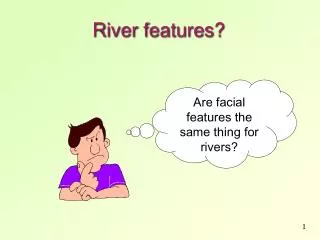
River features?
River features?. Are facial features the same thing for rivers?. River Features. Rivers are eroding, transporting and depositing constantly. The river can be divided into 3 sections – Upper Course at the Source, Middle Course and Lower Course at the Mouth of the river.

River features?
E N D
Presentation Transcript
River features? Are facial features the same thing for rivers?
River Features • Rivers are eroding, transporting and depositing constantly. • The river can be divided into 3 sections – Upper Course at the Source, Middle Course and Lower Course at the Mouth of the river. • The river displays different characteristics at each section.
Upper valley characteristics “V”shape valley, mostly vertical erosion Narrow, shallow channel, low velocity and discharge Interlocking spurs Large rocksthat come from upstream and from valley sides
Interlocking spurs, Robinson, Lake District An upper course valley often has interlocking spurs, and steep valley sides
River load in upper course Why are they rounded?
River load in upper course Why are they rounded? Boulders are large and semi-rounded, due to attritionwithin the loadand abrasion with the stream bed and banks
Waterfall formation Look at the diagram, How is a waterfall formed?
Upper Course: Waterfalls & Gorges Waterfall and Gorge 1 (OBLIQUE AERIAL VIEW) EROSION TYPE: Vertical and Headward
High Force waterfall, R. Tees Waterfall creates gorge as it recedes upstream by eroding the base and neck Plunge pool
Upper Course: Potholes Potholes EROSION TYPE: Vertical (by EDDY CURRENTS) Boulders broken off by erosion that sit on the river bed create swirling eddy currents as the water flows past as the river is not strong enough yet to move the boulders by TRACTION. These eddies swirl the boulder round and erode a pothole in the river bed by ABRASION.
Middle course, R. Tees HOW DOES THIS DIFFER FROM THE UPPER SECTION?
Middle course, R. Tees Valley opens out, more gentle slopes, wider valley bottom First signs of meanders River channel wider, deeper, greater velocity and discharge
Meandering Rivers WHAT IS A MEANDER?
Middle Course: Meanders Meanders 1 (Aerial View) Meanders are formed because the current swings to the outside of a bend and concentrates the erosion there. Deposition occurs on the inside of the bed where there is not enough energy to carry load. EROSION TYPE: Lateral
Middle Course: Meanders 2 Meanders 2 (Profile View / Cross Section X - Y) EROSION TYPE: Lateral This cross section clearly shows the eddy current (near ’X’) formed by the velocity of the river being concentrated on the outside of the bend. These UNDERCUT the bank causing the formation of a RIVER CLIFF. On the inside (NEAR ‘Y’), a SLIP-OFF-SLOPE is formed where current is too slow to carry any load.
Meander, R. Lavant, Chichester WHICH WAY IS THIS MEANDER MOVING? Floodplain Slip-Off Slope River Cliff Pebble deposits on the inner meander bend where there is low energy
WHERE IS EROSION TAKING PLACE? River Cliff F A E B Slip-off slope } Meander loop C D WHERE IS DEPOSTION TAKING PLACE?
What happens to the river when it moves to the middle course • Gradient becomes less steep • River continues to erode vertically a bit but more LATERAL erosion now occurs in MEANDERS • The meanders MIGRATE. What do you think that means? • Name three effects it have on the valley.
Lower Course: Severn Valley HOW DOES IT DIFFER FROM THE MIDDLE COURSE?
Lower Severn Valley Very wide floodplain Well developed meanders with bars in the channel indicating high sediment load Very gentle valley side gradients
Lower Course: Ox-bow lake Ox-Bow Lake 1 (Aerial View) Ox-bow lakes are formed when two meander RIVER CLIFFS are being eroded towards each other. These will eventually meet, causing the river to then flow across the bottom of the diagram. EROSION TYPE: Lateral
Lower Course: Ox-bow lake 2 Ox-Bow Lake 2(Aerial View)
The Nile Delta from space River Nile
Estuary Formation HOW DOES THIS DIFFER FROM A DELTA? RAISED VALLEY SIDES