Download
1 / 28
280 likes | 442 Views
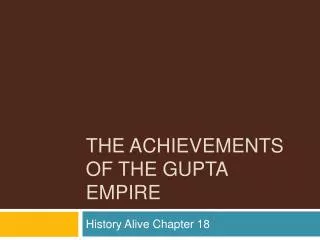
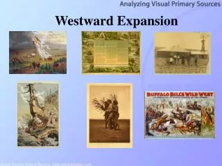
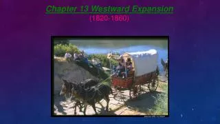
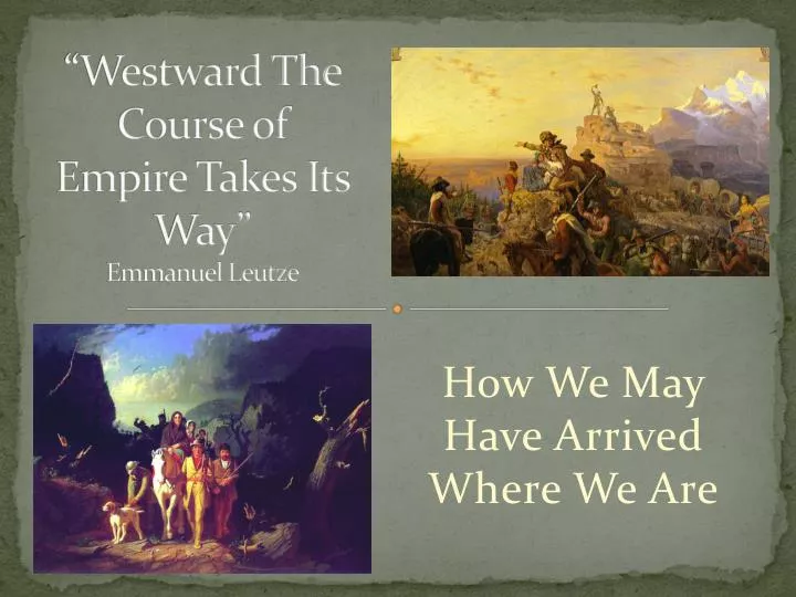
“Westward The Course of Empire Takes Its Way” Emmanuel Leutze. How We May Have Arrived Where We Are. 1651 - King’s Highway. 1651 -- Peter Stuyvesant used the old Delaware Indian trail to force out the Swedes.

E N D
“Westward The Course of Empire Takes Its Way”Emmanuel Leutze How We May Have Arrived Where We Are
1651 - King’s Highway • 1651 -- Peter Stuyvesant used the old Delaware Indian trail to force out the Swedes. • 1750 -- A continuous road exists for stagecoach or wagon traffic from Boston, MA to Charleston, SC • 1774 -- By the time of the First Continental Congress, the road could accommodate the largest carriage in reasonable safety. Boston, MA; New Haven, CT; Fairfield, CT; Greenwich, CT; New York City; Newark, NJ; Elizabeth, NJ; Princeton, NJ; Trenton, NJ; Philadelphia, PA; Wilmington, DE; New Castle, DE; Annapolis, MD; Alexandria, VA; Fredericksburg, VA; Williamsburg, VA; Yorktown, VA; Norfolk,VA; Edenton, NC; New Bern, NC; Wilmington, NC; Georgetown, SC; Charleston, SC
1664 - Boston Post Road • 1664 -- King Charles informs his governors in New York and New England that he wanted communication established between his colonies. • 1673 -- A crude riding trail is created to carry mail from New York to Boston; it becomes known as the Boston Post Road. • 1772 -- The first stagecoach in service makes the trip between Boston and New York City in just one week. • 1775-1781 -- During the Revolution, the Post Roads are used for maneuvering soldiers and equipment. Stagecoach service and the mail take second place.
1664 - Boston Post Road • Lower route (Southern), 270 miles long - Boston, MA; Providence, RI; New London, CT; New Haven, CT; Greenwich , CT; New York City • Middle Route, 225 miles long -- Boston, MA; Dedham, MA; Putnam, CT; Hartford, CT; New Haven, CT; Fairfield, CT; Greenwich, CT; New York City • Upper Route (Northern), 250 miles long -- Boston, MA; Cambridge, MA; Worcester, MA; Springfield, MA; Hartford, CT; New Haven, CT; Greenwich, CT; New York City
1722 - Great Valley Road • 1722 -- The Second Treaty of Albany guarantees Indians the use of the great Indian Road, which ran through the Shenandoah Valley. • 1730 -- The Scots-Irish establish Winchester, VA. • 1732 -- Sixteen families come with Joist Hite and settle in the Lower Shenandoah Valley • 1751 -- Quaker records begin in the Piedmont region of NC and GA.
1725 - Mohawk Trail • 1725-1750 -- Pioneers in NY move west through the Mohawk Valley to the Great Lakes. • 1776 -- From Albany to Lake Erie becomes part of the route followed by Loyalists into Upper Canada. • 1825 -- From Albany to Lake Erie is the route of the Erie Canal. Orange, MA; Williamstown, MA; Albany, NY; Schenectady, NY; Utica, NY; Oneida, NY; Syracuse, NY; Auburn, NY; Batavia, NY; Buffalo, NY
1735 - Fall Line Road • 1735 --The Fall Line Road carries traffic into VA and the Carolinas to Augusta, GA. • 1828 -- The Federal Road is laid out, starting at Columbus, GA, and many settlers desiring to go into AL and MS join that road by coming down the Fall Line Road. It is an easier path than the piedmont Upper Road which joins the Federal Road at Athens, GA. Fredericksburg, VA; Petersburg, VA; Warrenton, NC; Raleigh, NC; Cheraw, SC; Camden, SC; Augusta, GA
1740 - Upper Road • 1740-The proprietary governor of the Granville District begins issuing grants to Quakers and others from the tidewater counties of NC and VA. • 1750 -- The Upper Road has become an important wagon route for southbound migrations into NC. • 1776-1781 -- During the Revolution, used for troop movements, particularly with battles at Guilford Courthouse, King's Mountain, and Cowpens. Fredericksburg, VA; Amelia CH, VA; Hillsboro, NC; Salisbury, NC; Charlotte, NC; Spartanburg, SC; Greenville, SC; Athens, GA
1750s - Great Wagon Road • Followed Great Appalachian Valley from PA to NC to GA. • Main route for settlement of the Southern US, particularly the "backcountry“ for English, Anglo-Irish, Scots-Irish, Germans. • Began at Philadelphia, then through Lancaster and York, PA. • Crossed Potomac River at Harpers Ferry, entered Shenandoah Valley at Winchester, VA, then south via the Great Warriors' Trail to Roanoke River at Big Lick, today Roanoke. • At Roanoke, a road led to upper New River Valley and Holston River in upper Tennessee Valley. From there, the Wilderness Road led into KY. • From Big Lick/Roanoke, passed through the Roanoke River Gap, through the Piedmont region. • Passed through Winston-Salem, Salisbury, and Charlotte, NC, to Augusta, GA.
1752 - Braddock’s Road • 1752 -- The Ohio Company of Virginia engages Colonel Thomas Cresap to blaze a path from Cumberland, MD, to its trading post on the Monongahela River (present-day Brownsville, PA). • 1753 -- Virginia Governor Dinwiddie sends George Washington to Fort LeBoeuf (Waterford, PA) to tell the French to withdraw from British territory. At Cumberland, MD, Washington is joined by Christopher Gist, an experienced woodsman.
1774 - Wilderness Road • 1750 -- Dr. Thomas Walker explores Cave Gap, which he later calls Cumberland Gap. Christopher Gist crosses the whole of KY to the Miami River. • 1769 -- Daniel Boone reaches the Cumberland Gap and passes into the Blue Grass region. • 1775 -- Thomas Henderson "buys" twenty million acres from the Cherokees. The Transylvania Company sends Daniel Boone and about 30 woodsmen with rifles and axes to mark out a road through the Cumberland Gap. • 1775 -- Boone's men complete the blazing of the first trail through the Cumberland Mountains, establish Boonesborough on the Kentucky River. • 1796 -- The road is widened and sometimes relocated by James Knox and Colonel Joseph Crockett, allowing Conestoga Wagons to travel on it. Now it is officially the Wilderness Road
Later Kentucky Roads • The Kentucky Road opened in 1779 to American pioneers and was succeeded by Avery's Trace in 1787. This route was the primary trail to the Cumberland settlements until Avery's Trace was opened in 1788, and could accommodate wagons about 1795. Even then, Avery's was a difficult trail. • The Natchez Trace was probably the oldest overland way to reach French Lick. In 1796 the Natchez Trace was extended to Maysville, KY on the Ohio River. • In 1805 the Georgia Road followed part of the Middle Cherokee Path from Athens, GA to Nashville, TN.
1780s-Cumberland Trace From Stanford, KY, to Robinson’s Creek, Trace Creek in Green County, crossed Green River, then crossing Little Barren River at Elk Lick, southeast of Elk Lick Knob; near Monroe, Hart County, by Oven Spring, Bearwallow (Vaughn's Knob), Horse Well, Cave City, Prewitt's Knob, Limestone Spring, Walker's Stand or Three Forks (later Bell's Tavern, now Park City), Dripping Springs in Edmonson County, South Pilot Knob (now called the Smith Grove Knob) following the general course of 31-W and I-65 highways, then southwesterly to Big Barren crossing at Drakes Creek, then up Drakes Creek to the Cumberland settlements.
1796 - Zane’s Trace • 1796 -- Colonel Ebenezer Zane petitions Congress to authorize him to build a road from Wheeling to Limestone (Maysville), KY. • 1796 -- Congress awards Colonel Zane a contract to complete the path by January 1, 1797, and requires him to operate ferries across the Muskingum, Hocking, and Scioto rivers as soon as the path is open.
1801 - Natchez Trace • 1801-03 -- Jefferson makes a treaty with the Chickasaw and Choctaw so a road can be opened along the Trace. • Although it will serve thousands of returning flatboat men, the road is initially conceived with strategic military purpose, if US is embroiled with Spain over New Orleans. • Completed in 1803.
1805 - National Road • 1803 -- Act for admission of Ohio contains provisions for construction of a road linking East and West. • 1818 -- The road reaches Wheeling. • 1833 -- The road enters Columbus. • 1839 -- Illinois opens an 89-mile clay-surfaced section from Indiana to Vandalia, then capital of Illinois. • 1926 --The old National Road becomes part of U.S. 40.
1806 - Federal Road • 1806 -- With permission from the Creeks Indians, the Federal Road began as a postal road. • 1820 -- Two hundred and thirty thousand immigrants, were living in AL and MS.
Later Roads and Trails • 1812 - Oregon Trail
Later Roads and Trails • 1823 - Santa Fe Trail
Later Roads and Trails • 1825 - Chicago Road
Later Roads and Trails • 1846 - Mormon Trail
Later Roads and Trails • 1846 - California Trail