Download
1 / 27
270 likes | 413 Views
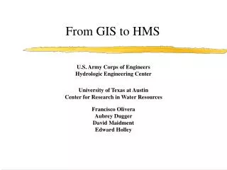
From GIS to HMS. U.S. Army Corps of Engineers Hydrologic Engineering Center University of Texas at Austin Center for Research in Water Resources Francisco Olivera Aubrey Dugger David Maidment Edward Holley. Overview. Digital Elevation Model (DEM). Hydrologic Parameters. Precipitation Data.

E N D
From GIS to HMS U.S. Army Corps of EngineersHydrologic Engineering Center University of Texas at AustinCenter for Research in Water Resources Francisco OliveraAubrey DuggerDavid MaidmentEdward Holley
Overview Digital Elevation Model (DEM) Hydrologic Parameters Precipitation Data GIS to HMS HMS Hydrograph
Digital Elevation Model (DEM) • DEM of the Upper Cedar River in Iowa. • Cell size: 500 m
Flow Direction • Water flows to one of its neighbor cells according to the direction of the steepest descent. • Flow direction takes one out eight possible values.
Flow Accumulation • Flow accumulation is an indirect way of measuring drainage areas (in units of grid cells).
Stream Definition • All grid cells draining more than 250 cells (62.5 Km2) are part of the stream network.
Stream Segmentation • Stream segments (links) are the sections of a stream channel connecting two successive junctions, a junction and the outlet, or a junction and the drainage divide.
Watershed Delineation • All grid cells flowing towards a specific stream segment (link) constitute its watershed or drainage area. • The watershed grid is then converted from raster into vector.
Dissolving Watershed Polygons • Dangling polygons should be dissolved into any of its adjacent (through the side) polygons.
Watershed Parameters • Length of main channel L (ft) • Slope of main channel s (%) • Average curve number • Lag time tc (min) (SCS 1973):
Stream Parameters • Muskingum steps • Muskingum K • Muskingum X
HMS Basin File • The output of HECPREPRO is a text file that serves as the HMS Basin File (input).
Hydrologic Elements Structure • Hydrologic elements structure showing subbasins, reaches, junctions and sinks.
Hydrologic Elements Structure • Detail of the hydrologic element structure.
Theissen Polygons • A Theissen polygon is defined for each precipitation station.
Theissen and Subbasin Polygons • Theissen polygons intersected with subbasin polygons. • Each polygon of the resulting coverage belongs to only one Theissen polygon and only one subbasin polygon.
Theissen and Subbasin Polygons • Attributes of the subbasins are attached to the resulting coverage by joining the attribute tables.
Watershed Precipitation • The watershed precipitation is the weighted average (according to the Theissen polygons) of the precipitation recorded at the neighbor stations.
Conclusions • The connection between GIS and HMS has been developed. • Sub-basin attributes can be transferred. • Problems transferring reach attributes. • Model calibration necessary to estimate hydrologic parameters.