Download
1 / 27
270 likes | 445 Views
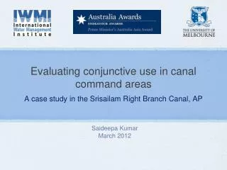
Evaluating conjunctive use in canal command areas. A case study in the Srisailam Right Branch Canal, AP. Saideepa Kumar March 2012. Acknowledgements. Australian Centre for International Agricultural Research (ACIAR) & Prime Minister’s Australia Asia Award

E N D
Evaluating conjunctive use in canal command areas A case study in the Srisailam Right Branch Canal, AP Saideepa Kumar March 2012
Acknowledgements • Australian Centre for International Agricultural Research (ACIAR) & Prime Minister’s Australia Asia Award • Dr. Paul Pavelic & Dr. Biju George – supervision, guidance and support all the way • Dr R. Sakthivadivel, Dr K. Palanisami & Dr Madar Samad - guidance and direction • Mr. Vinay Kumar, Mr. B.M. Murali Krishna Rao, Dr. K. Venugopal, Mr. Suhas Raje & Dr. Joseph Plakkootam, Dr. Giridhar Krishna & Mr.Subramaniam – support and encouragement • Agricultural officers and farmers of SRBC Block IV – sharing experiences • Ms. Aruna Jyothi and Mr. Venkatradha – maps and figures
My motivation.. India vs. Australia • Common problems • Water scarcity • Water sharing between states (Murray Darling Basin) • Extensive irrigation on the Murray – closed mouth, salinity issues • Climate variability/ Climate change • Yet different conditions and solutions • Scale (size of landholdings) • Highly mechanised and precise • Water entitlements, allocations & trading • Climate change adaptation
Contents • Conjunctive use in canal command areas • Case study - SRBC • Methodology • Scenario Analysis • Key findings
Conjunctive use in canal command areas “Conjunctive use refers to efforts planned at the scheme and basin levels to optimize productivity, equity and environmental sustainability by simultaneously managing surface and groundwater resources.” (ARD 2006) Potential Benefits from conjunctive use: • Increased availability and reliability of water supply and protection of rural livelihoods • Drought proofing • Improved sustainability of groundwater resources • Address water-logging and salinity issues in head reaches • Equitable distribution of water within the command area (head vs. tail reaches)
SRBC • Scarce rainfall zone - Average annual rainfall = 772 mm; • Farmers dependent on groundwater for irrigation prior to project; • Geology: Quartzites, shales and limestone; • SRBC Irrigation Project commenced in 2004; • Dependent on surplus water available in the Krishna • 21 Blocks in total; 16 currently receiving canal water • Block IV used as model block for case study
SRBC Block IV SRBC Main Canal
SRBC Block IV Paddy field irrigated using groundwater
Pre & Post-project land-use and production Pre-project (1996-2000) Post-project (2004-2008) • Post-project changes: • 100% increase in gross area sown & cropping intensity • Area under Paddy increased over 2.5 times during Kharif • Improved crop yields; reduced pumping costs; increase in land value
Pre & Post-project groundwater levels Post-project water levels Pre-project water levels Pre-monsoon water level (< 3m) • Post-project changes: • Rising trend of groundwater levels • Threat of water-logging conditions in several villages
Current Challenges • Inequitable water availability – Head vs. Tail • Access to surface water and groundwater • Saline groundwater in tail-end villages • Threat of water-logging • Soil salinization • Crop losses • Drainage costs • Significant volume of canal water lost to drainage • Water productivity improvements minimal
Surface water-groundwater interactions in a canal command area (Adapted from FIP 2010)
Pre-project groundwater balance RMSD = 0.776 (m)
Post-project groundwater balance RMSD = 0.546 (m)
Determining optimum levels of CU Level of CU can be influenced by regulating canal supplies to levels that prompt sustainable groundwater use, prevent water-logging conditions and promote equitable distribution of water within the command area. Guidelines to determine optimal CU levels: Water Availability, i.e., Water supply (groundwater draft + canal supplies) >= Crop irrigation demand; and Groundwater Sustainability, i.e., Groundwater Draft ≈ Safe Development level and Water-logging conditions do not occur, i.e., Groundwater Draft > Water-logging threshold; and Equitable distribution: Surplus water allocation to a command area unit (Example: Block) is minimised
1a – Cumulative Impact over 5 years at design levels of CU Assumptions: 2004-09 rainfall patterns; Cropping patterns of 2004-09; Canal operations as per project design Impacts: Water-logging conditions likely to be experienced within one year ~21 GL of surplus water available per annum in Block IV – can be reallocated elsewhere to improve equitable distribution
3a – Cumulative Impact over 5 years at optimum levels of CU Assumptions: 2004-09 rainfall patterns; Increased cropping intensity; Optimum CU Impacts: Groundwater Draft above safe levels – required to minimise threat of water logging Up to 48% of canal water saved – can be allocated elsewhere
Key Findings • Introduction of canal water to the SRBC region has benefitted farmers but presents challenges of • Increased threat of water-logging conditions exacerbated by saline groundwater in some areas • Over-allocation of canal water – up to 48% of canal water can be saved and allocated elsewhere to improve equity • Inequitable distribution of water – head reaches vs. tail-end • Opportunities exist to address above-mentioned issues by: • Planned conjunctive use of surface water and groundwater by regulating canal supplies to maintain water balance in the system • Optimum block-wise allocation of canal water to improve equitable distribution within the command
Constraints • Infrastructure for distribution of surface water • Equitable access to groundwater – physical and financial access • Water-use efficiency • Awareness and farmer participation • Access to Information