Download
1 / 58
680 likes | 1.11k Views
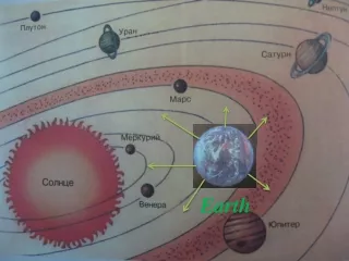
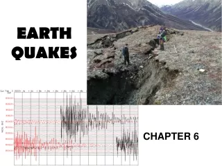
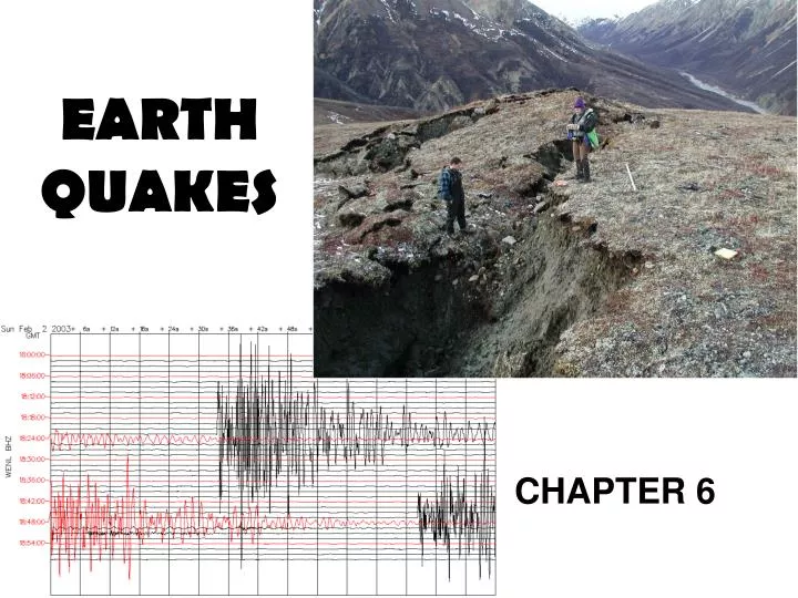
EARTH QUAKES. CHAPTER 6. 6.1 Earthquakes and Plate Tectonics. Section Objectives: Discuss the elastic rebound theory Explain why earthquakes generally occur at plate boundaries. 6.1 EARTHQUAKES AND PLATE TECTONICS. Earthquakes are vibrations of the earth’s crust.

E N D
EARTHQUAKES CHAPTER 6
6.1 Earthquakes and Plate Tectonics • Section Objectives: • Discuss the elastic rebound theory • Explain why earthquakes generally occur at plate boundaries
6.1 EARTHQUAKES AND PLATE TECTONICS Earthquakes are vibrations of the earth’s crust ELASTIC REBOUND THEORY • Rocks on each side of a fault are moving slowly • The fault locks up • Stress increases to a certain point • Rocks fracture • Spring back to original shape (elastic rebound)
6.1 EARTHQUAKES AND PLATE TECTONICS • When rocks fracture, they send out seismic waves that stress other rocks, causing them to fracture and spring back. • When the rocks spring back it causes a series of small tremors called aftershocks. Seismogram of Dec. 2005 Sumatra earthquake
6.1 EARTHQUAKES AND PLATE TECTONICS The point on the earth’s surface directly above the focus is called the epicenter. The area along a fault where the slippage first occurs is called the focus.
Focus Depths Shallow-Focus (0-70 km) Intermediate-Focus (70-300 km) Deep-Focus (300-650 km)
Focus Depths • 90 % of continental earthquakes have a shallow focus • Shallow focus earthquakes cause the most damage • WHY? • By the time the vibrations from an intermediate or deep focus earthquake reach the surface their energy has been used up.
MAJOR EARTHQUAKE ZONES 3. Eurasian-Melanesian belt 2. mid-ocean ridge 1. Pacific Ring of Fire 2. mid-ocean ridge 2. mid-ocean ridge Earthquake Epicenters
Earthquake Zones 1. Pacific Ring of Fire- most plates are being subducted, (convergence) while some plates scrape pat each other(transform) 2. Mid Ocean Ridge- divergence 3.Eurasian Melanesian mountain belt-convergence of Eurasian plate with the African and Indian plate
Earthquake Zones Plate movements cause stress on the crust….therefore you have Earthquakes.
Fault Zones • At some plate boundaries there are groups of interconnected faults calledfault zones. • Fault zones form at plate boundaries because of the intense stress that results when plate edges interact. • The San Andreas Fault is an example of a fault zone. San Andreas Fault Zone in Southern California
New Madrid 1812 Not all earthquakes form along plate boundaries. In 1811-1812 several very strong earthquakes hit the New Madrid area of Missouri (rang church bells in Boston Massachusetts) The source was an ancient fault zone deep within the crust.
What four types of plate boundaries cause earthquakes? • 1. plates colliding (convergence) • 2. plates pulling apart (divergence) • 3. plates subducting(convergence) • 4. plates sliding past each other (transform boundaries)
6.2 RECORDING EARTHQUAKES Section Objectives: • Compare the three types of seismic waves. • Discuss the method scientists use to pinpoint an earthquake. • Discuss the method most commonly used to measure the magnitude of earthquakes.
6.2 RECORDING EARTHQUAKES • SEISMIC WAVES CAN BE DETECTED AND RECORDED BY USING AN INSTRUMENT CALLED A SEISMOGRAPH.
Seismic Waves • When two people hold opposite ends of a rope and shake one end, they send energy through the rope in the form of waves. • Like the waves that travel through the rope, seismic (SIZE mihk) waves generated by an earthquake travel through Earth.
Seismic Waves • During a strong earthquake, the ground moves forward and backward, heaves up and down, and shifts from side to side. • The surface of the ground can ripple like waves do in water.
Primary Waves • When earthquakes occur, three different types of seismic waves are produced. • Primary waves (P-waves) cause particles in rocks to move back and forth in the same direction that the wave is traveling.
Primary Waves • If you squeeze one end of a coiled spring and then release it, you cause it to compress and then stretch as the wave travels through the spring. • PARTICLES MOVE BACK AND FORTH LIKE A SPRING • CAN TRAVEL THROUGH SOLID, LIQUID & GAS P wave animation
Secondary Waves • Secondary waves (S-waves) move through Earth by causing particles in rocks to move at right angles to the direction of wave travel.
Secondary Waves • CAUSES ROCK PARTICLES TO VIBRATE FROM SIDE TO SIDE AT RIGHT ANGLES TO THE DIRECTION WAVE IS TRAVELING (shear waves) • CAN TRAVEL THROUGH SOLIDS S wave animation
Surface Waves • WHEN P AND S WAVES REACH THE EARTHS SURFACE, THEIR ENERGY CAN BE CONVERTED INTO A THIRD TYPE. • SURFACE WAVES TRAVEL SLOWLY OVER THE EARTH’S SURFACE LIKE AN OCEAN WAVE.
Surface Waves • Surface waves cause most of the destruction resulting from earthquakes. • SLOWEST OF THE WAVES Surface wave
II. LOCATING AN EARTHQUAKE • TO LOCATE THE EPICENTER OF AN EARTHQUAKE, SCIENTISTS ANALYZE THE ARRIVAL TIME OF P AND S WAVES. • IF THE S WAVES ARRIVE SOON AFTER THE P WAVES, THEN THE EARTHQUAKE IS CLOSE, IF THE S WAVES ARRIVE LATER THE EARTHQUAKE IS FARTHER AWAY.
II. LOCATING AN EARTHQUAKE • FOR SCIENTIST TO FIND THE EPICENTER OF AN EARTHQUAKE, THEY NEED RECORDINGS FROM AT LEAST THREE SEISMOGRAPH STATIONS.
Measuring Seismic Waves • Seismic waves from earthquakes are measured with an instrument known as a seismograph. • Seismographs register the waves and record the time that each arrived.
Measuring Seismic Waves • Seismographs consist of a rotating drum of paper and a pendulum with an attached pen. • When seismic waves reach the seismograph, the drum vibrates but the pendulum remains at rest.
Measuring Seismic Waves • The stationary pen traces a record of the vibrations on the moving drum of paper. • The paper record of the seismic event is called a seismogram.
Measuring Seismic Waves • Seismographs differ according to whether they are intended to measure horizontal or vertical seismic motions.
Seismograph Stations • Primary waves arrive first at seismograph stations, and secondary waves, which travel slower, arrive second. • Because surface waves travel slowest, they arrive at seismograph stations last.
Seismograph Stations • This difference in arrival times is used to calculate the distance from the seismograph station to the earthquake epicenter.
Seismograph Stations • If seismic waves reach three or more seismograph stations, the location of the epicenter can be determined. • To locate an epicenter, scientists draw circles around each station on a map.
Seismograph Stations • The radius of each circle equals that station’s distance from the earthquake epicenter. • The point where all three circles intersect is the location of the earthquake epicenter.
Also described as the amount of ground motion. • The height of the lines traced on the paper of a seismograph is a measure of the energy that is released, or the magnitude, of the earthquake.Also described as the amount of ground motion. Measuring Earthquake Magnitude Click image to view movie.
Measuring Earthquake Magnitude • The Richter magnitude scale is used to describe the strength of an earthquake and is based on the height of the lines on the seismogram. • The Richter scale has no upper limit. However, scientists think that a value of about 9.5 would be the maximum strength an earthquake could register. • MOMENT MAGNITUDE SCALE
Measuring Earthquake Magnitude • For each increase of 1 on the Richter scale, the ground motion is 10 times greater. • For each increase of 1 on the Richter scale, the energy released is32times greater.
III. EARTHQUAKE MEASUREMENT • LARGEST RECORDED EARTHQUAKE 8.9 • MAJOR E.Q. 7 OR ABOVE • MODERATE E.Q. BETWEEN 6 & 7 • MINOR EARTHQUAKE BETWEEN 2.5 & 6 MICROQUAKES LESS THAN 2.5
Past Earthquakes • Most of the earthquakes you hear about are large ones that cause great damage. • However, of all the earthquakes detected throughout the world each year, most have magnitudes too low to be felt by humans.
Past Earthquakes • Scientists record thousands of earthquakes every day with magnitudes of less than 3.0. • Each year, about 55,000 earthquakes are felt but cause little or no damage.
Describing Earthquake Intensity • The modified Mercalliintensity scale describes the intensity. • The levels of this scale are determined by the amount of damage or the reaction of people • An earthquake can have more than one intensity!
Describing Earthquake Intensity Examples: • An intensity of IV would be felt by everyone indoors during the day but would be felt by only a few people outdoors. • An intensity of XII would cause total destruction of buildings, and objects such as cars would be thrown upward into the air.
Describing Earthquake Intensity • An intensity-XII earthquake would cause total destruction of buildings, and objects such as cars would be thrown upward into the air.
Why do P waves travel faster through the lithosphere than through the asthenosphere? • Because P waves travel faster through the more rigid rock of the lithosphere than through the somewhat plastic rock in the asthenosphere
6.3 EARTHQUAKE DAMAGE • MOST INJURIES OCCUR DUE TO THE COLLAPSE OF BUILDINGS. • OTHER DANGERS INCLUDE FIRES, LANDSLIDES, BROKEN ELECTRIC LINES AND GAS LINES, AND FLOOD WATERS AND COLLAPSING DAMS.
I. DESTRUCTION TO BUILDINGS AND PROPERTY • MOST STRUCTURES CANNOT WITHSTAND THE SWAYING MOTION OF AN EARTHQUAKE.
I. DESTRUCTION TO BUILDINGS AND PROPERTY • THE SOIL YOUR FOUNDATION IS BUILT ON CAN DETERMINE HOW MUCH DAMAGE OCCURS TO THE STRUCTURE. • LOOSE SOIL CAN VIBRATE MORE THAN FIRM SOIL WHICH WILL CAUSE MORE DAMAGE TO A FOUNDATION.
Tsunamis • An earthquake under the ocean causes a sudden movement of the ocean floor. • The movement pushes against the water, causing a powerful wave that can travel thousands of kilometers in all directions.
Tsunamis • Ocean waves caused by earthquakes are called seismic sea waves, or tsunamis (soo NAH meez). • Far from shore, a wave caused by an earthquake is so long that a large ship might ride over it without anyone noticing.
Tsunamis • But, when one of these waves breaks on a shore, it forms a towering crest that can reach 30 m in height.
Tsunami Warnings • Just before a tsunami crashes onto shore, the water along a shoreline might move rapidly toward the sea. • This should be taken as a warning sign that a tsunami could strike soon. You should head for higher ground immediately.