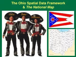
The Ohio Spatial Data Framework & The National Map
The Ohio Spatial Data Framework & The National Map. Local. State. National. 125 th Anniversary 1884 – 2009 USGS Mapping & GIS. December 9th, 1884 U.S. Congress authorized USGS to begin systematic topographic mapping of the United States

The Ohio Spatial Data Framework & The National Map
E N D
Presentation Transcript
The Ohio Spatial Data Framework& The National Map Local State National
125th Anniversary1884 – 2009USGS Mapping & GIS • December 9th, 1884 U.S. Congress authorized USGS to begin systematic topographic mapping of the United States • “A Government cannot do any scientific work of more value to the people at large than by causing the construction of proper topographic maps of the country.” JWP
Four Disciplines of the U.S. Geological Survey • Geography and Mapping • Geology • Biology • Water • USGS Ohio Water Science Center • Surface water, ground water, water quality • Flood warning system for Findlay
The National Map: Data Themes • Imagery • Elevation • Transportation • Hydrography • Structures • Boundaries • Land cover • Geographic names
Ohio Framework Data and National MapBut First . . . • International Charter & Ohio Disasters • GOS & Ohio Metadata Server • NSDI CAP Grants • U.S. National Grid • National Atlas • National Map Developments • viewer, next generation maps…
International Charter Satellite Imagery and Ohio Disasters • Unified system of space data acquisition & delivery to those affected by natural or technological disasters • Each member agency commits resources to support the provisions of the Charter, helping to mitigate the effects of disasters on human life and property. • Commercial Satellite Imagery Companies Partner with USGS in Support of the International Charter “Space and Major Disasters” DigitalGlobe & GeoEye
Geospatial One-Stop (GOS) andOhio Metadata Server • Metadata for Map Services: Making Geospatial Data and Map Services Available to Larger Audiences
Geospatial One-Stop (GOS) andOhio Metadata Server • Register & publish live data & map services. • Good metadata elements needed • content type, on-line linkage values, descriptive titles, abstracts, key word per each data layer in map service • titles should include a place name, what the data are about, and a time frame, and possibly who developed the data and the data format (WMS, WFS, etc.).
Make you data easy to find & viewNew GOS Search Widget • Find, view, download, and mash-up web map services currently published in GOS • View search results as an RSS Feed or save results and add to web page as KML • Plug into most GIS viewers or applications • Add into 2D & 3D Viewers – Google Maps, ArcGIS JavaScript API, Google Earth, Bing Maps, ArcGIS Explorer
NSDI CAP Grants2010 National Spatial Data InfrastructureCooperative Agreements Program • Submit proposals in mid October 2009 through Grants.gov
2010 NSDI CAP Grants • Category 1: Metadata Trainer and Outreach Assistance • Category 2: Framework Data Exchange through Automated Geo-Synchronization • Category 3: Fifty States Initiative: Strategic and Business Plan Development • Category 4: Fifty States Initiative: Business Plan Development and Implementation • Category 5: Return on Investment (ROI) Methodology and Business Case Development for Multi-agency NSDI Projects • Category 6: FGDC Standards Development and Implementation Assistance and Outreach • Category 7: Demonstration of Geospatial Data Partnerships across Local, State, Tribal, and Federal Government
U.S. National Grid • http://mississippi.deltastate.edu/
Agriculture: Ag Census 2002, Crops, Farmland... • Biology: Bat Ranges, Butterflies, Forests, Invasive… • Boundaries: Congress Districts, Counties, Fed lands • Climate: Precip, Hazard Events, Hurricanes, Sea Temp • Environment: Air Releases, Hazard Waste, Toxics • Geology: Earthquakes, Landslides, Relief, Volcanoes • History: Election Results, Territorial Acquisitions • Map Reference: Cities and Towns, Urban Areas... • People: Census, Crimes, Energy Consumption, Mortality...
National Atlas of the Unites States • 1789-2008 Presidential Elections Map – thanks to Ohio Secretary of State and OGIRP • Ohio Ninth District Map for Representative Kaptur – thanks to Lucas and Ottawa Counties
The National Map • Base topographic data • Seamless • Continuously maintained • Nationally consistent • Developed and maintained through partnerships • Available on line • Source for products and services
Fast Base Map 100% National Map Content One-stop to Download National Map Data and view Map Services Direct Access to Topo Maps (USGS store) New Advanced Features New National Map ViewerLate 2009 Release
National Map Viewer • WMS and new Base Map Services are designed to be easily plugged into most GIS viewers or applications • Add into preferred 2D Viewer – Google Maps, ArcGIS JavaScript API • Or 3D Viewer - Google Earth, Bing Maps, ArcGIS Explorer. • Add to web page via KML
Topographic Maps fromThe National Map Data • Create next generation 7.5-minute USGS topographic maps • Bundle with scanned historic topographic maps
Historic USGS quadrangle scanning • Scan complete collection of • approximately 250,000 USGS • quadrangles existing as paper • copies, using consistent, high • quality specifications • Provide all editions and all scales • matching US Topo release cycle • All maps will have complete • Metadata • GeoPDF files available for • download from USGS Store
The National Map: Data Themes • Imagery • Elevation • Transportation • Hydrography • Structures • Boundaries • Land cover • Geographic names • Parcels, PLSS, geodetic control
National Map – Imagery • OSIP 2006-2007 funding from NGA & DHS • NGA Urban Area Imagery Program - UAIP • OSIP II message from DOD NGA – • “Please let the counties know that my office hopes to partner on the statewide collection that is scheduled to begin in 2011.” • NGA urban areas with sunset clause • Not much 2010 funding – ARRA stimulus? • NGA border imagery
National Map – ElevationNational Elevation Dataset - NED • OSIP Lidar to CLICK • OSIP DEM to NED • Flat water requirement Breakline help
National Map – ElevationNational Elevation Dataset - NED • OSIP DEM to NED • One arc second – 30 meters • One third arc sec – 10 meters • One ninth arc sec – 3 meters • Flat water requirement Breakline help • Thanks Allen, Ashland, Crawford, Delaware, Geauga, Holmes, Lake, Medina, Ottawa, Summit, Williams. • Seeking more in north half
National Map - Transportation • Ohio LBRS – Great Example • Federal transportation not yet unified • Issues • addresses, local roads, commercial, OSM • Transportation for the Nation – NSGIC • DOT, Census, USGS workshop this year • National Transportation Dataset issues & TFTN
National Hydrography Dataset NHD is a digital basemap of surface waters, such as streams, rivers, lakes, and reservoirs. It includes names. It supports network and flow analysis. It is a common framework for referencing surface- water related features, such as stream gages, pollution sources, and water quality test sites. Maintained via stewardship.
National Map - HydrographyNational Hydrography Dataset - NHD • National program • Combines best of several federal efforts • USGS DLG 100K & 24K • US EPA Reach File RF3 • USFS CFF • other national, state, and regional partners • Coordinated update efforts
NHD, WBD, GNIS, NWI, FIRM, NED Current integration with Watershed Boundary Dataset (HUC’s) Stream and lake names coordinated with Geographic Names Information System (GNIS) Future improved integration with wetlands (NWI), flood plains (DFIRMS), elevation (NED), and other framework themes
NHD and Names • Stream names in Ohio • Central Ohio (MORPC) • Cincinnati area issues • Cleveland, Akron . . . • Ohio BGN
National Map – HydrographyNational Hydrography Dataset • NHD video • Six minutes • Land cover • Structures • Boundaries • PLSS • Geographic Names • Geodetic control – bench marks
National Land Cover Dataset (NLCD) NLCD 2001 will be part of a land characterization database that also includes: • LANDSAT 7 imagery • Terrain slope, aspect, and elevation • Soil moisture • Impervious surface • Tree cover • NLCD 2006 next
The National Map: Data Themes • Structures - buildings • TechniGraphicS (TGS) Wooster • & HSIP buildings for NGA • Stewardship for structures • Hospitals, fire stations, . . . • Boundaries • Initially from TIGER
Ohio PLSS Informaiton on788 Ohio Quadrangles Example map collar information from central Ohio - Area west of the Scioto River lies within the Virginia Military District Area north of Base Line lines within the United States Military District Land lines based on the Base Line of the United States Military District Area south of the Base Line lies within Congress Lands east of the Scioto River Land lines within Ts. 4 and 5 N.-R. 22 W. based on the Scioto River Base Land lines within Ts.11 and 12 N.-R 21 W. based on the Ohio River Base
National Map – Geographic Names • Geographic names • Mt. McKinley and Ohio
Charles Hickman - Geographer - U.S. Geological Survey National Map Liaison to Ohio 6480 Doubletree Avenue Columbus, Ohio 43229 USA chickman@usgs.gov (614) 430-7768 The National Map http://nationalmap.gov • Ask USGS • Email ask@usgs.gov • Phone 1-888-ASK-USGS • Web http://www.usgs.gov