Download
1 / 32
320 likes | 339 Views
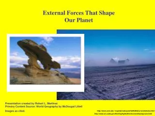
Explore the processes shaping our Earth - from solstices to ecosystems. Learn about tropical climates and atmospheric phenomena like tornadoes and tropical storms. Engage in practical exercises to grasp these concepts effectively.

E N D
Seasons, Tilt, Tropics, Arctic It is winter in the Northern hemisphere! It is summer in the Northern hemisphere! June 21 December 21 Solstice Solstice It is winter in the Southern hemisphere! It is summer in the Southern hemisphere!
Earth’s Tilt - Putting it together • Video: The Reasons for the Seasons • Video: The Land of the Midnight Sun
Practical Exercise Experiment • Take out a piece of loose leaf paper • Write your name/date/period in top right hand corner of the paper. • Number the paper 1-6 skipping a blank line in between each.
Experiment: • Place the globe in the center of the far RIGHT table. • Point the North Pole so that it is tilted toward the RIGHT side of the room. • Now shine the flashlight from the far LEFT table at the globe. • Adjust the flashlight so that the beam covers the globe and just the globe • What month of the year would this be? • What is the season in the Northern Hemisphere? • What is the season in the Southern Hemisphere?
Experiment: • Place the globe in the center of the far LEFT table. • Point the North Pole so that it is tilted toward the RIGHT side of the room. • Now shine the flashlight from the far RIGHT table at the globe. • Adjust the flashlight so that the beam covers the globe and just the globe • What month of the year would this be? • What is the season in the Northern Hemisphere? • What is the season in the Southern Hemisphere?
Air gets hot when compressed This principle can be seen in the piston fire starter. Video Explanation “Air gets very hot when it is compressed under high pressure. A classic example would be the heat that is created when one uses a bicycle pump. But when the air is compressed in a fire piston it is done so quickly and efficiently that it can reach a temperature in excess of 800 degrees Fahrenheit. This is hot enough to ignite the tinder that is placed in the end of the piston which has been hollowed out to accept it.”
Where is the contiguous US? Which wind belt to we get?
Global Wind Belt for most of the Contiguous United States Westerlies
Which wind belt would be most difficult for sailing vessels? The Doldrums: known for long calm periods with little or no wind, for days or even weeks!
Fronts • Meeting of two air masses of different densities. Principal cause of “weather”
Hydrologic Cycle This is how water moves around our planet as a liquid a solid and a gas
Ocean currents are the movement of water in our oceans The currents are trying to equalize water temperature around the planet.
Orographic Lift – Rain Shadow As warm moist air cools, condensation will occur.
Orographic Lift – windward side If the mountains are high enough, then as the air moves higher in altitude it will cool rapidly. Most of the moisture in the air will condense and fall as rain. This means heavier precipitation on the windward side (2 & 3).
Orographic Lift – leeward side As the much dryer air moves over the mountain and lower in altitude it will warm. Most of the moisture in the air is gone. This means very dry warm air on the leeward side (4 & 5). Maybe even a desert. This process is called the “rain shadow effect.”
Orographic Lift – Rain Shadow 3. Windward side 4. Cool dry air descends and warms 5. Leeward Side 1. Warm moist air 2. Condensation and Precipitation
Tropical Storm • Tropical Storm: • A tropical cyclone in which the maximum sustained surface wind speed (using the U.S. 1-minute average) ranges from 34 kt (39 mph or 63 km/hr) to 63 kt (73 mph or 118 km/hr).
Hurricane and Typhoon • Hurricane / Typhoon: • A tropical cyclone in which the maximum sustained surface wind (using the U.S. 1-minute average) is 64 kt (74 mph or 119 km/hr) or more. The term hurricane is used for Northern Hemisphere tropical cyclones east of the International Dateline to the Greenwich Meridian. • The term typhoon is used for Pacific tropical cyclones north of the Equator west of the International Dateline.
Tornado • A tornado is defined as a violently rotating column of air extending from a thunderstorm to the ground. The most violent tornadoes are capable of tremendous destruction with wind speeds of 250 mph or more. Damage paths can be in excess of one mile wide and 50 miles long.
Waterspout • Waterspouts are weak tornadoes that form over warm water. Video
Ecosystem • Is a community of living organisms and how they interact and depend on each other and the air, soil, and water around them. • An ecosystem depends on the recycling of nutrients and other essential components to sustain itself.
Tropical Humid Climates • Found in areas close to the equator • Warm temperatures • Plentiful rainfall all year • Never have truly cold weather • Daily thunderstorms and heavy rainfall are common
Tropical Wet/Dry Climates • Near the tropic s of Capricorn and Cancer • Seasonal change in the weather due to where the rays of the sun are hitting the earth directly • Summer: • Direct sunlight, low unstable air pressure • Heavy Rainfall (Rainy Season) • Winter • Indirect sunlight, high stable air pressure • Cool dry air (Dry Season)
Chart from page 52-53 • In Dry-Arid: yearly rainfall less than 10” • low latitude desert day temp 110F-115F • High Latitude-Tundra: yearly rainfall 5-15” • coolest month average temp 0F • Middle Latitude-Mediterranean: yearly rainfall 14-35” • Vegetation= scrub, grassland, woodland • Dry-Semiarid: Vegetation grassland, few trees • High Latitude-Ice Cap Vegetation NONE