Download

1 / 7
70 likes | 85 Views
Aerial photography plays a crucial role in monitoring wildlife populations and their habitats. With the ability to cover large areas efficiently, expert aerial photographers capture images that provide valuable information about animal populations, migration patterns, and behavior.<br><br>Visit us:- https://www.vernlund.com/about

E N D
Carl Vernlund Photography LLC The Role of Aerial Photography in Preserving Our Planet
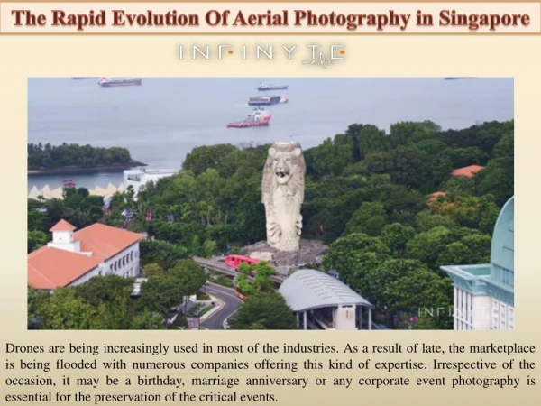
Aerial photography has emerged as a powerful tool in environmental conservation efforts. With their unique ability to capture vast landscapes from above, expert aerial photographers contribute significantly to documenting changes in ecosystems, monitoring wildlife populations, and raising awareness about pressing environmental issues. Through their lens, they provide invaluable visual data that supports scientific research, informs conservation strategies, and inspires action toward a more sustainable future. Documenting Changes in Ecosystems Aerial photography offers a comprehensive and bird's-eye view of our planet's ecosystems. Expert aerial photographers capture high-resolution images that reveal the intricate details of forests, wetlands, coastlines, and other habitats.
These images can be compared over time to identify changes such as deforestation, urban encroachment, or natural disasters. By documenting these changes, scientists and conservationists gain critical insights into the impact of human activities and climate change on ecosystems. Monitoring Wildlife Populations Aerial photography plays a crucial role in monitoring wildlife populations and their habitats. With the ability to cover large areas efficiently, expert aerial photographers capture images that provide valuable information about animal populations, migration patterns, and behavior. By photographing wildlife from above, they can assess population densities, track movements, and identify potential threats to vulnerable species. These insights aid conservation efforts by informing habitat restoration, protection measures, and species management plans. Identifying Environmental Issues and Raising Awareness Aerial photography serves as a visual medium for highlighting environmental issues and raising public awareness. Expert aerial photographers capture striking images that depict the impact of pollution, deforestation, habitat loss, and other environmental challenges. These images have the power to evoke emotions, grab attention, and provoke discussions.
These photographs engage a broad audience through exhibitions, media publications, and online platforms, fostering a deeper understanding of the need for environmental conservation and spurring collective action. Supporting Scientific Research and Conservation Strategies The data-rich imagery provided by expert aerial photographers is a valuable resource for scientists and conservation organizations. High-resolution aerial photographs offer detailed information about vegetation cover, land use patterns, water bodies, and topography. This data aids in ecological research, landscape planning, and the development of conservation strategies. It enables scientists to analyze the health of ecosystems, identify critical areas for protection, and prioritize conservation efforts based on accurate and up-to-date information. Collaboration with Technology and Data Analysis
The synergy between aerial photography and technological advancements has revolutionized environmental conservation. Geographic Information System (GIS) technology allows aerial images to be overlaid with other geospatial data, creating detailed maps and models for in-depth analysis. Remote sensing techniques, such as thermal imaging and multispectral imaging, further enhance the capabilities of aerial photography by providing additional layers of information. These technological tools, combined with the expertise of aerial photographers, enable a comprehensive understanding of ecosystems and facilitate evidence-based decision-making in conservation. Final Thoughts Aerial photography has become an indispensable tool in environmental conservation efforts. Through their expertise, expert aerial photographers contribute to documenting ecosystem changes, monitoring wildlife populations, and raising awareness about pressing environmental issues. Their visually stunning images provide valuable data that supports scientific research, informs conservation strategies, and engages the public. As technology continues to advance, the collaboration between expert aerial photographers and conservation organizations will further empower efforts to protect and preserve our precious natural resources. Together, they are paving the way for a sustainable future where the beauty and diversity of our planet thrive for generations to come!
Contact Details:- Address: West Hartford, Connecticut, US Phone no. :- 8602806790 Email ID:- carl@vernlund.com Website:- http://www.vernlund.com/ Wendy’s Picks