Download
1 / 1
10 likes | 19 Views
The top survey is an App that can help while surveying on the field by a finely crafted camera having all the requisites in support of surveyors. Civil engineers, Photographers, Archaeologists, researchers, etc can take maximum benefits of such an amazing tool during their site survey.<br><br>Download The App Now<br>http://bit.ly/3oehWXz

E N D
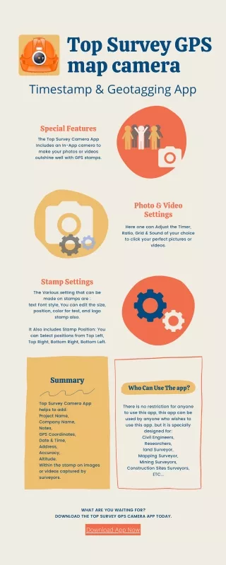
Top Survey GPS map camera Timestamp & Geotagging App Special Features The Top Survey Camera App Includes an In-App camera to make your photos or videos outshine well with GPS stamps. Photo & Video Settings Here one can Adjust the Timer, Ratio, Grid & Sound of your choice to click your perfect pictures or videos. Stamp Settings The Various setting that can be made on stamps are : text Font style, You can edit the size, position, color for text, and logo stamp also. It Also includes Stamp Position: You can Select positions from Top Left, Top Right, Bottom Right, Bottom Left. Summary Who Can Use The app? Top Survey Camera App helps to add: Project Name, Company Name, Notes, GPS Coordinates, Date & Time, Address, Accuracy, Altitude. Within the stamp on images or videos captured by surveyors. There is no restriction for anyone to use this app, this app can be used by anyone who wishes to use this app. but it is specially designed for: Civil Engineers, Researchers, land Surveyor, Mapping Surveyor, Mining Surveyors, Construction Sites Surveyors, ETC... WHAT ARE YOU WAITING FOR? DOWNLOAD THE TOP SURVEY GPS CAMERA APP TODAY. Download App Now